 Image
Image
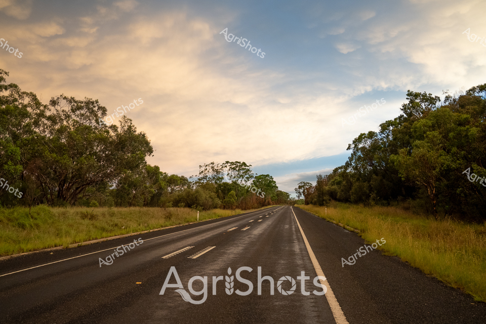
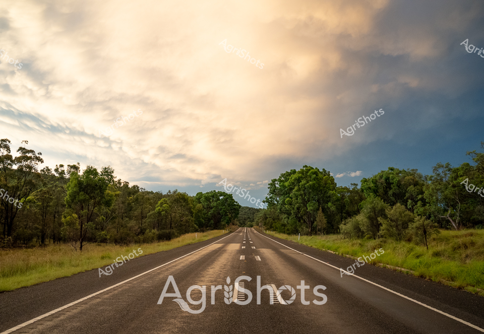
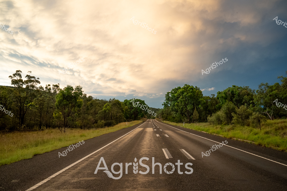
Golden afternoon light bathes a lonely rural highway cutting through the lush Queensland landscape, capturing the serene transition between grasslands and eucalyptus woodlands typical of the Granite Belt region. The bitumen road stretches toward the horizon, perfectly centered and flanked by verdant grass verges and mature tree lines creating natural boundaries. Soft clouds drift across a warm amber and blue sky, suggesting late summer or early autumn when the agricultural landscape begins to transform. Weathered gum trees stand sentinel along the roadside, their silvery-green foliage providing subtle texture and depth to the expansive scene. The road's clean, well-maintained surface speaks to the infrastructure supporting rural agricultural communities, connecting farmlands and providing critical transport routes for produce and livestock. This tranquil landscape embodies the quiet beauty of Australian agricultural heartlands - a testament to the interconnected networks that sustain rural life and agricultural productivity.
 Video
Video
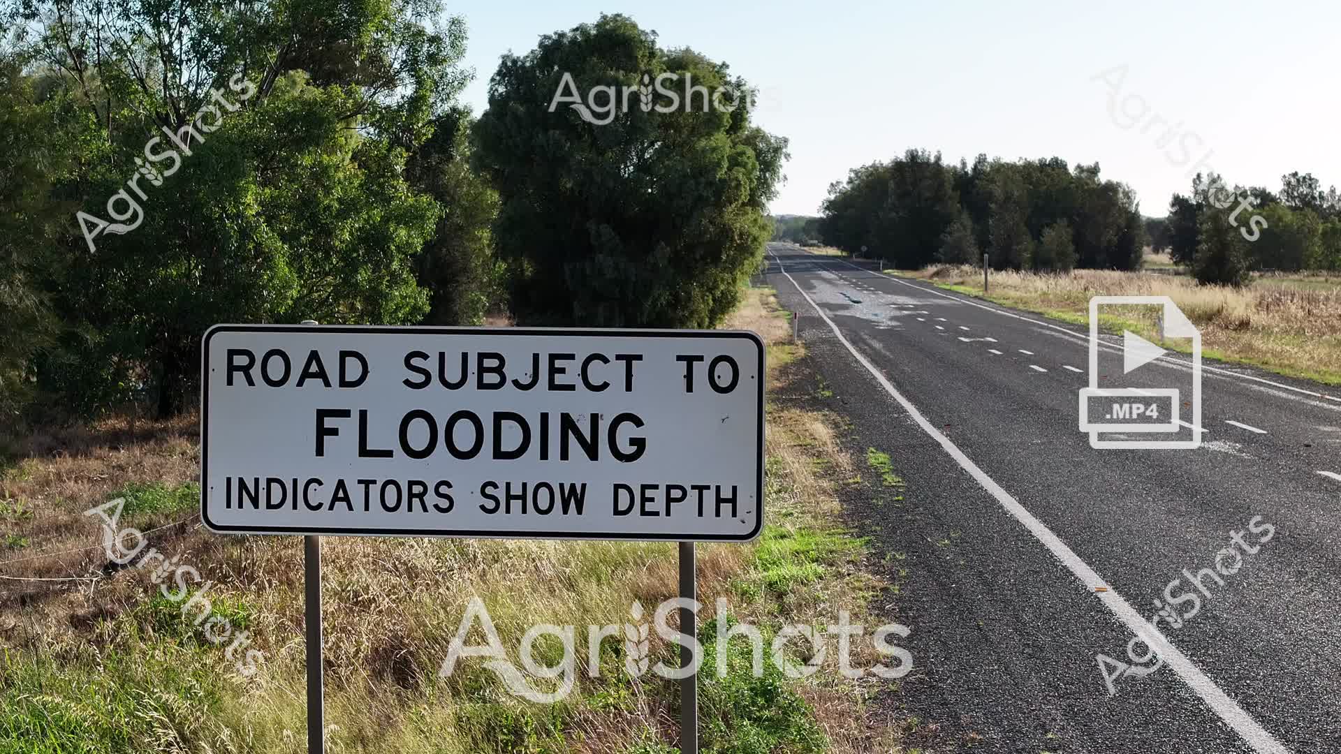
Rural Road Flooding Warning: A Critical Agricultural Infrastructure Alert A stark warning sign stands sentinel alongside a rural highway, signaling potential flood risks for transportation networks in the Riverina region of New South Wales. The asphalt roadway stretches through a golden agricultural landscape, lined with mature trees and dry grasslands, capturing the harsh summer conditions typical of inland Australian farming districts. The crisp white "Road Subject to Flooding" sign provides critical information for travelers and transport logistics, highlighting the unpredictable environmental challenges faced by rural communities and agricultural supply chains. Weathered grasses and native vegetation frame the road's edge, suggesting the harsh climate and seasonal variations that impact agricultural mobility and infrastructure resilience. The clear, unobstructed highway represents the vital transportation arteries that connect farming regions, moving livestock, crops, and essential supplies across vast distances. This image powerfully communicates the intersection of agricultural operations, environmental conditions, and transportation safety in the Australian rural landscape.
 Image
Image
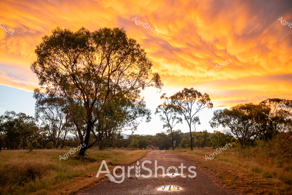
Molten gold spills across the sky, setting the Queensland landscape ablaze with late afternoon light. A dusty rural road winds through a classic Australian bushland, flanked by weathered eucalyptus trees with silvery-green foliage silhouetted against the dramatic cloudscape. The gravel track stretches toward the horizon, punctuated by a small rocky outcrop in its center, symbolizing the rugged resilience of the Granite Belt region. Dry grasslands frame the path, their amber and brown tones suggesting the heat of a late summer evening, with the scattered eucalypts standing as silent sentinels of the agricultural landscape. The extraordinary sunset transforms the ordinary rural scene into a breathtaking canvas, with clouds streaming like fiery brushstrokes across the burnished sky. This image captures the raw, untamed beauty of Queensland's agricultural heartland - a landscape of endurance, subtle textures, and magnificent natural drama that defines the Australian rural experience.
 Video
Video
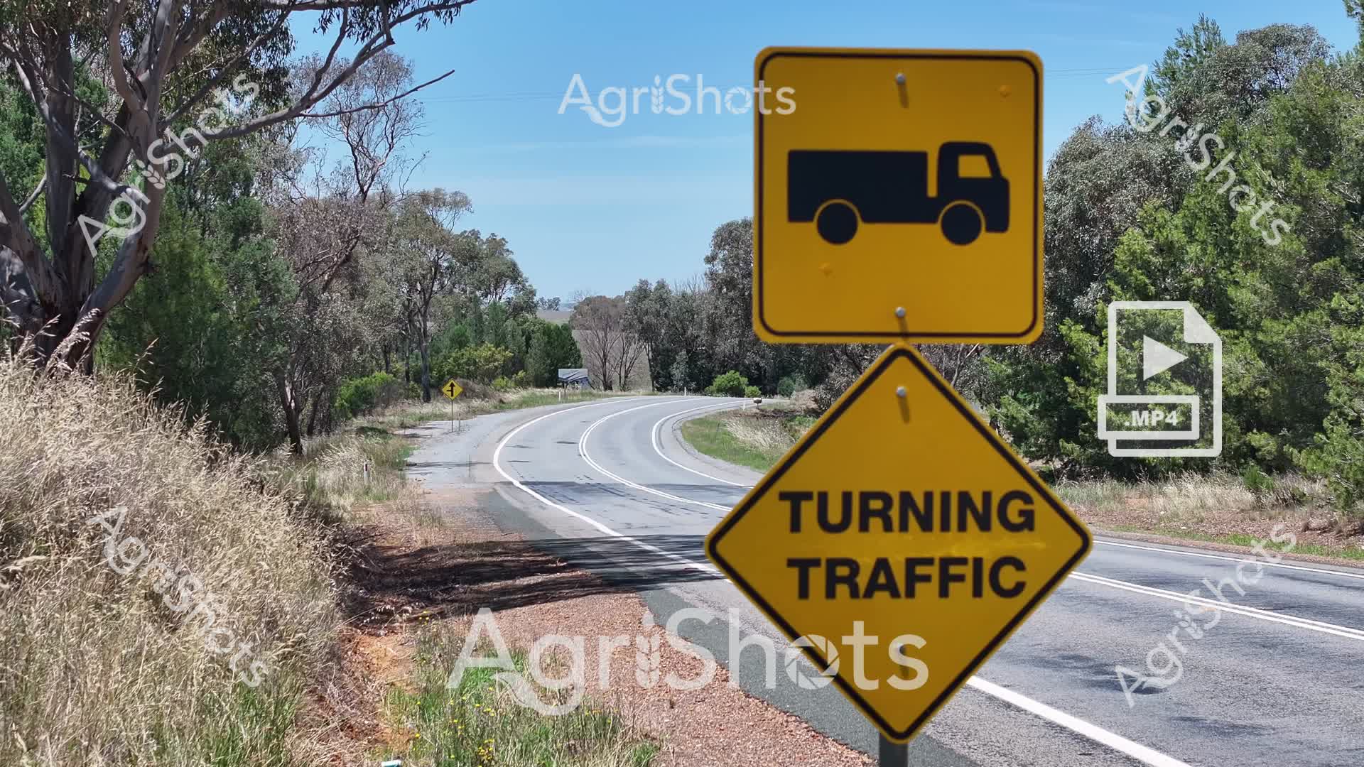
Rural Road Safety in the Riverina: A Cautionary Landscape Golden summer sunlight bathes a winding country road in the NSW Riverina, where essential agricultural transportation safety is paramount. Vivid yellow road signs alert drivers to potential truck movements, with a prominent "TURNING TRAFFIC" warning mounted alongside a vehicle movement icon, highlighting the critical awareness needed in rural transport corridors. The serpentine bitumen roadway curves through a classic Australian bush landscape, flanked by weathered eucalyptus trees, dry grasses, and scattered native vegetation that speaks to the challenging environmental conditions of the region. These carefully placed warning signs represent the agricultural sector's commitment to road safety, protecting the vital logistics network that connects farmers, producers, and markets across this expansive agricultural heartland. The clear blue sky and meticulously maintained road infrastructure underscore the professional approach to rural transportation management, where every turn and movement must be anticipated and navigated with precision and care.
 Video
Video
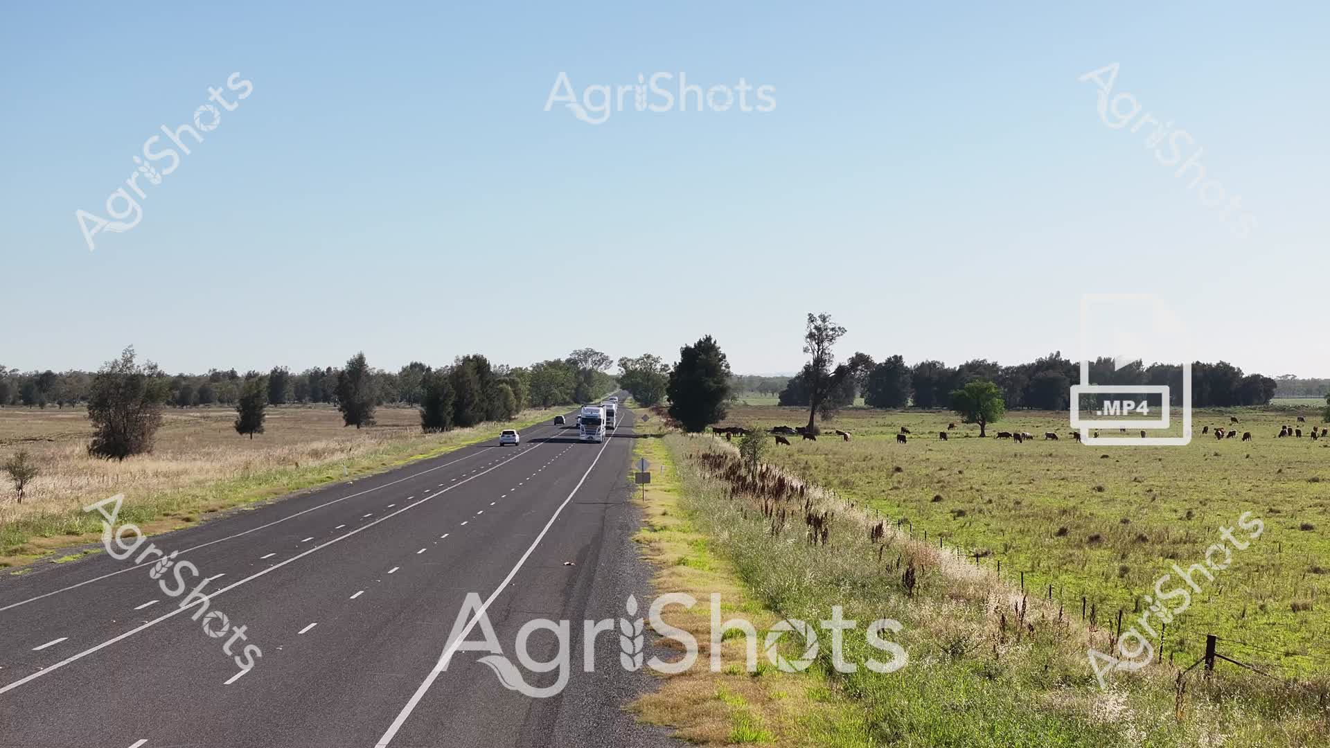
Rural Riverina Highway: Pastoral Tranquility A pristine multi-lane highway bisects the lush summer landscape of New South Wales, cutting a smooth asphalt ribbon through verdant pastureland. Scattered eucalyptus trees punctuate the expansive green paddocks, where a healthy herd of cattle graze peacefully, their dark forms creating a gentle contrast against the bright grasslands. Long shadows and clear azure skies suggest mid-morning light, highlighting the region's agricultural prosperity. A white truck and several passenger vehicles traverse the road, representing the vital transportation infrastructure that connects rural producers to broader markets. The roadside features neat fencing and native vegetation, embodying the carefully managed agricultural ecosystem of the Riverina. This scene captures the quintessential Australian rural experience - a harmonious blend of modern infrastructure and timeless pastoral beauty, where agricultural productivity meets natural landscape.
 Video
Video
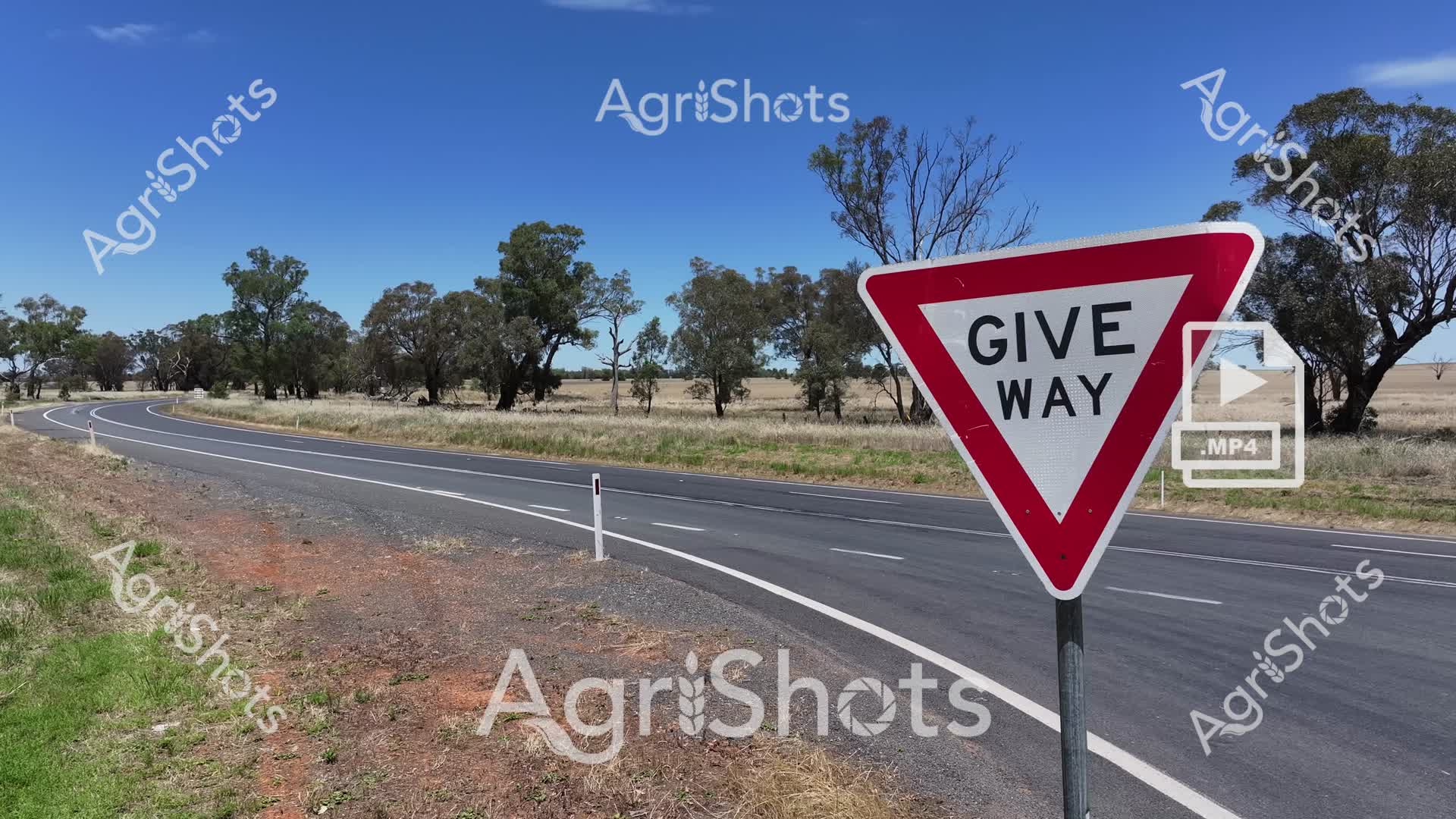
Dusty ochre earth meets windswept grasslands along a serpentine rural highway in the heart of New South Wales' Riverina region. A vibrant crimson and white "GIVE WAY" sign stands sentinel against a backdrop of scattered eucalyptus trees, their silvery-green foliage punctuating the vast summer landscape under an expansive azure sky. The bitumen road curves gently, its fresh black surface a stark contrast to the sun-bleached grasses and ruddy roadside verge, capturing the unforgiving beauty of Australian agricultural terrain. White road markers trace the highway's edge, guiding travelers through this open countryside where farming and transportation intersect. The scene epitomizes the critical infrastructure that connects remote agricultural communities, highlighting the importance of road safety in a landscape where long-haul trucks and farm machinery share these vital transport arteries. This raw, unfiltered glimpse of rural infrastructure speaks to the resilience and precision required in Australia's agricultural heartland.
 Video
Video
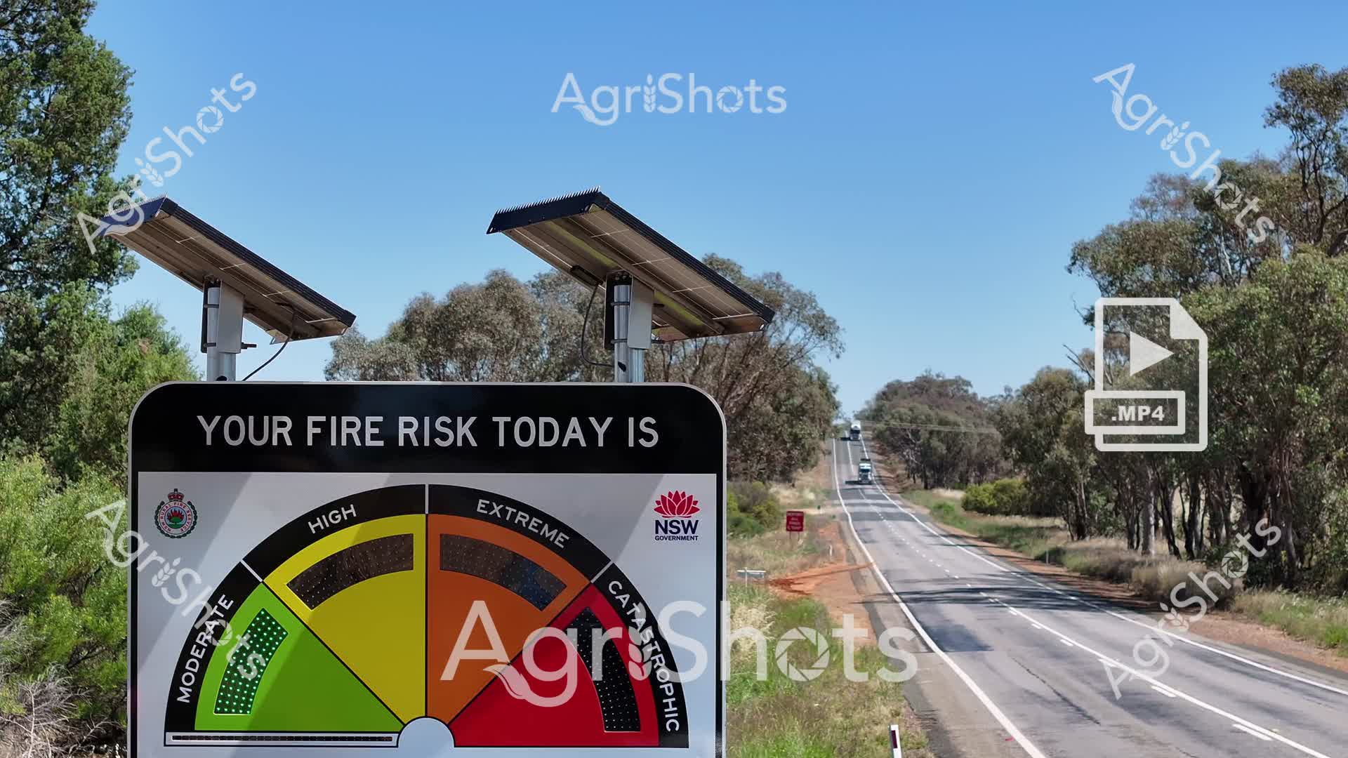
A stark reminder of Australia's bushfire vulnerability emerges along a sun-baked rural highway in New South Wales. The fire danger indicator glows a menacing orange-red, signaling extreme risk under the relentless summer sky. Solar-powered warning stations stand sentinel, their angled panels catching the harsh midday light, overlooking a lonely stretch of bitumen cutting through eucalyptus woodland. Sparse grasslands and scattered gum trees frame the roadside, their muted greens and grays reflecting the parched landscape's resilience. The NSW Rural Fire Service emblem anchors the warning sign, a symbol of preparedness in a region perpetually dancing with environmental threat. This image captures the tension of rural Australian summers - a landscape beautiful yet precarious, where fire risk is as much a part of the environment as the trees themselves.
 Image
Image
Golden afternoon light bathes an expansive rural highway cutting through dense Australian bushland, capturing the serene essence of Queensland's Granite Belt region. The asphalt roadway stretches confidently between lush green grasslands and mature eucalyptus woodlands, creating a perfect symmetrical pathway toward distant horizons. Dramatic cloudscapes unfurl across the sky, blending warm amber and soft blue tones, suggesting the transitional light of late summer or early autumn. Verdant trees crowd the roadside, their rich green foliage providing a textural contrast to the smooth bitumen surface marked with precise white lane dividers. The scene evokes a sense of quiet anticipation and rural connectivity, representing the vital transportation arteries that link agricultural communities across Queensland's vast landscape. This image powerfully communicates the interconnectedness of Australian rural infrastructure, where well-maintained roads serve as lifelines linking farms, markets, and regional centers.
 Video
Video
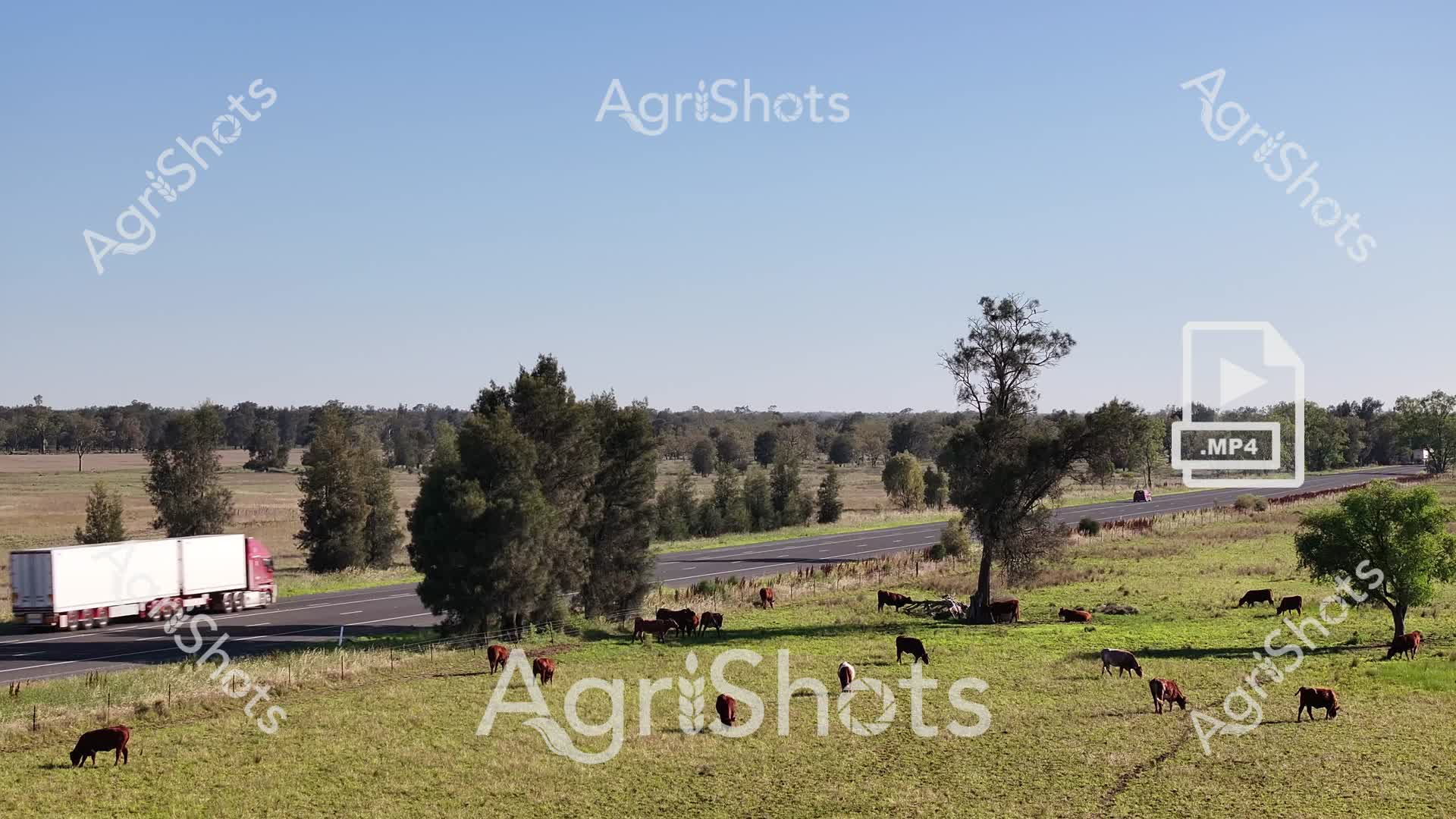
Grazing cattle dot the lush pastures of the Riverina, a verdant landscape stretching between scattered eucalyptus trees and a well-maintained highway. Diverse herds of beef cattle - some deep russet, others midnight black - peacefully graze on vibrant green grasslands, creating a classic Australian rural scene bathed in bright summer sunlight. A pink-cabbed semi-trailer traverses the bitumen road, a subtle reminder of the agricultural supply chain that connects these remote pastoral lands to broader markets. The expansive paddock offers a panoramic view of rolling grasslands punctuated by native trees, their shadows casting gentle patterns across the undulating terrain. Fencelines define the boundaries between grazing areas, while the clear azure sky suggests a perfect, warm day in rural New South Wales. This quintessential Australian agricultural vista captures the serene intersection of livestock farming, transportation infrastructure, and the timeless beauty of the country's pastoral heartland.
 Video
Video
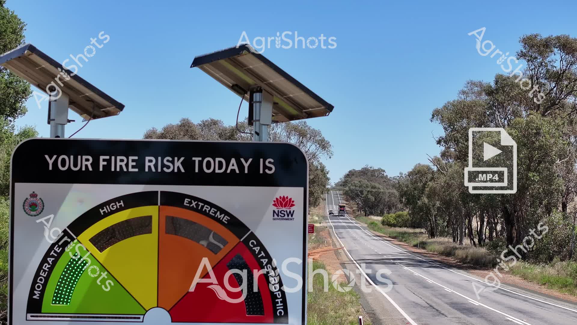
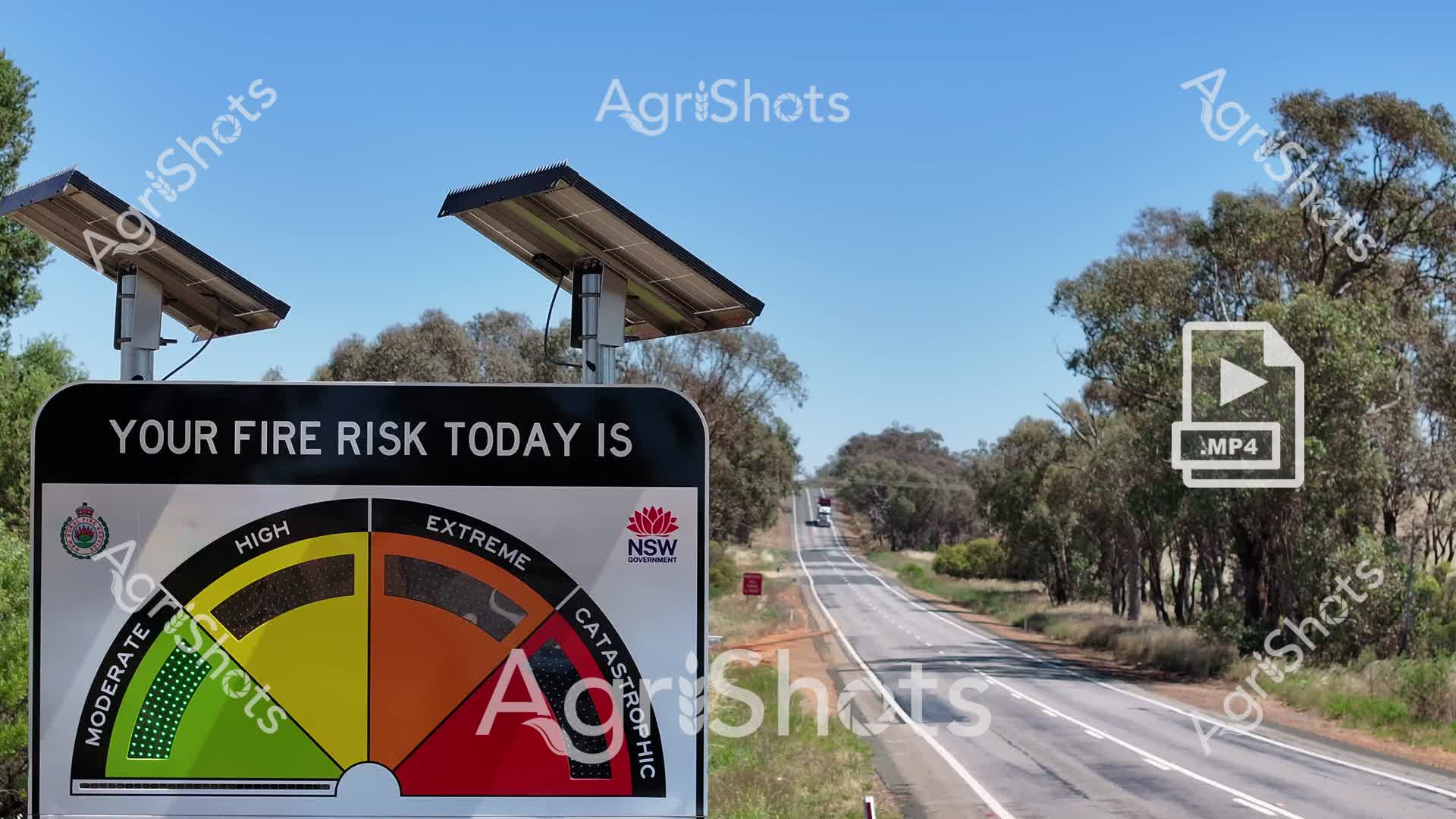
Fire danger awareness blazes across a sun-drenched New South Wales highway, with a vivid risk indicator panel dominating the foreground. The fire danger meter, mounted beneath solar-powered sensors, graphically displays escalating risk levels from moderate green through yellow and orange to catastrophic deep red, reflecting the intense summer conditions of the Riverina region. A long, empty rural highway stretches into the distance, lined with scattered eucalyptus trees and dry grasslands, embodying the vulnerable landscape during bushfire season. Solar panels atop the sign suggest technological preparedness and sustainable monitoring of environmental hazards. The clear azure sky and sparse roadside vegetation underscore the potential for rapid fire spread, while the official NSW Government branding reinforces the critical public safety messaging. This powerful visual communication stands as a sentinel, warning travelers and local communities about the day's potentially devastating fire conditions.
 Video
Video
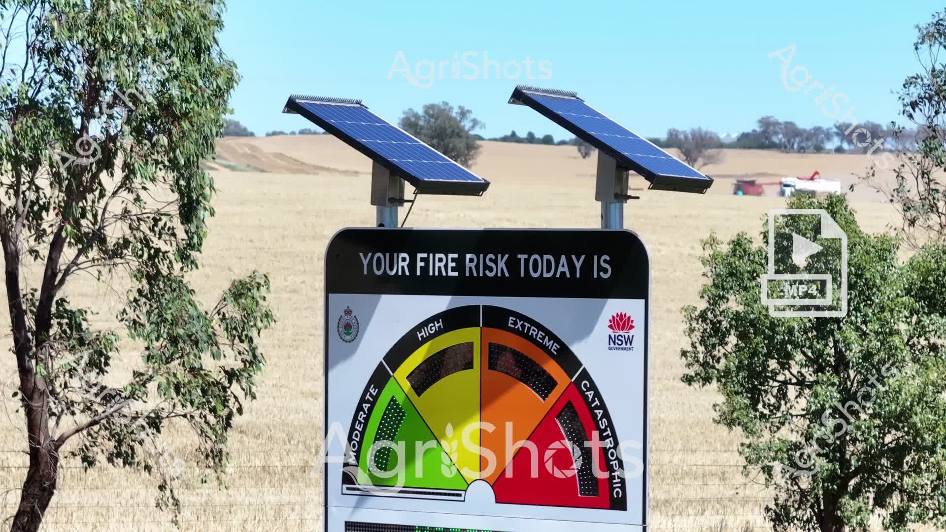
Fire danger warning sign stands sentinel in a golden, drought-parched paddock near a stand of eucalyptus trees, powered by twin solar panels capturing the intense Australian summer sunlight. The NSW Government fire risk indicator meter is calibrated to today's conditions, with the dial positioned between moderate and high, suggesting heightened environmental vulnerability. Crisp blue skies and bleached grasslands create a stark backdrop, highlighting the critical importance of fire awareness in rural agricultural landscapes. The rugged, self-powered sign represents a crucial public safety technology, providing real-time risk assessment for farmers, travelers, and local communities navigating the challenging bushfire-prone terrain of the Riverina region. Mounted on a sturdy metal frame with solar charging capability, the sign embodies technological resilience in protecting human life and agricultural assets against potential environmental hazards. The carefully positioned warning system reflects New South Wales' proactive approach to emergency preparedness in an increasingly unpredictable climate.
 Image
Image
Molten gold spills across the sky, transforming an outback dirt road into a canvas of breathtaking rural beauty. Silhouetted eucalyptus trees frame a dusty track cutting through dry grasslands, their branches etched against a blazing sunset typical of Queensland's Granite Belt region. The landscape pulses with the raw, elemental energy of an Australian summer evening, where scorched earth meets an incandescent horizon. A small puddle in the road's center captures a mirror-like reflection, providing a momentary counterpoint to the expansive, arid surroundings. Weathered gum trees stand as silent sentinels, their gnarled forms testament to generations of resilience in this unforgiving yet magnificent landscape. The scene captures the essence of rural Australia - a timeless, rugged beauty that speaks of endurance, open spaces, and the profound connection between land and sky.
 Video
Video
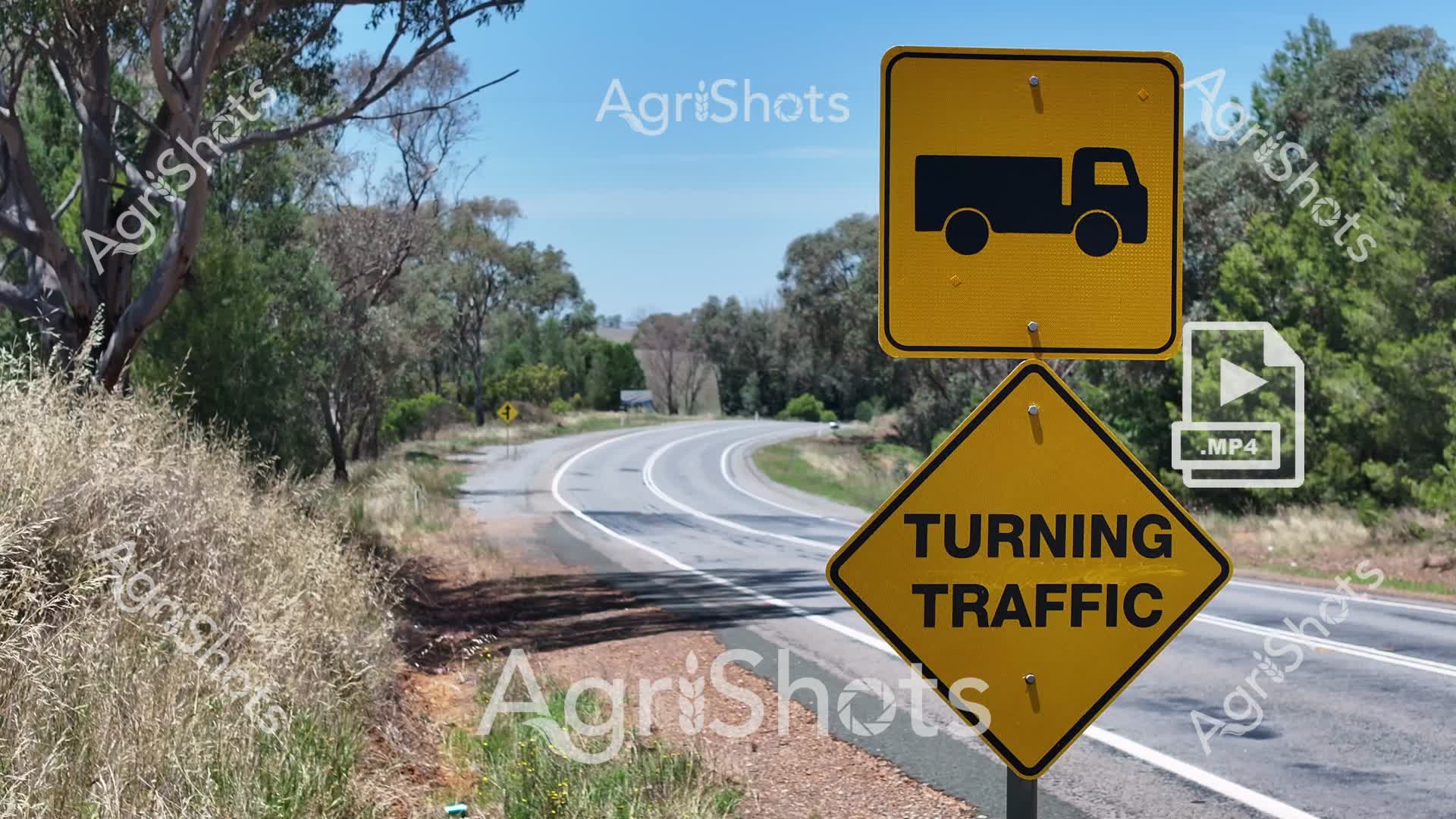
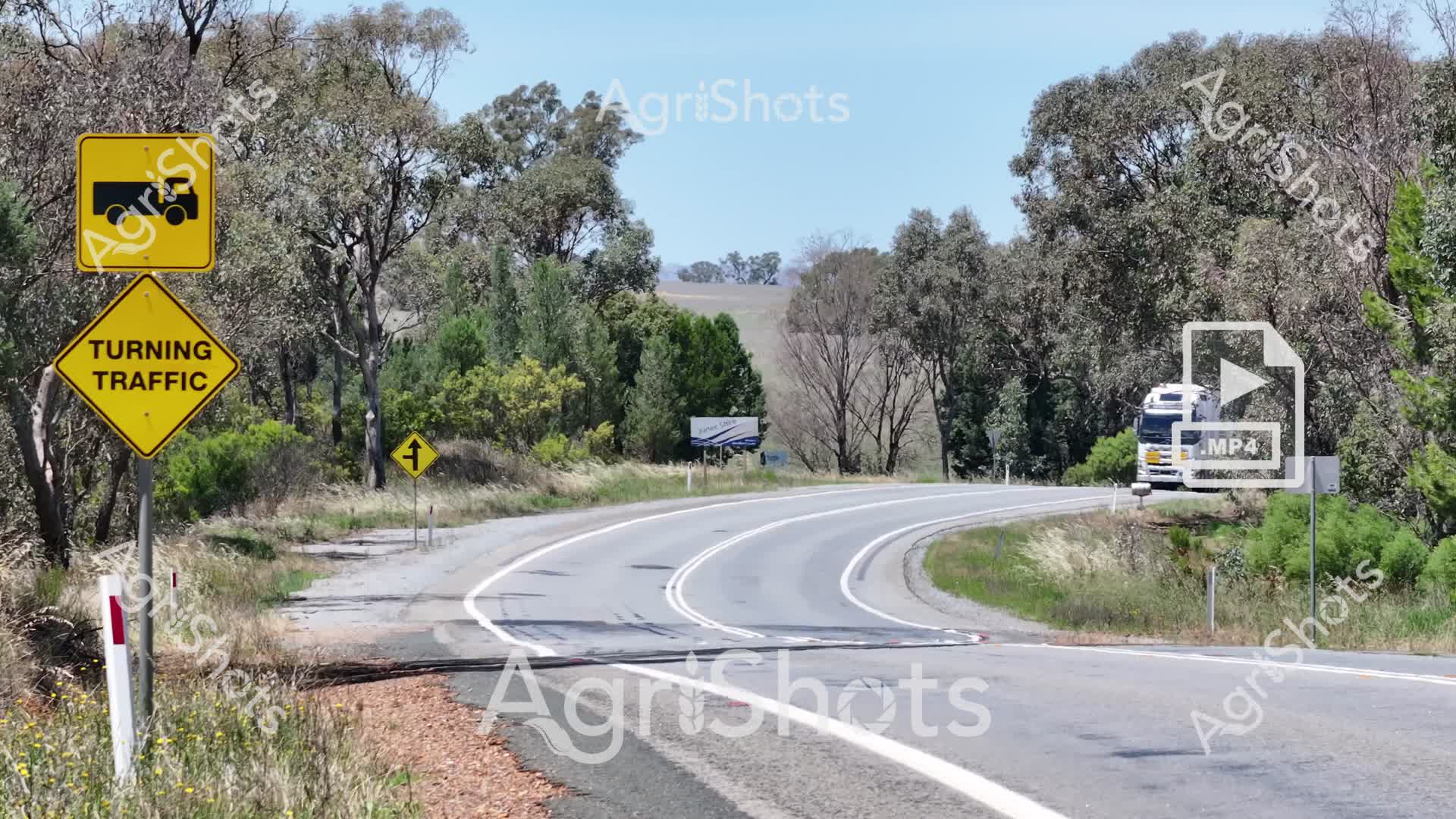
Rural Road Safety in the Riverina: Truck Turning Caution A sweeping country highway cuts through the golden-hued summer landscape of New South Wales' Riverina region, where silvery eucalyptus trees frame a gentle curve. Brilliant yellow traffic signage warns of turning vehicles, with a truck icon and bold "TURNING TRAFFIC" text alerting drivers to potential hazards on this rural thoroughfare. The road's asphalt gleams under intense sunlight, surrounded by windswept dry grasses and sparse woodland, capturing the harsh beauty of an Australian agricultural district. Weathered roadside vegetation and scattered gum trees underscore the rugged resilience of this farming landscape, where transportation and agricultural logistics are critical to regional economic survival. The crisp, clear signage represents a crucial safety measure, highlighting the delicate dance between heavy agricultural machinery and local traffic along these isolated highways. This scene embodies the practical, no-nonsense approach to road management in remote agricultural zones, where every journey carries both opportunity and risk.
 Video
Video
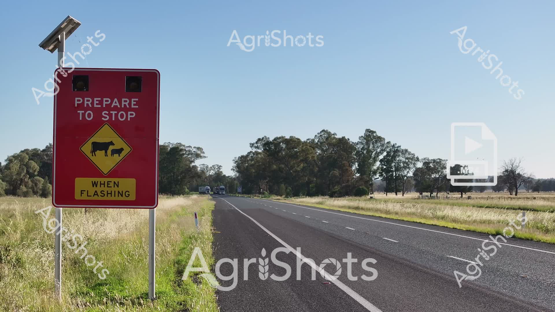
Rural Road Safety in the Riverina: Livestock Crossing Alert A vivid crimson warning sign stands sentinel alongside a sun-drenched country highway, its bold message commanding immediate attention. Solar-powered and strategically positioned, the sign alerts drivers to potential livestock on the roadway, with a clear yellow diamond icon depicting cattle and the instruction "PREPARE TO STOP WHEN FLASHING". The sealed bitumen road stretches ahead, flanked by golden grasslands and a distant treeline of eucalyptus, capturing the quintessential Australian rural landscape of New South Wales' Riverina region. Soft summer light bathes the scene, highlighting the crisp contrast between the vibrant red signage and the pale blue sky, creating a powerful visual reminder of the delicate interaction between agricultural movement and road transit. This image encapsulates the critical safety protocols that protect both livestock and drivers in remote agricultural areas, where farm animals and highway traffic must coexist with vigilance and respect.
 Video
Video
A crisp summer day unfolds across the Riverina's expansive agricultural landscape, where a vital "GIVE WAY" sign commands attention against the backdrop of scattered eucalyptus trees and golden grasslands. The serpentine rural highway cuts through sun-drenched paddocks, its asphalt gleaming under a cloudless cerulean sky, embodying the essential infrastructure that connects Australia's agricultural heartland. Weathered roadside grasses in ochre and sage green frame the roadway, with white lane markers and a red-trimmed traffic sign providing sharp visual contrast to the organic terrain. This scene captures the quiet resilience of rural transportation networks, where every intersection represents a moment of careful negotiation and mutual respect among farmers, truckers, and travelers navigating the vast, productive countryside. The image speaks to the unspoken protocols of rural movement - a metaphorical and literal crossroads where agricultural productivity and safety intersect, reflecting the meticulous care inherent in Australian farming culture.
 Video
Video
Verdant pastures of the Riverina unfurl beneath an expansive Australian sky, where a substantial herd of black and red-coated cattle graze leisurely across a lush green landscape. Scattered eucalyptus trees punctuate the rolling grasslands, providing gentle shade and breaking the seemingly infinite horizon. A smooth bitumen road cuts through the foreground, a stark geometric contrast to the organic undulations of the pastoral scene, highlighting the sophisticated infrastructure supporting rural agricultural systems. The cattle, appearing healthy and well-distributed, demonstrate the robust cattle farming practices of New South Wales, with animals systematically grazing and maintaining the grassland ecosystem. Soft summer light bathes the landscape, casting subtle shadows and emphasizing the rich emerald and olive tones of the paddock, while a small dam glimmers in the middle distance, providing essential water resources for the livestock. This compelling agricultural vista captures the essence of Australian pastoral farming - a harmonious blend of natural beauty, agricultural productivity, and strategic land management.
 Video
Video
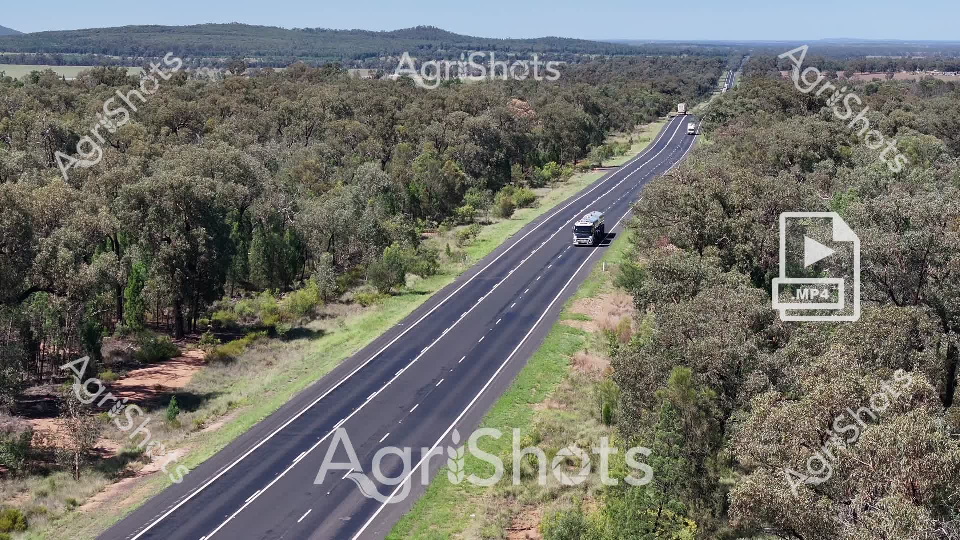
Cutting through the heart of the Riverina's expansive eucalyptus woodland, this pristine highway represents the vital arteries of Australian agricultural logistics. A sleek, dark-cabined freight truck navigates the freshly sealed, multi-lane road, its trajectory laser-straight between walls of silvery-green bushland. Overhead drone imagery captures the magnificent engineering of rural infrastructure, where carefully maintained roadways allow produce and supplies to traverse challenging terrain with remarkable efficiency. The landscape speaks of summer - dry grasses edging the roadway, robust gum trees standing sentinel, and a clear azure sky promising heat. Shadows cast by dense forest canopies create a patchwork of light and shade across the bitumen, highlighting the road's immaculate lane markings and smooth surface. This vista epitomizes the connectivity that underpins Australia's agricultural success, where modern transportation networks seamlessly link remote production zones with metropolitan markets.
 Video
Video
Rural Road Safety in the Riverina: A Turning Point A sweeping rural highway cuts through the sun-drenched landscape of New South Wales, revealing the critical importance of road safety in agricultural transport corridors. Vibrant yellow warning signs alert drivers to turning traffic, highlighting the complex choreography of trucks and vehicles navigating these arterial routes connecting farming communities. Sparse eucalyptus and native woodland frame the road's gentle curve, with distant rolling hills suggesting the expansive Riverina agricultural region. A large truck navigates the bend, embodying the lifeline of rural supply chains and the constant movement of produce and agricultural resources. The clear summer sky and well-maintained road infrastructure underscore the region's commitment to efficient and safe transportation. These roadways are more than mere passages - they are critical arteries that pulse with the economic and logistical heartbeat of Australian agriculture, connecting farms, markets, and communities across vast distances.
 Video
Video
A critical fire danger indicator stands sentinel along a sun-drenched rural highway in New South Wales, its solar-powered display warning of escalating bushfire risks during the unforgiving Australian summer. The fire danger meter, branded with the NSW Government emblem, glows with urgent colors ranging from moderate green to catastrophic deep red, signaling potential devastation for the surrounding eucalyptus-lined landscape. Stretching into the distance, the empty bitumen road cuts a stark line through the dry woodland, punctuated by scattered gum trees and sparse undergrowth - a terrain primed for potential wildfire spread. Two solar panels crown the warning sign, drawing energy from the intense sunlight to power this critical public safety communication. The crisp blue sky and bleached vegetation underscore the harsh conditions of the Riverina region, where summer transforms the landscape into a tinderbox awaiting a single spark. This image captures the persistent threat of bushfires and the vigilant monitoring systems deployed to protect rural communities from potential catastrophic environmental events.
 Image
Image
Rural Queensland Highway at Golden Hour A ribbon of asphalt stretches through the lush pastoral landscape of the Granite Belt region, capturing the sublime transition between late afternoon and early evening. Verdant eucalyptus and native woodland trees frame both sides of the highway, their rich green foliage contrasting against the dramatic cloudscape overhead. Warm golden sunlight bathes the road, casting long shadows and illuminating the bitumen with a honeyed glow that speaks to the endless horizons of rural Australia. The highway's crisp white lane markings cut a precise line through the undulating grasslands, symbolizing connection and movement across this expansive agricultural terrain. Soft clouds drift across a blue-tinged sky, creating a luminous backdrop that hints at the approaching sunset and the day's gentle conclusion. This scene embodies the quiet majesty of Queensland's agricultural heartland - a landscape of connection, possibility, and natural beauty.
 Video
Video
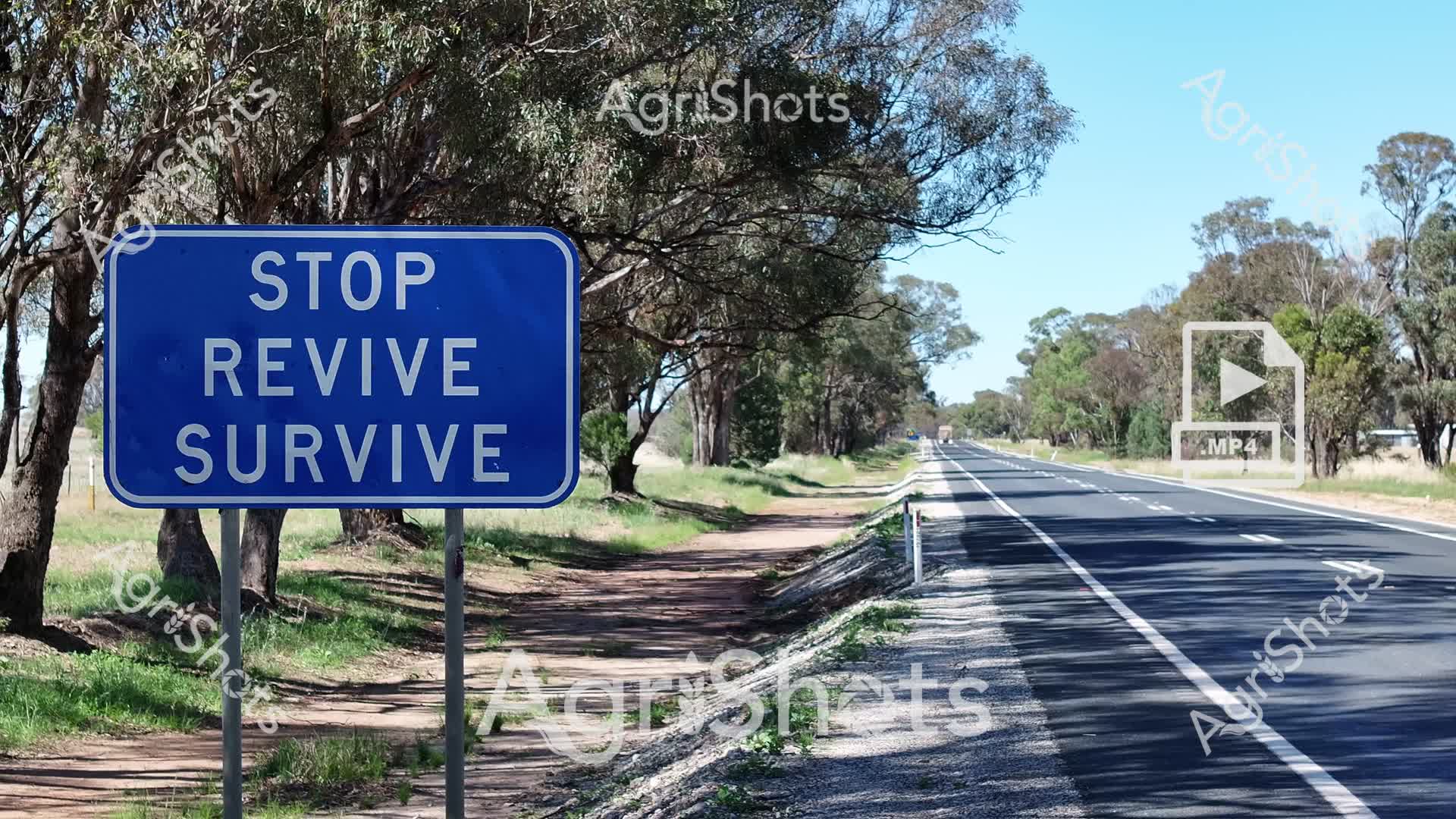
Capturing the stark resilience of rural Australian road safety, this powerful roadside scene embodies the "Stop Revive Survive" road safety campaign critical to long-distance travel in the Riverina region. A deep blue highway sign stands sentinel alongside a dusty country road lined with weathered eucalyptus trees, their silvery-green foliage casting dappled shadows on the sun-baked landscape. The sealed asphalt highway stretches into the distance, a lifeline cutting through the dry summer grasslands, highlighting the immense distances travelers must navigate across New South Wales. Roadside gravel and sparse vegetation underscore the challenging driving conditions that make driver fatigue a serious risk in rural Australia. The image speaks to the importance of road safety awareness, with the stark messaging serving as a vital reminder for truck drivers, travelers, and agricultural workers who traverse these expansive rural highways. The crisp blue sky and golden-green landscape capture the unforgiving beauty of the Australian summer, where staying alert can mean the difference between life and death.
Well, you've ploughed through the whole field!
No more crops to harvest here, mate.
Try searching for something else in our library of 50,000+ royalty-free media: