Related Images & Videos
View All Similar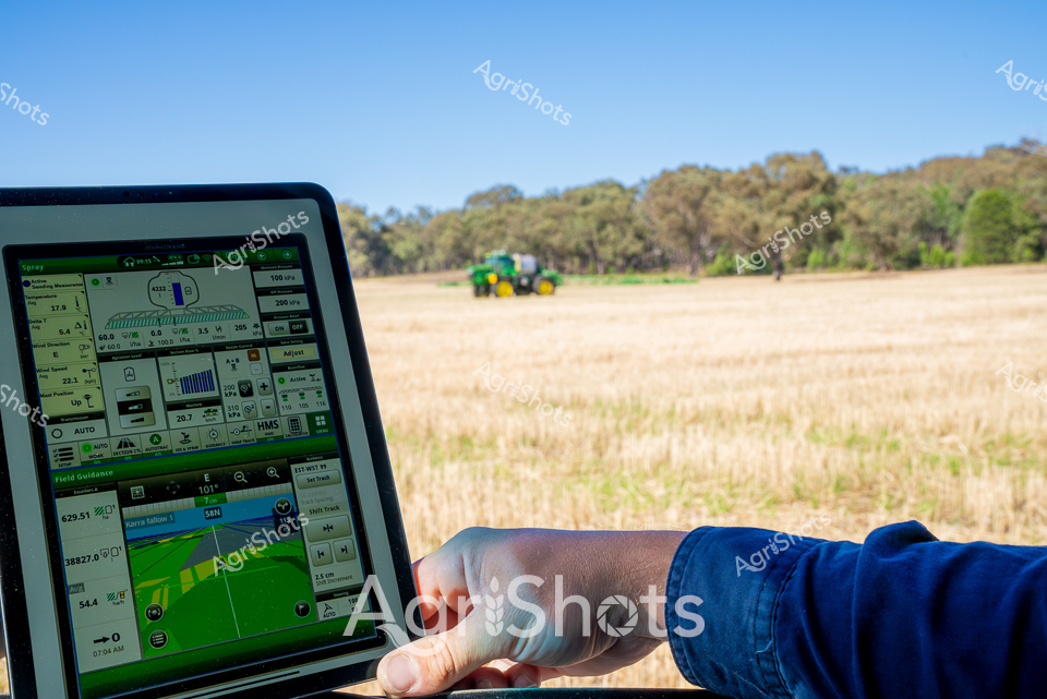


Purchase This Image
Get unlimited downloads with a subscription
View Subscription PlansAbout This Image
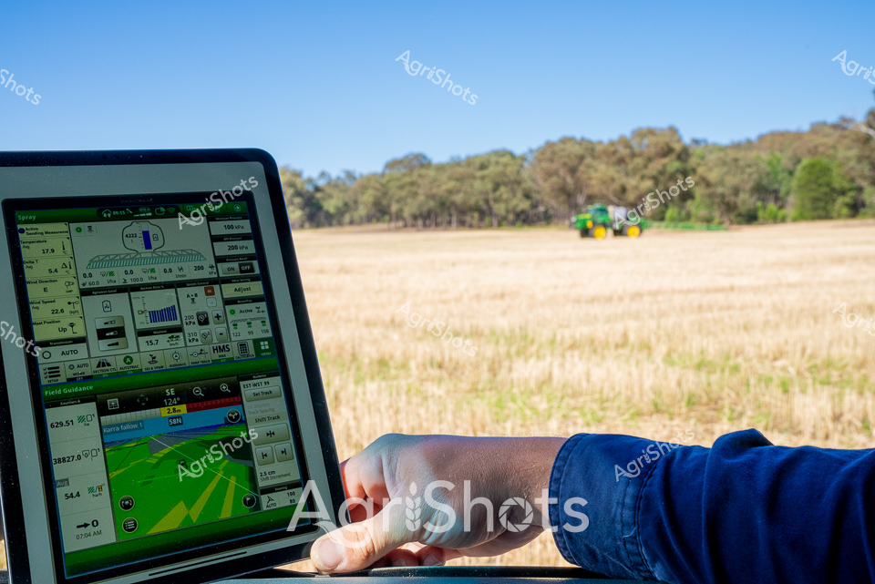
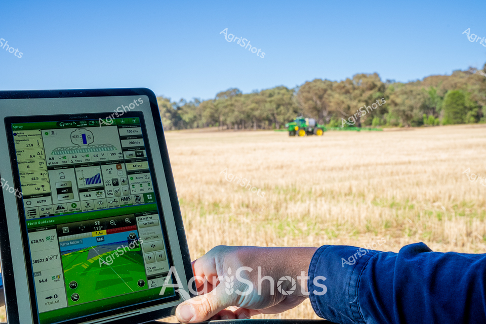
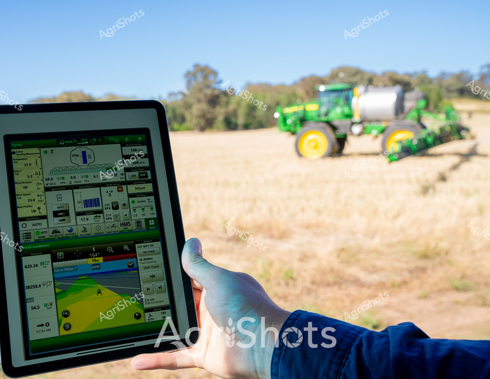
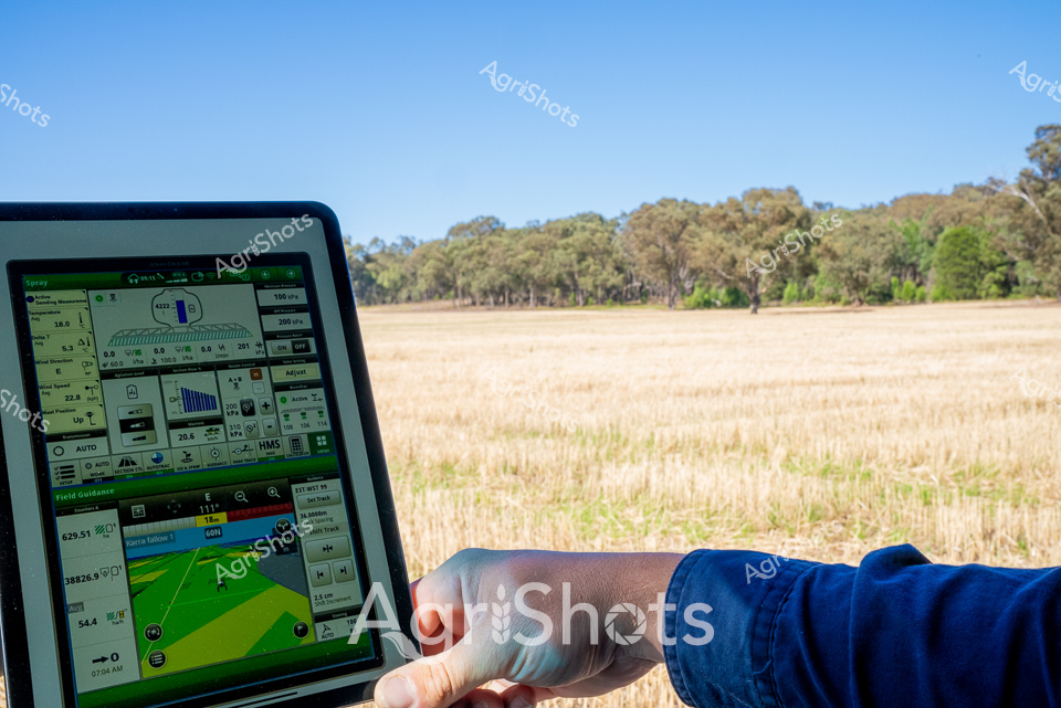
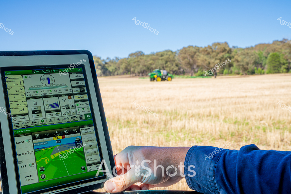
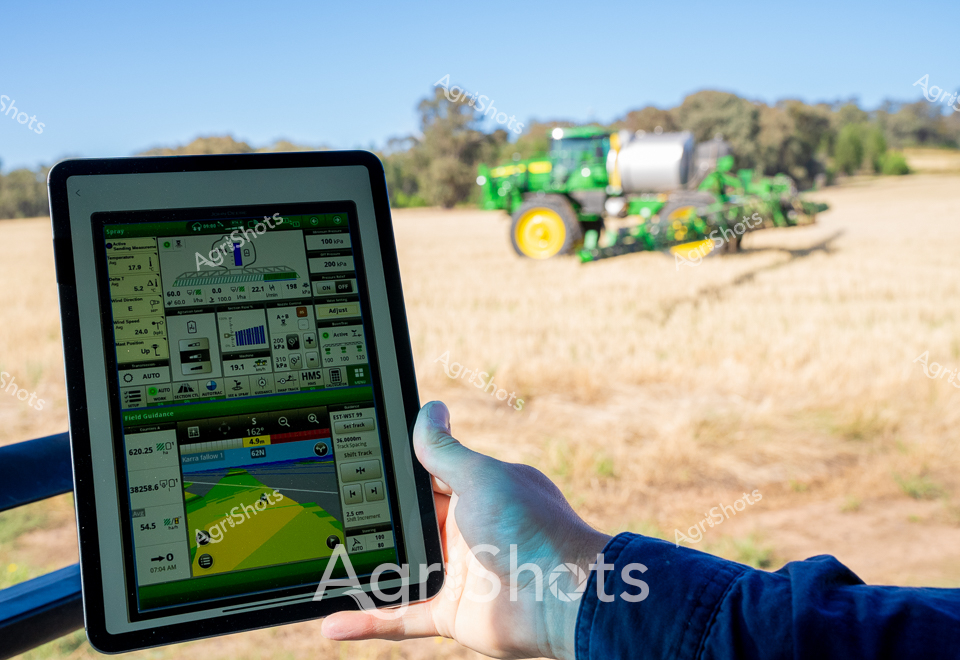
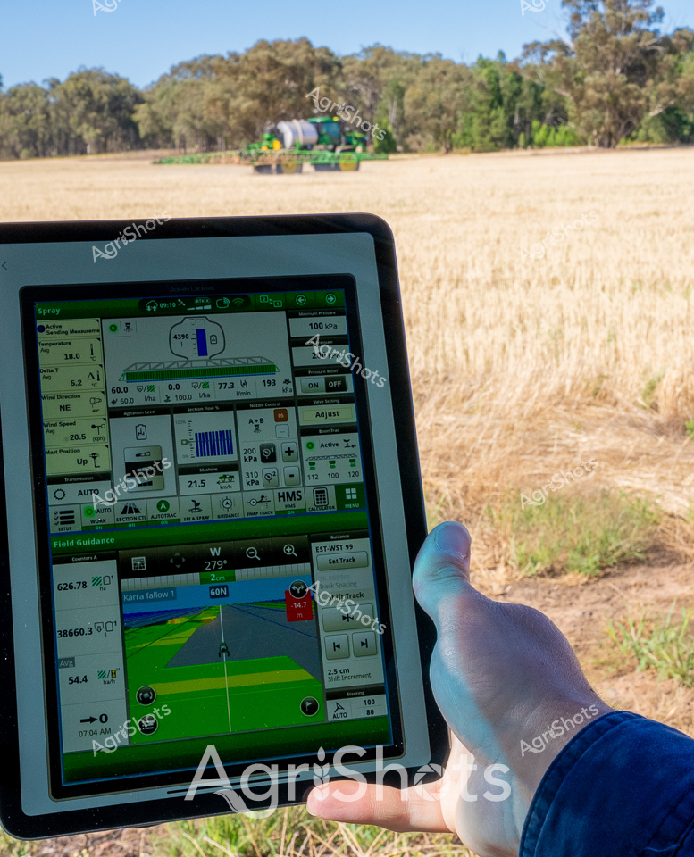
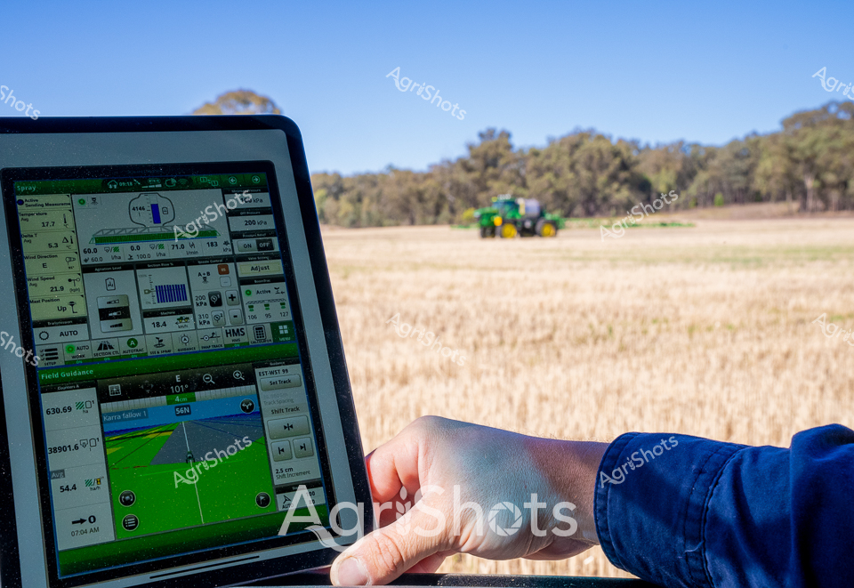
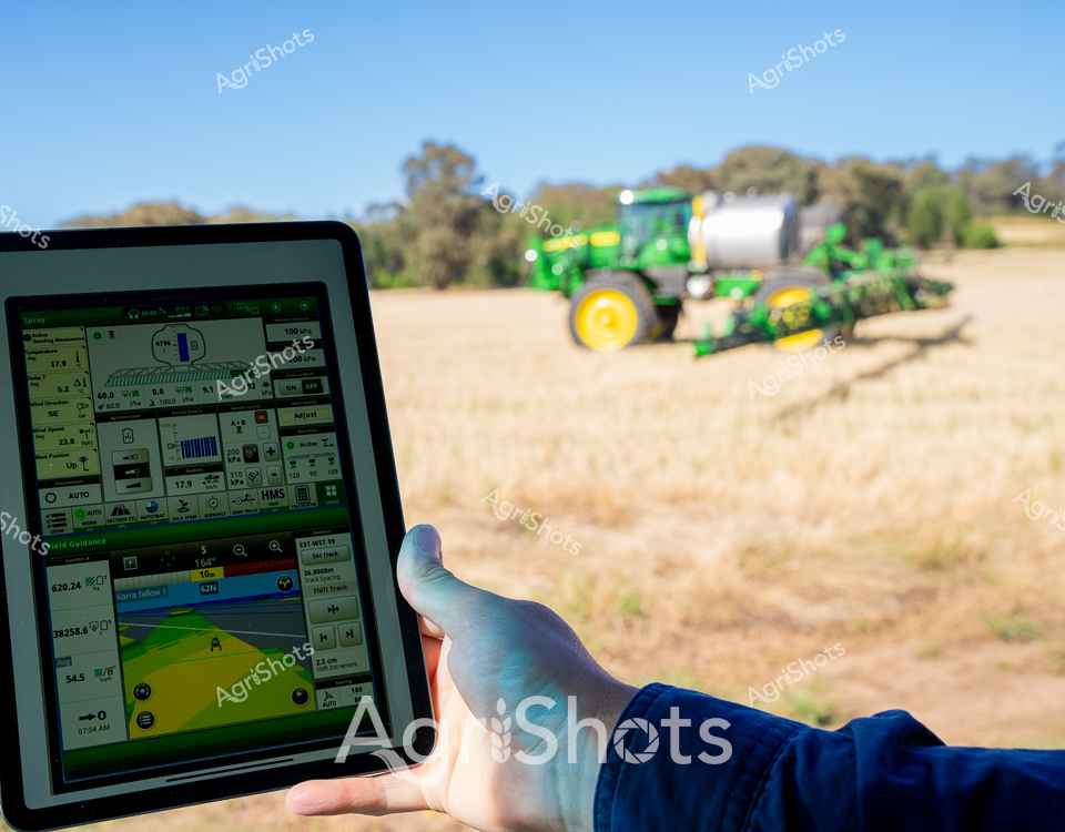
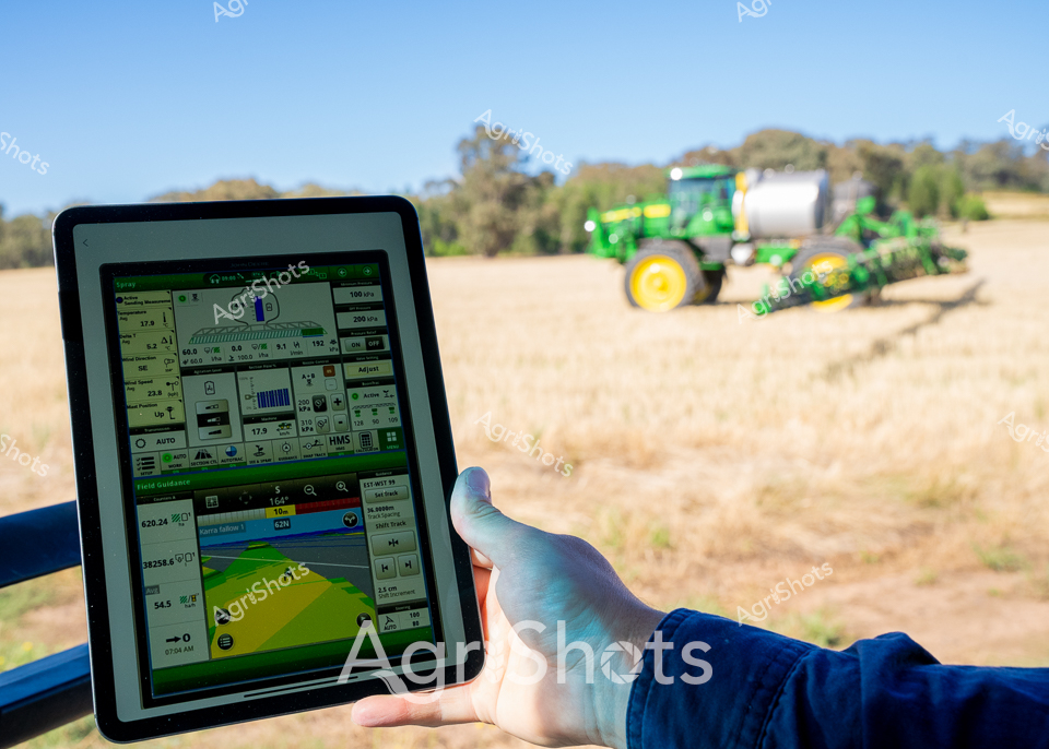
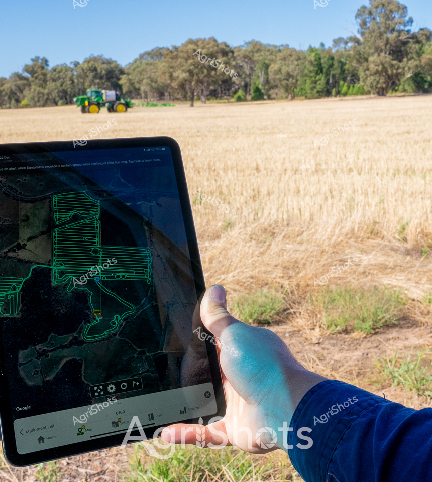
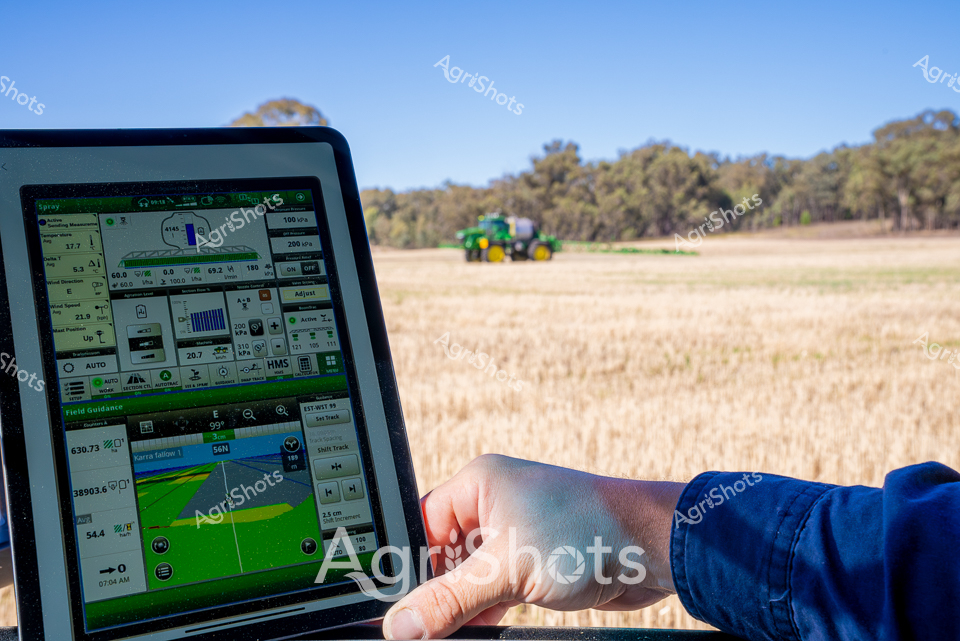
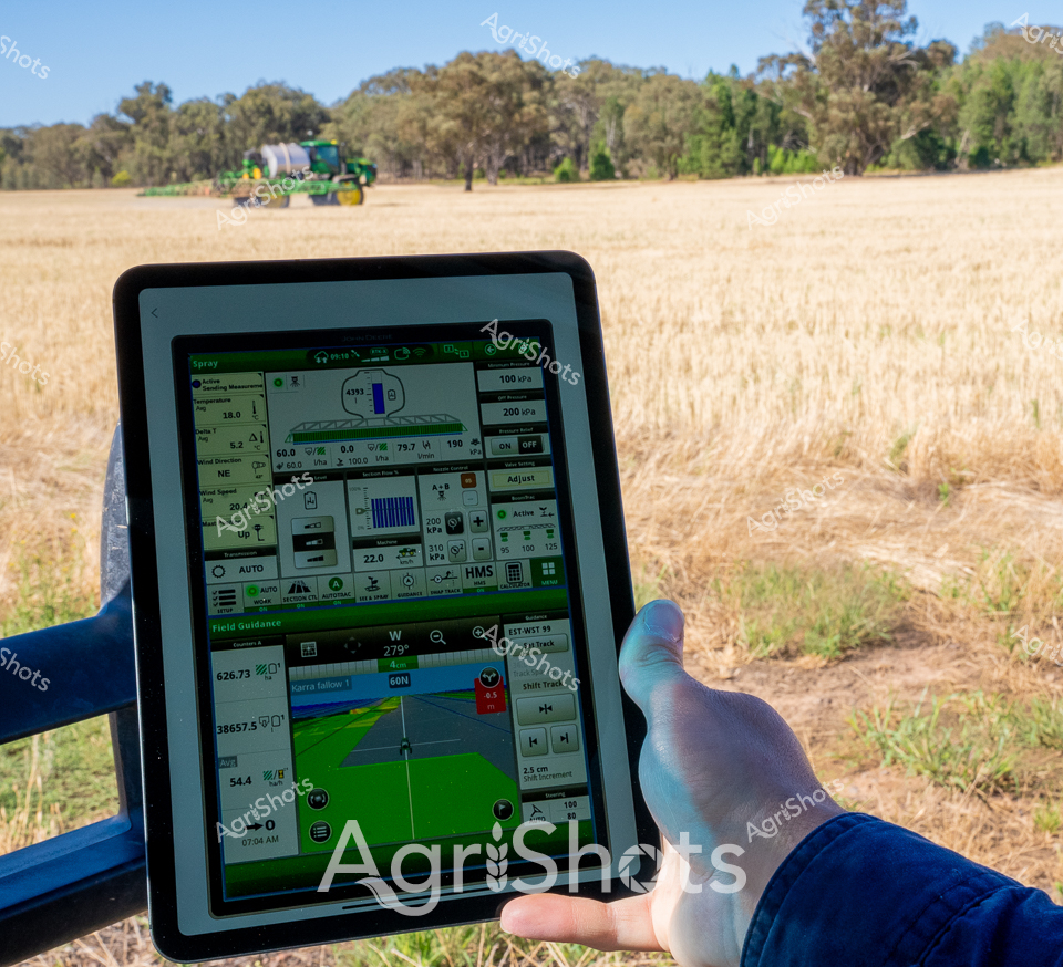
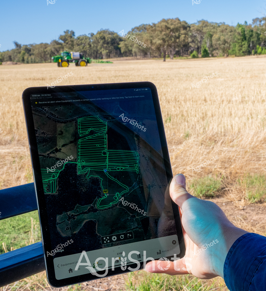
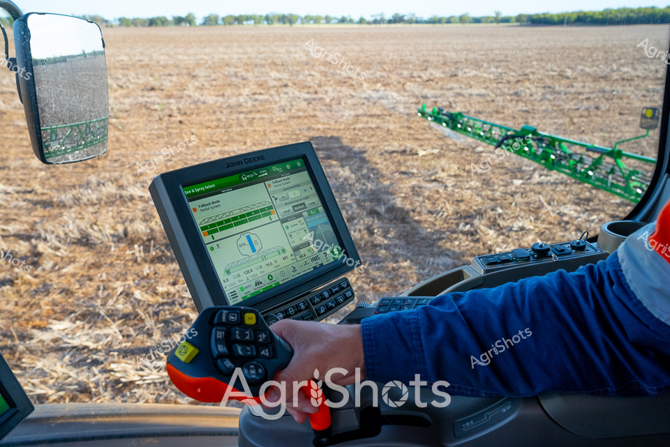
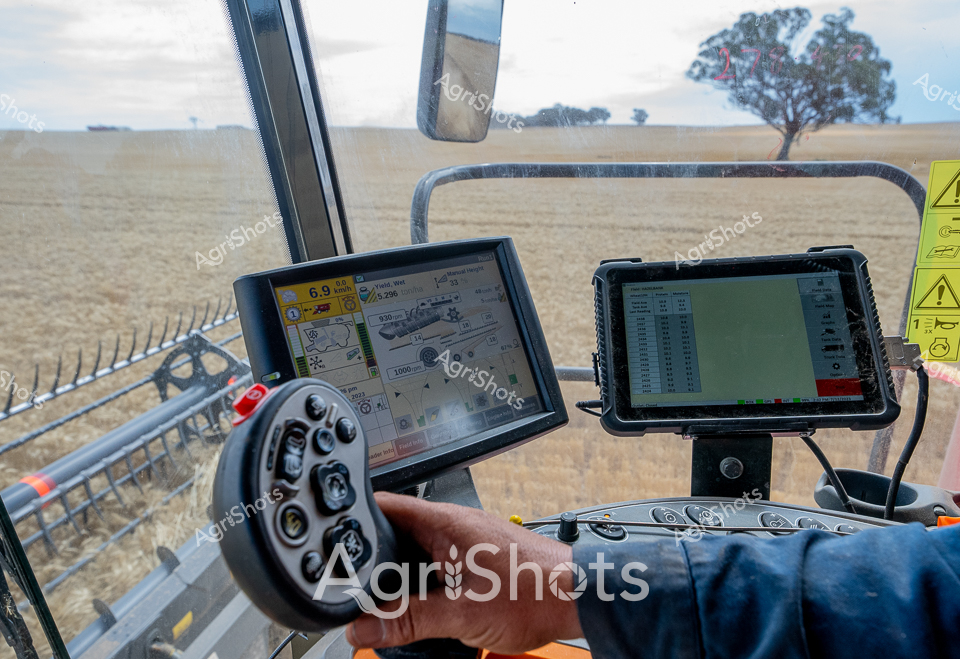
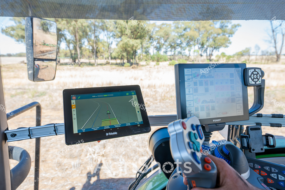
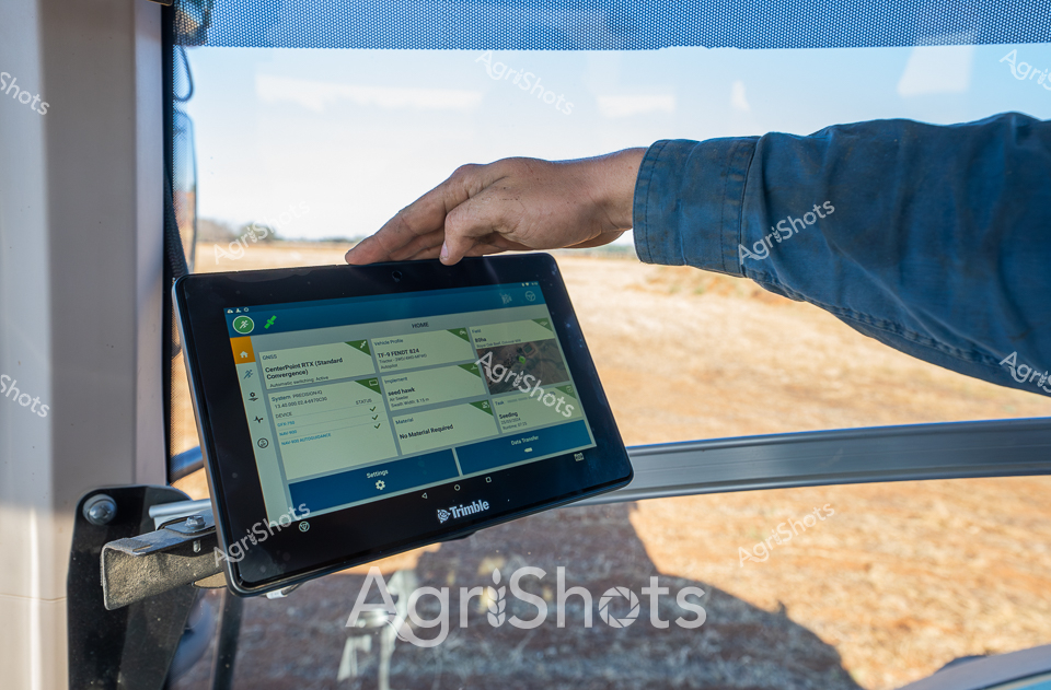
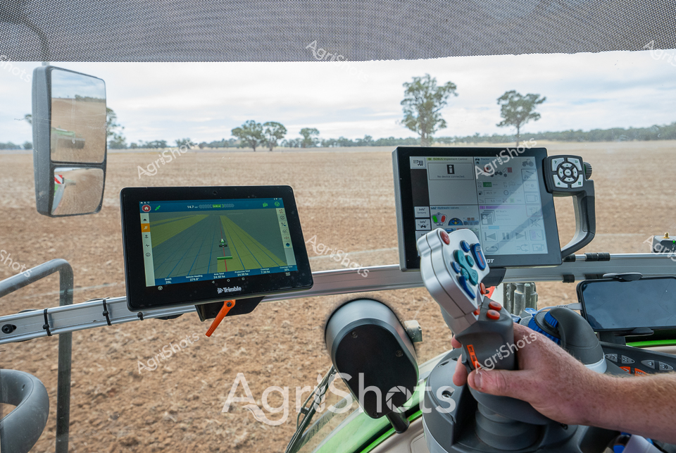
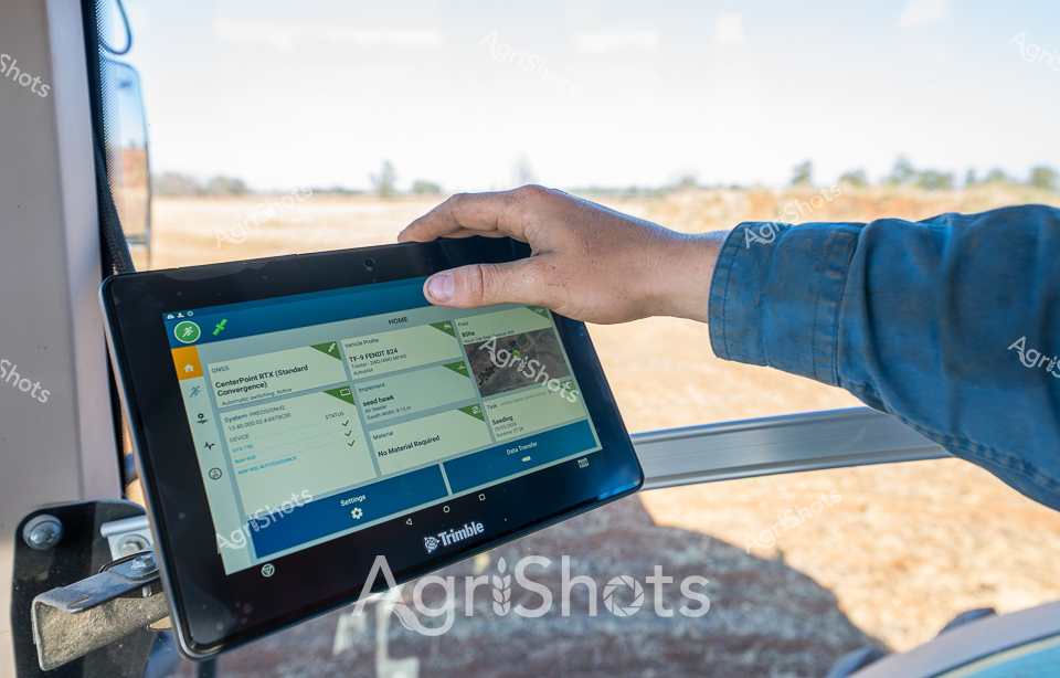
Precision agriculture unfolds across a golden stubble field in the Riverina region of New South Wales. A blue-sleeved arm rests beside a digital interface displaying intricate GPS and field mapping data, capturing the cutting-edge technology transforming modern farming. In the background, a green John Deere agricultural vehicle traverses the dry, wheat-harvested landscape, silhouetted against a stand of eucalyptus trees under a crystalline summer sky. The tablet screen reveals a sophisticated field guidance system, with color-coded zones and detailed metrics demonstrating the complex digital management of contemporary broadacre cropping. Crisp lines of green and blue graphics overlay a satellite-mapped field view, representing real-time agricultural data that guides precision spraying and crop management. This image encapsulates the marriage of traditional agricultural landscapes with advanced technological innovation, where every hectare is monitored, measured, and managed with scientific accuracy.