
Related Images & Videos
View All Similar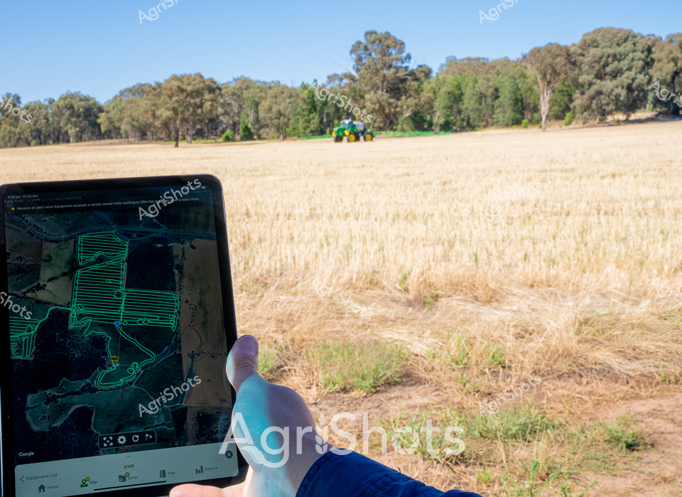


Purchase This Image
Get unlimited downloads with a subscription
View Subscription PlansAbout This Image
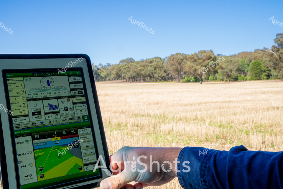
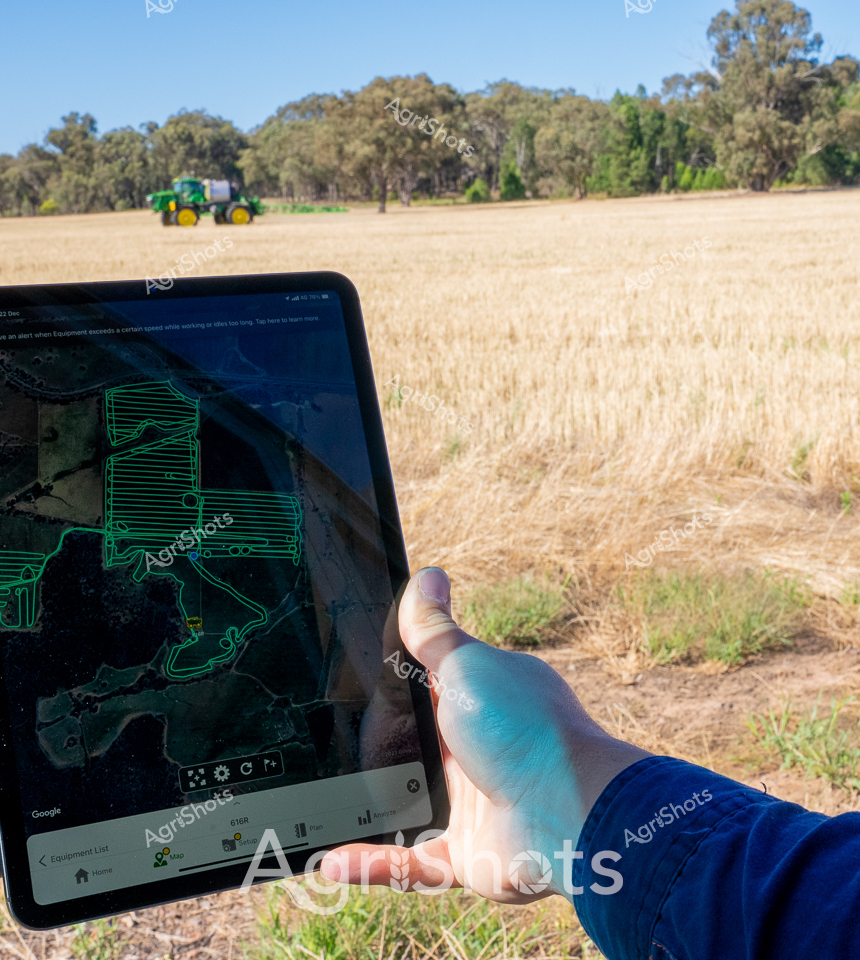
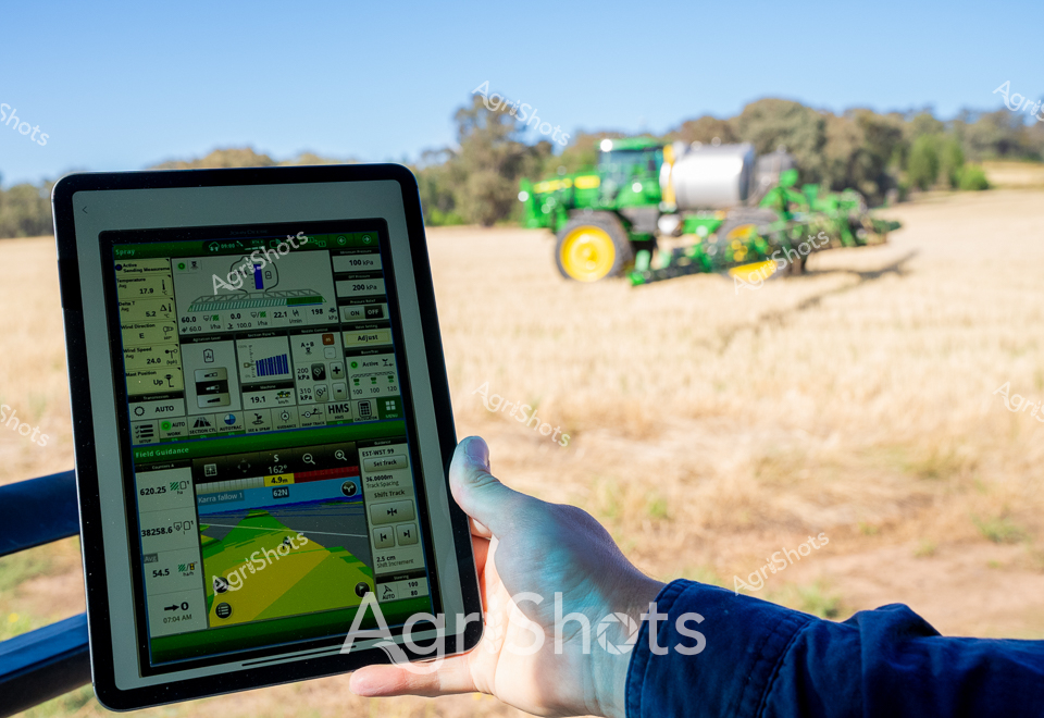
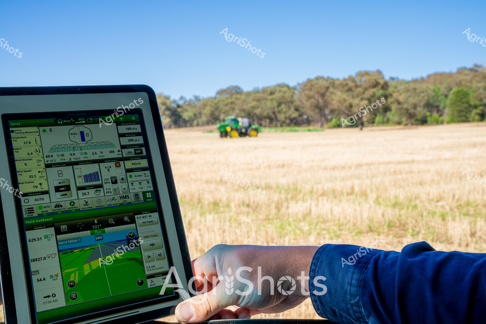
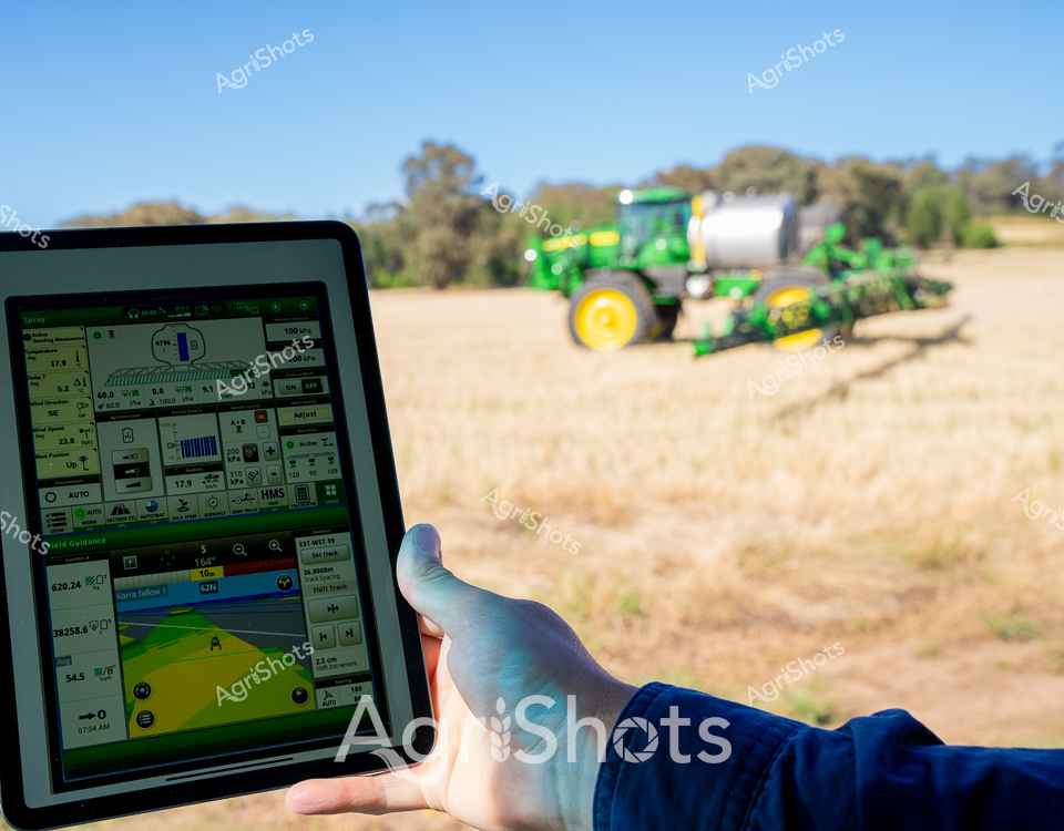
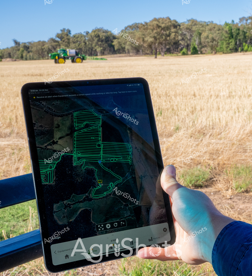
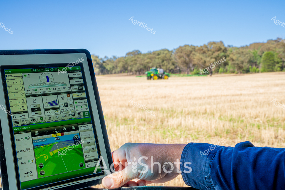
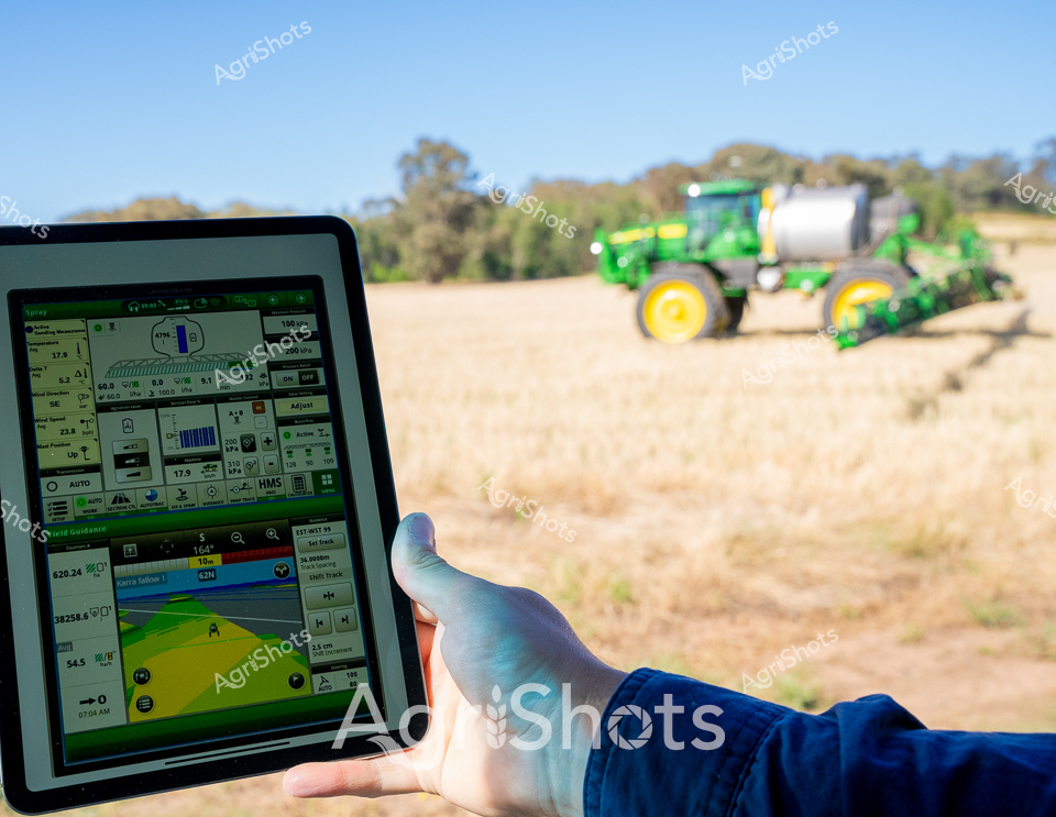
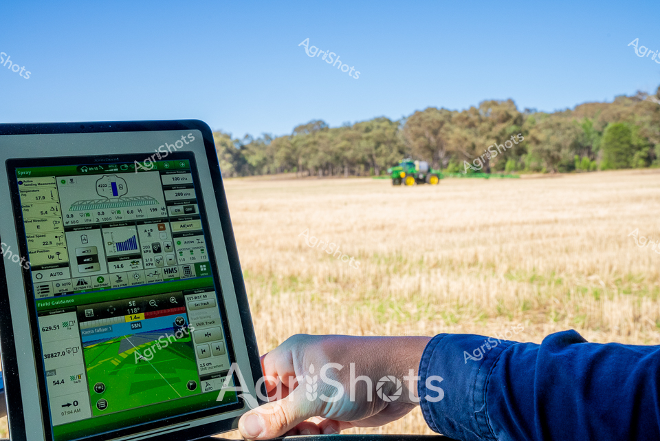
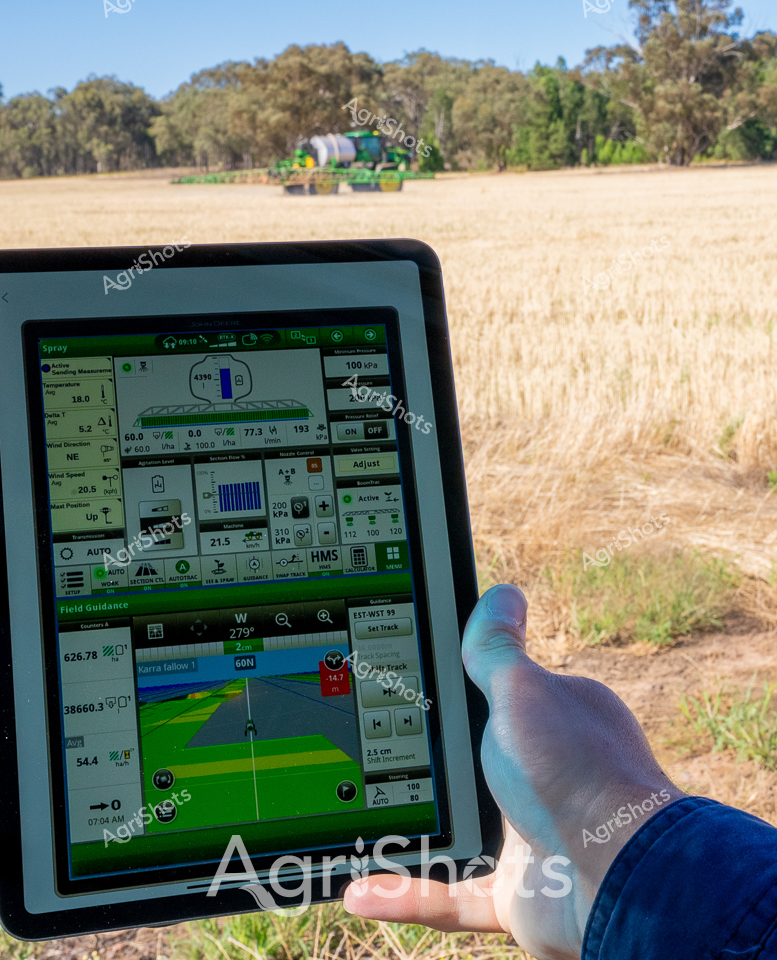
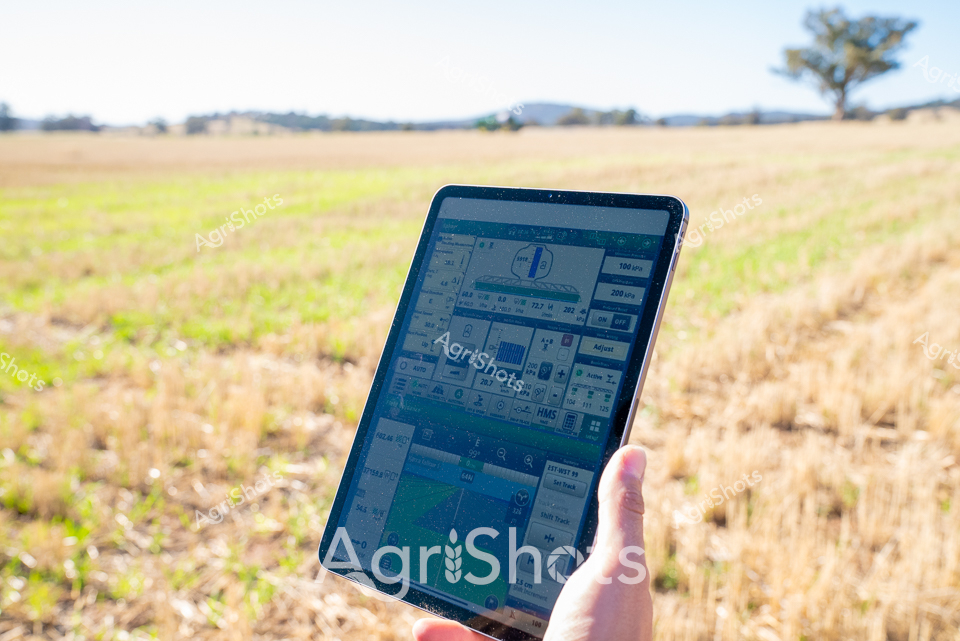
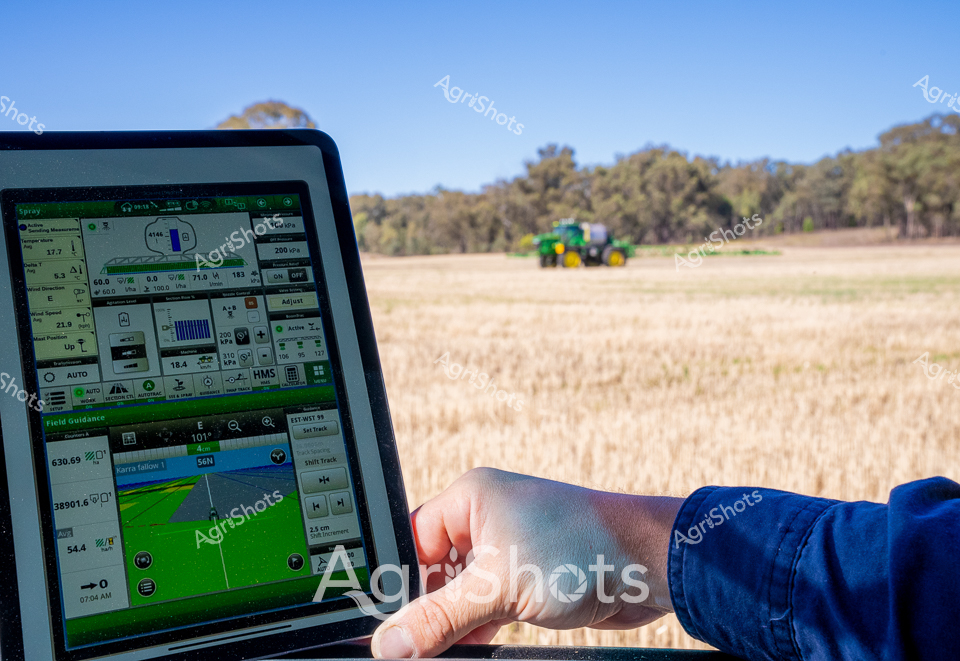
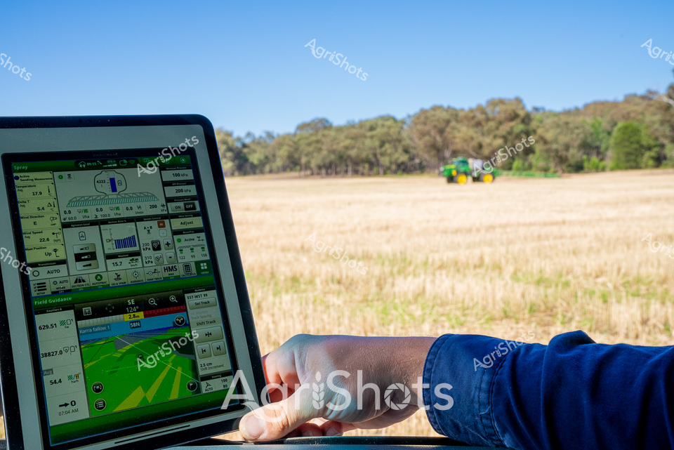
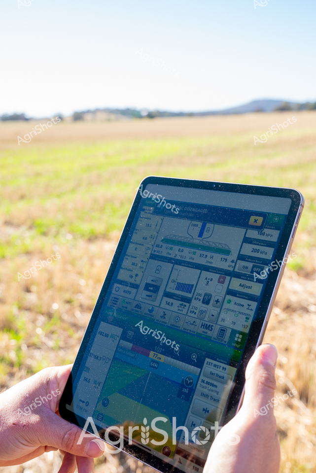
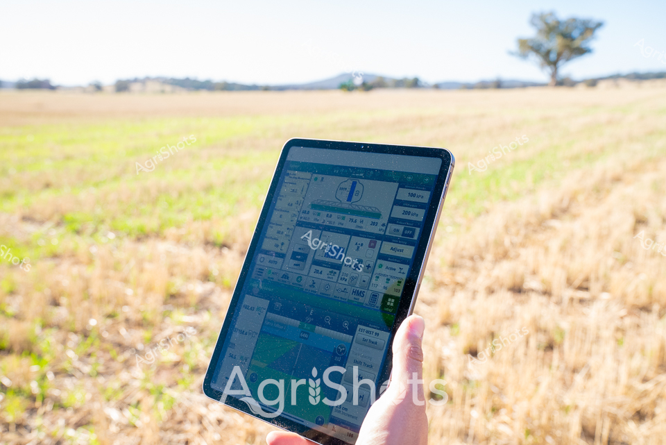
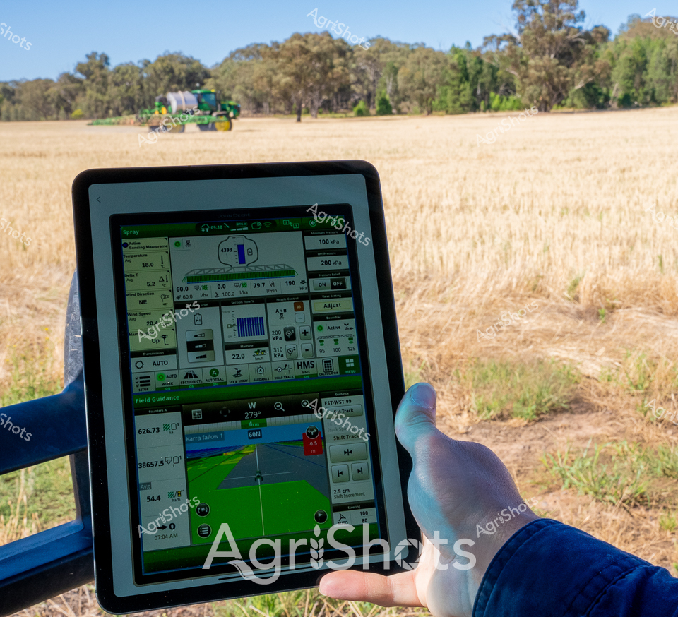
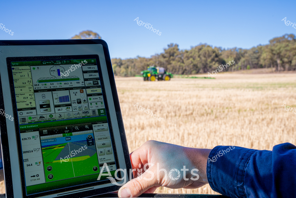
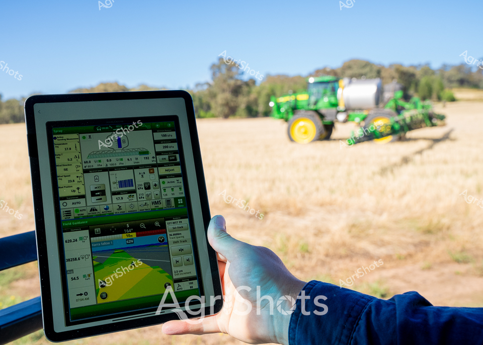
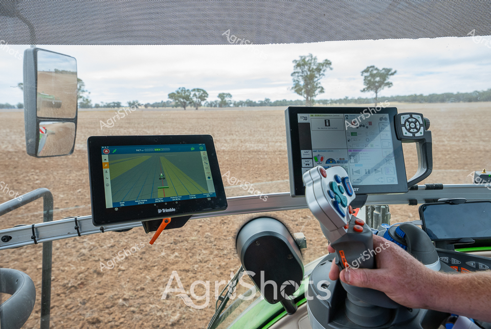
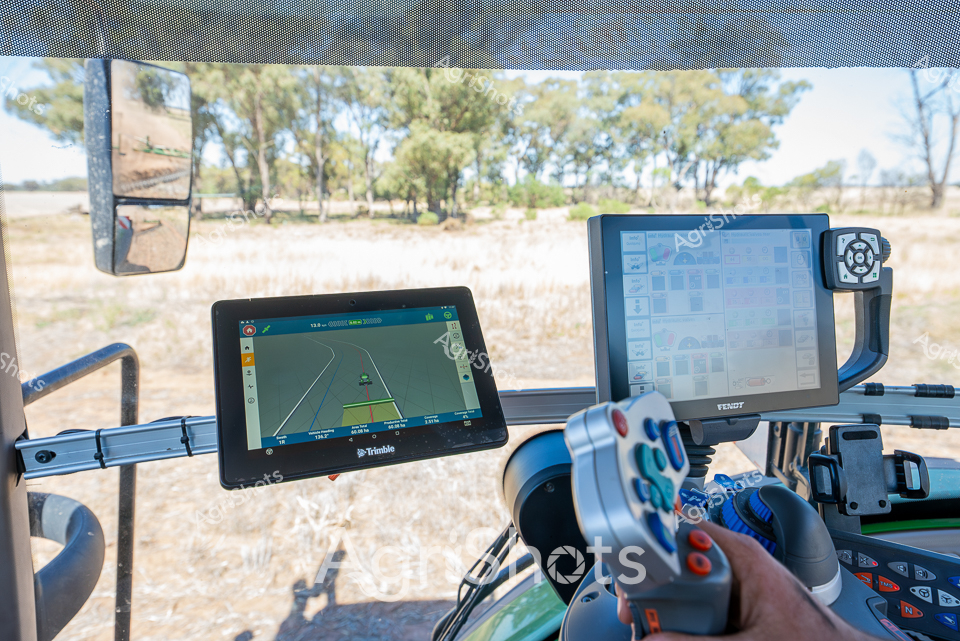
Precision agriculture transforms the golden stubble fields of New South Wales' Riverina region, where digital mapping meets rural landscape. A gloved hand cradles an iPad, displaying an intricate green-lined digital map overlaying satellite imagery of the farm's boundaries and topography. A distant green and yellow John Deere spray rig moves across the sun-drenched paddock, its path likely guided by the same geospatial technologies visible on the tablet screen. The blue-sleeved arm suggests a farmer or agricultural technician leveraging cutting-edge GPS and crop management software to optimize field operations, marking a sophisticated intersection of technology and traditional agricultural practice. Verdant trees line the horizon, contrasting with the dry, wheat-colored ground, capturing the intense summer conditions of inland Australia. This image eloquently portrays the modern agricultural workflow, where data-driven precision replaces traditional guesswork, enabling farmers to manage vast landscapes with unprecedented accuracy and efficiency.