 Image
Image
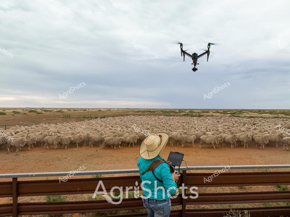
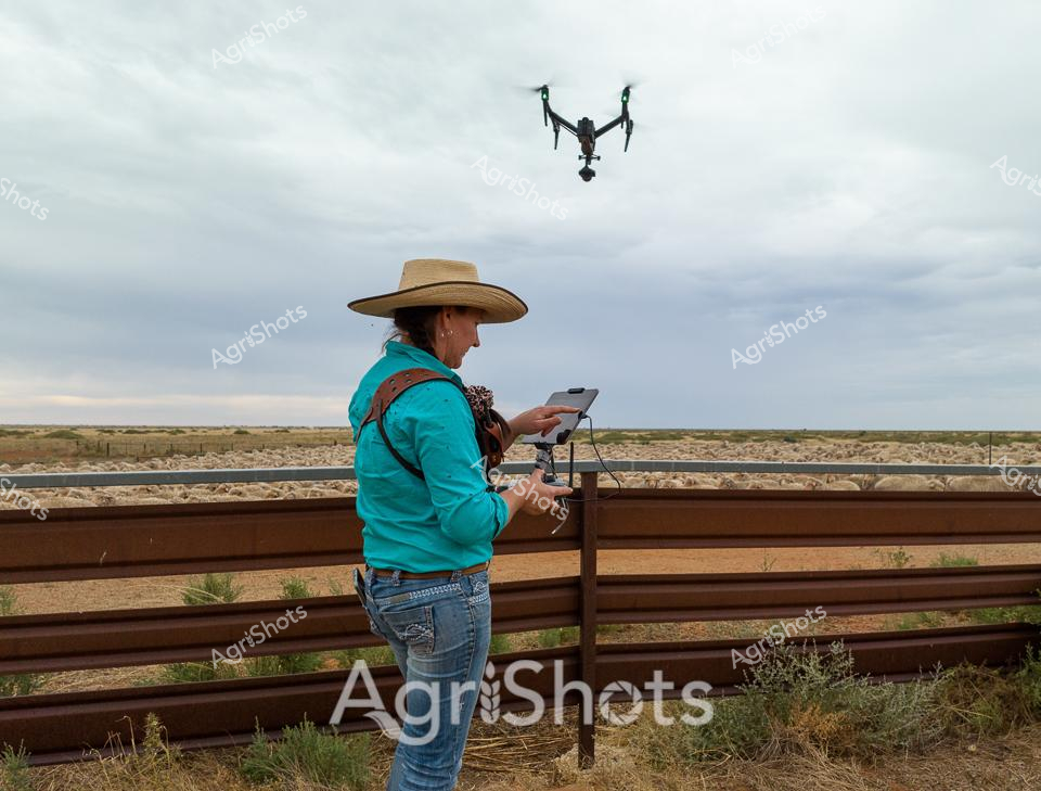
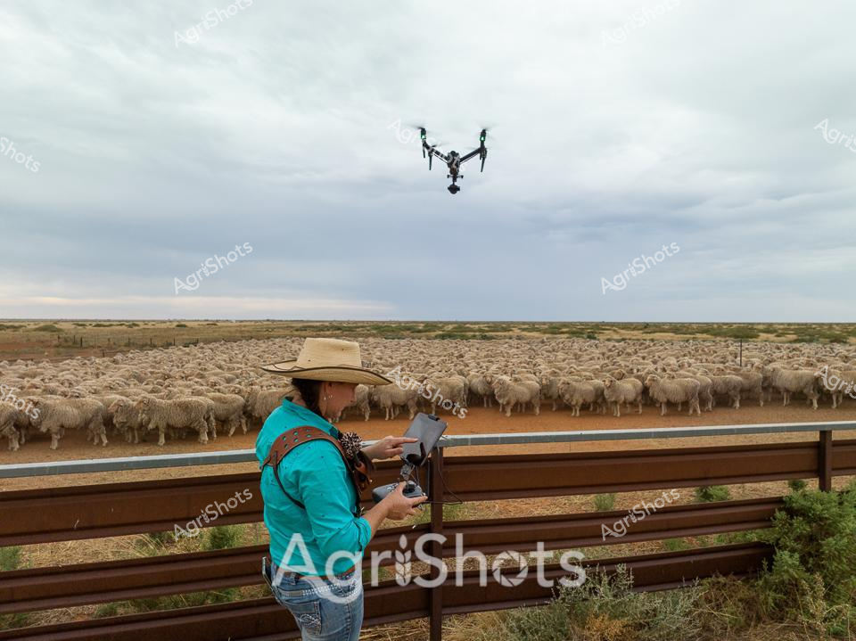
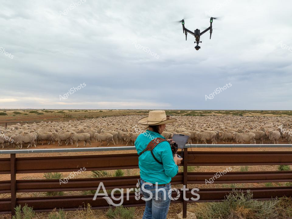
A drone hovers above a vast merino sheep flock, capturing the expansive pastoral landscape of rural New South Wales. A station hand in a bright turquoise shirt and wide-brimmed sun hat stands at the fence line, operating a tablet to control the aerial technology surveying the densely packed woolly herd. The earth is a rich ochre red, contrasting with the pale, fleece-covered bodies of hundreds of merino sheep clustered tightly in the yards. Overcast skies create a muted, soft light that emphasizes the textures of wool and dust, highlighting the intersection of traditional agriculture and modern digital monitoring techniques. The scene represents the innovative spirit of Australian agricultural practices, where cutting-edge drone technology meets time-honored livestock management. This image encapsulates the evolving nature of station work, where digital tools are seamlessly integrated into the timeless rhythms of rural life, allowing farmers to monitor and manage livestock with unprecedented precision and efficiency.
 Image
Image
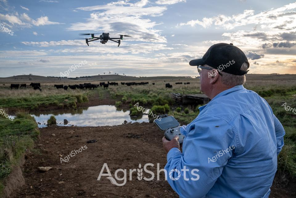
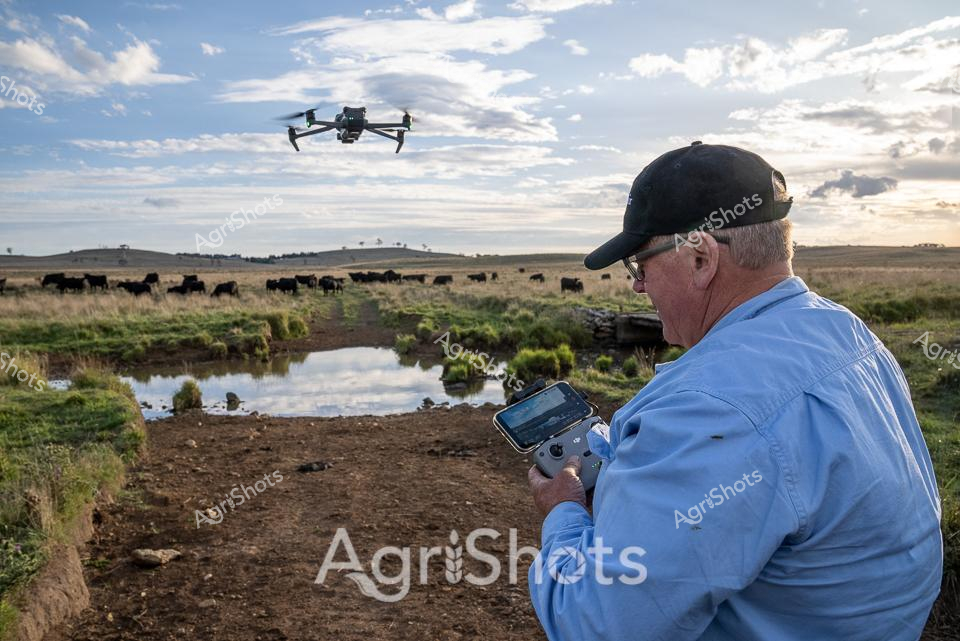
Cutting-edge agricultural surveillance unfolds across a sweeping New England tablelands landscape at golden hour. An experienced stockman operates a professional-grade drone, methodically tracking a herd of black Angus cattle grazing near a reflective creek line. His blue work shirt and black cap signal focused precision as he navigates the remote control, leveraging modern technology to monitor livestock movements with unprecedented efficiency. Soft spring light filters through scattered clouds, casting dramatic shadows across the undulating pasture where dark cattle move slowly between patches of green grass and weathered earth. The drone hovers with mechanical stillness, a stark technological contrast to the timeless rhythms of pastoral agriculture. This image captures the evolving intersection of traditional farming practice and advanced digital monitoring, showcasing how Australian agricultural professionals are embracing innovative tools to manage livestock with greater insight and minimal disruption.
 Image
Image
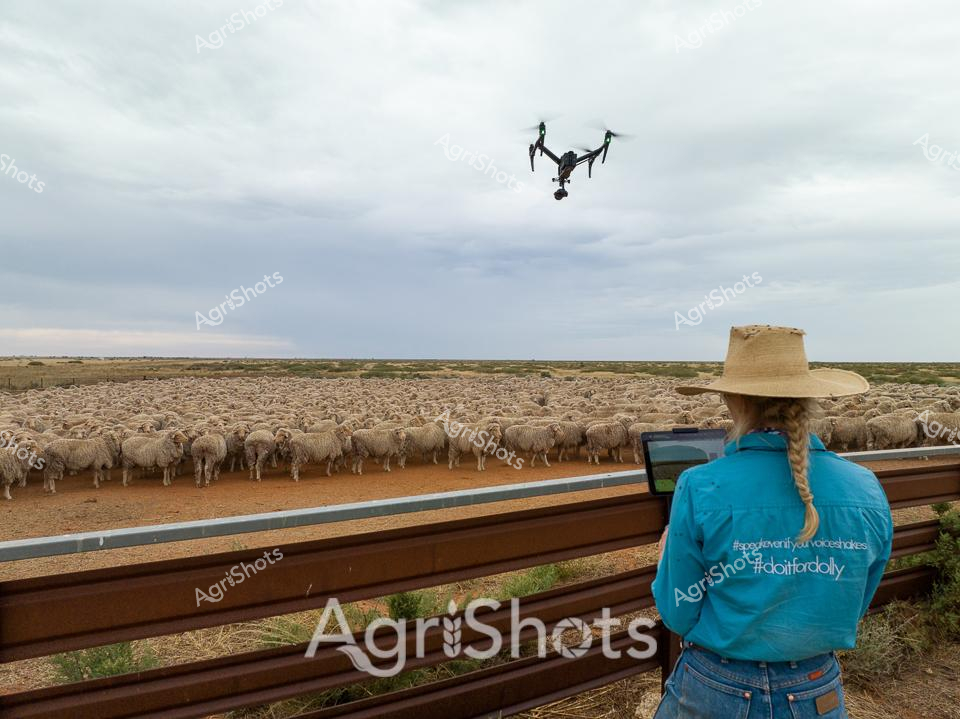
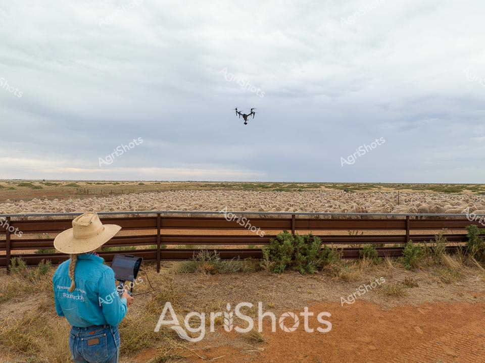
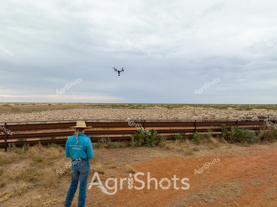
A sprawling merino sheep flock fills the dusty paddock, their woolly backs creating a dense sea of cream and tan against the arid landscape of rural New South Wales. A station hand wearing a wide-brimmed sun hat and bright blue shirt stands at the fence line, operating an iPad while a drone hovers overhead - capturing the modern intersection of agricultural tradition and cutting-edge technology. The clouded sky provides a muted backdrop to the scene, suggesting early morning or late afternoon light across the expansive station property. Precision and care are evident in the orderly arrangement of the livestock, with wooden yards creating clean lines that contrast the organic movement of the sheep. This image captures the essence of Australian agricultural innovation - where generations of pastoral expertise meet digital monitoring and aerial surveillance. The hashtag #doitfordolly hints at a deeper story, suggesting a personal or community connection behind this moment of rural technological engagement.
 Image
Image
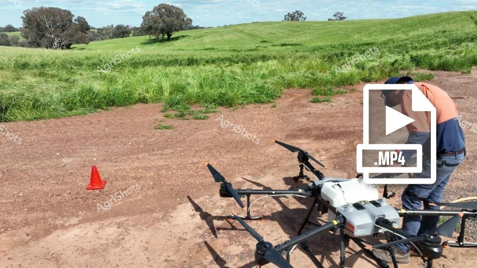
Agricultural precision technology transforms modern farming in the golden wheat belts of New South Wales. A specialist agricultural technician wearing a high-visibility orange safety vest and blue cap operates an advanced agricultural drone on a reddish-brown dirt pathway, surrounded by expansive green wheat fields under a softly clouded blue sky. The sophisticated multi-rotor drone, equipped with specialized agricultural sensing and spraying equipment, stands ready for targeted crop management - representing the cutting edge of sustainable and efficient farming practices. A bright safety cone signals careful operational protocols, while rolling green pastures and scattered eucalyptus trees in the background showcase the classic Australian rural landscape. This image captures the intersection of technological innovation and traditional agricultural expertise, demonstrating how modern farmers leverage drone technology for precise crop monitoring, pest management, and potential fertilization or treatment applications. The scene embodies the progressive spirit of Australian agricultural innovation, where high-tech solutions meet the timeless challenge of productive land management.
 Image
Image
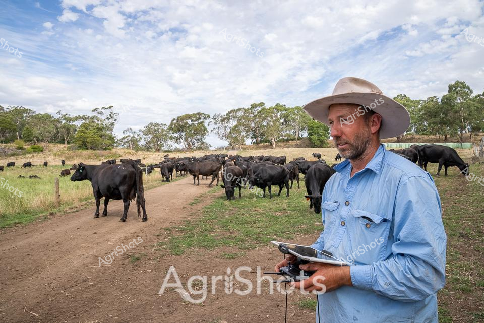
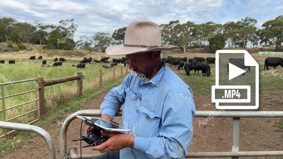
Beneath a soft, cloud-dappled sky in rural Victoria, an experienced cattle farmer stands amid a herd of sleek Black Angus cattle. Wearing a classic wide-brimmed Australian bush hat and a light blue work shirt, he operates a drone controller and tablet, representing the modern intersection of agricultural tradition and cutting-edge technology. The dirt track winds through a paddock dotted with eucalyptus trees, where multiple Angus cattle graze and mill about, their deep black coats gleaming in the diffused sunlight. The scene captures the precision of contemporary agricultural management, where digital tools enable farmers to monitor livestock health, track grazing patterns, and manage large herds with unprecedented efficiency. Mature trees frame the landscape, suggesting a well-established farming property with generations of agricultural knowledge embedded in its soil. The rugged terrain and expansive sky epitomize the quintessential Australian rural environment - a blend of harsh beauty and carefully managed agricultural productivity. This image eloquently illustrates the evolving nature of beef cattle farming, where technological innovation meets time-honored agricultural practices, showcasing how Australian farmers are leveraging advanced tools to enhance livestock management and sustainability.
 Image
Image
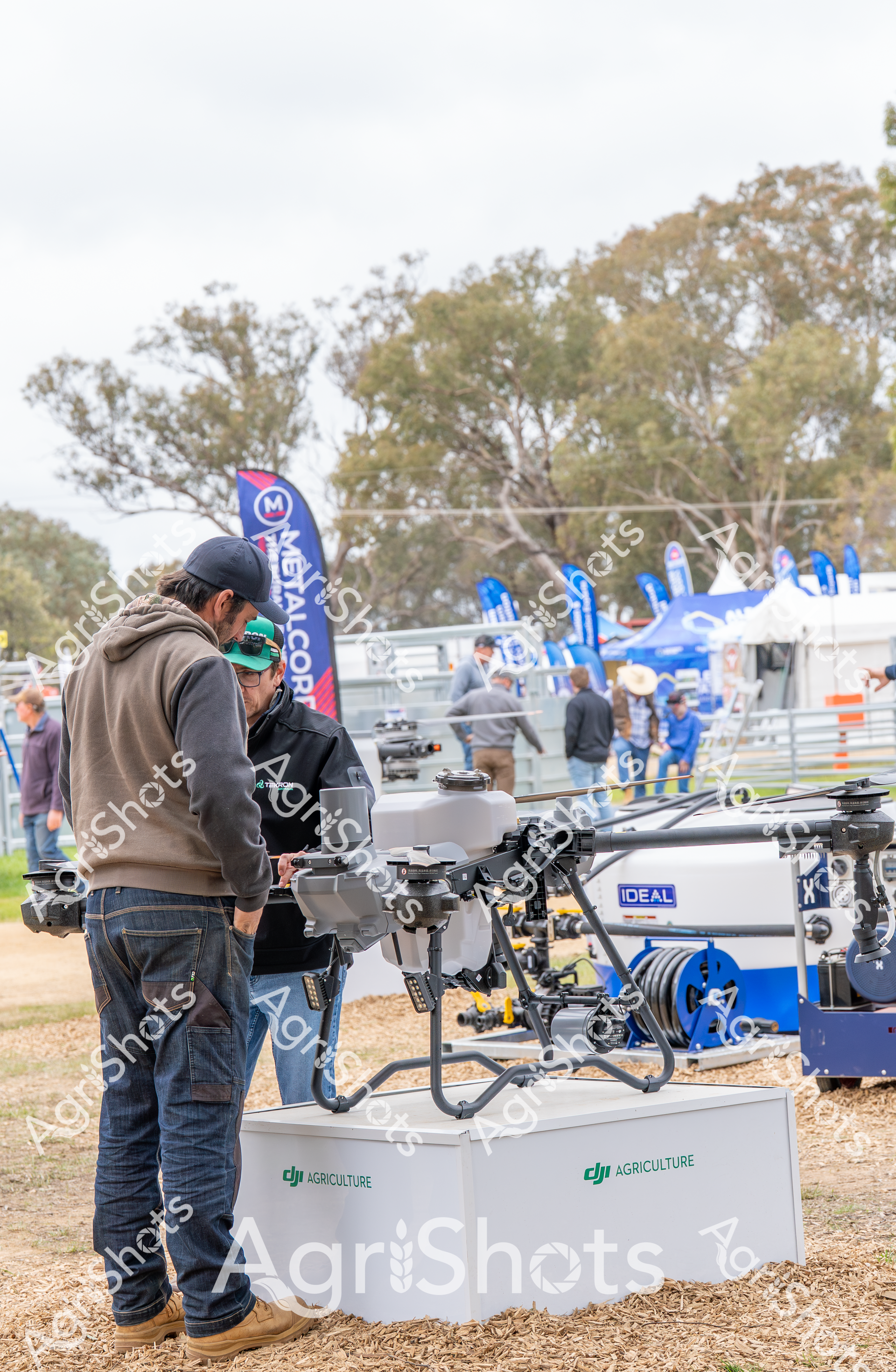
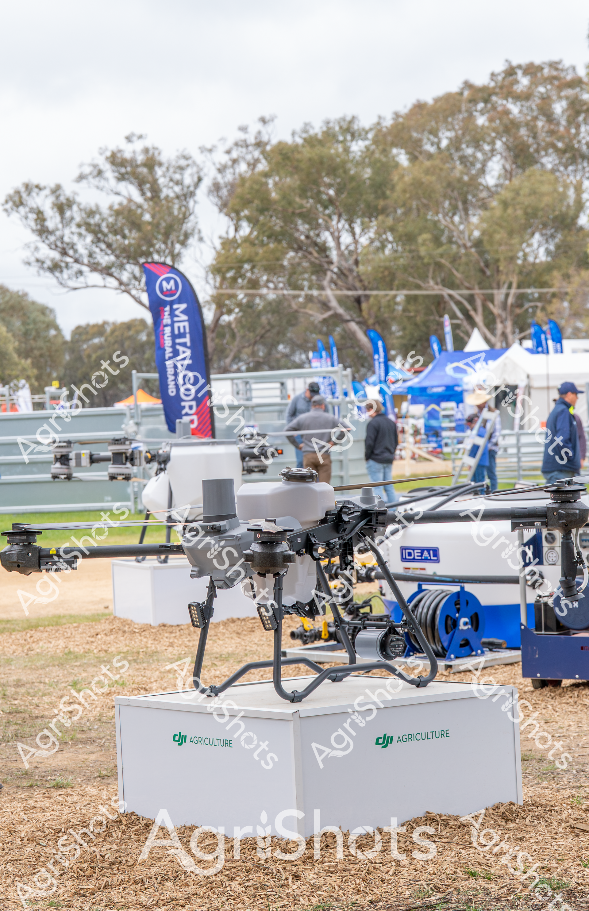
In the vibrant setting of the Henty Field Days, a cutting-edge agricultural drone from DJI Agriculture sits prominently displayed, symbolizing the technological revolution transforming modern farming practices. The sophisticated unmanned aerial vehicle, with its intricate mechanical frame and precise engineering, rests on a branded display stand, drawing the attention of farmers and agricultural professionals exploring the latest innovations. Around the drone, a cluster of interested attendees in practical rural attire - wearing caps, hoodies, and sturdy work jeans - examine the machinery, highlighting the intersection of traditional agricultural expertise and advanced technological solutions. The outdoor exhibition space is characterized by a soft, overcast spring landscape, with eucalyptus trees providing a muted green-grey backdrop to the event. Blue branded flags flutter in the background, creating a dynamic visual environment that speaks to the energy and innovation of contemporary agricultural technology. The DJI Agriculture drone represents more than just a piece of equipment - it's a testament to the precision and efficiency now possible in crop monitoring, irrigation management, and targeted agricultural interventions. The scene captures the essence of Australian agricultural innovation: practical, forward-thinking, and deeply connected to the land, while embracing technological solutions that promise to enhance productivity and sustainability in farming practices.
 Image
Image
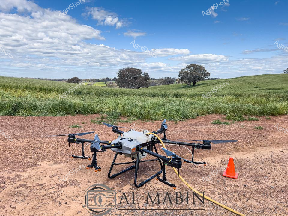
Agricultural innovation sweeps across the undulating wheat fields of New South Wales, where a sophisticated agricultural drone stands ready for precision crop management. The hexacopter drone, equipped with specialized spraying equipment, rests on a rust-colored dirt patch against a backdrop of verdant green pastures and scattered eucalyptus trees. A bright orange safety cone marks the drone's launch and landing zone, highlighting the careful technical approach to modern farming practices. Puffy white clouds drift across a brilliant blue sky, casting soft shadows on the gently rolling landscape that speaks to the expansive agricultural heartland of rural Australia. The drone represents cutting-edge technology in agricultural science, capable of delivering targeted crop treatments with unprecedented accuracy and minimal environmental impact. This scene captures the seamless integration of advanced technology with traditional farming landscapes, showcasing how Australian agriculture continues to evolve and embrace innovative solutions for sustainable food production.
 Image
Image
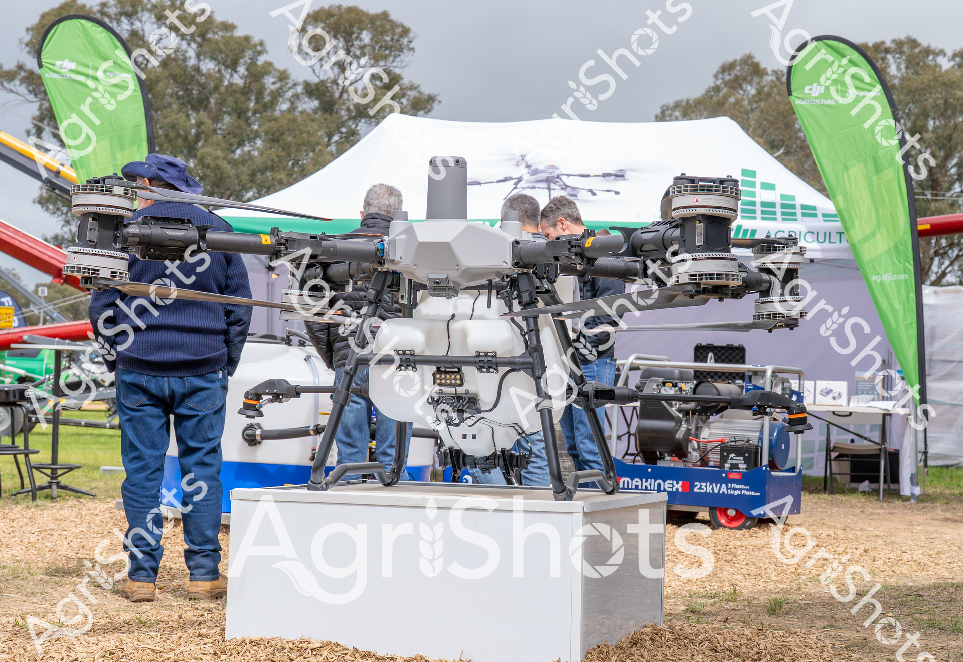
A sophisticated agricultural drone stands prominently displayed at the Henty Field Days in New South Wales, representing cutting-edge precision farming technology. The large white and grey unmanned aerial vehicle features multiple powerful rotors and a complex central processing unit, mounted on a sleek display stand surrounded by green event banners. Agricultural professionals carefully examine the drone's intricate mechanical details, highlighting the technological innovation transforming modern farming practices. In the background, a white exhibition tent and eucalyptus trees create a quintessential Australian rural event atmosphere, with wood chip ground covering adding texture to the outdoor display area. A portable generator from Makine sits nearby, underlining the technical infrastructure required to support advanced agricultural equipment demonstrations. The scene captures the intersection of high-tech engineering and agricultural innovation, showcasing how sophisticated machinery is revolutionizing crop monitoring, surveying, and precision agriculture across Australian farmlands.
 Image
Image
Surveying the arid expanses of a remote Australian station, a seasoned rural worker pilots a drone above rugged sheep yards, embodying the innovative spirit of modern agricultural technology. Dressed in a vibrant turquoise work shirt and a protective wide-brimmed hat, the operator stands steadily against a wooden fence, carefully navigating the unmanned aerial vehicle with a tablet controller. The overcast sky and sparse desert landscape of New South Wales create a muted backdrop, emphasizing the precision and strategic focus of precision farming techniques. The drone hovers purposefully, likely capturing detailed aerial imagery of the surrounding Merino sheep paddocks, enabling remote monitoring and management of the expansive agricultural terrain. This scene represents the intersection of traditional rural skills and cutting-edge digital technologies, showcasing how contemporary farmers leverage advanced tools to optimize livestock management and land assessment. The image captures the quiet determination of Australian agricultural workers who blend time-honored pastoral knowledge with sophisticated technological solutions.
 Image
Image
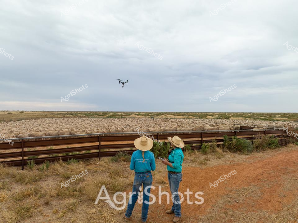
Sunlight breaks through overcast skies over a vast merino sheep station in western New South Wales, where two stockmen survey a densely packed livestock yard. Dressed in turquoise work shirts, wide-brimmed sun hats, and sturdy denim, the station hands operate a drone hovering overhead, likely monitoring the flock or assessing paddock conditions. The rich terracotta-colored earth contrasts sharply with the muted golden fleece of hundreds of merino sheep crowded behind sturdy wooden rail fencing. Sparse native grasses and scattered shrubs frame the landscape, capturing the rugged beauty of Australian agricultural terrain. Modern technology meets traditional pastoral practice as the drone provides an aerial perspective, representing the innovative approaches of contemporary farming. The scene epitomizes the resilience and technological adaptation of Australian rural workers, seamlessly blending time-honored livestock management with cutting-edge digital tools.
 Image
Image
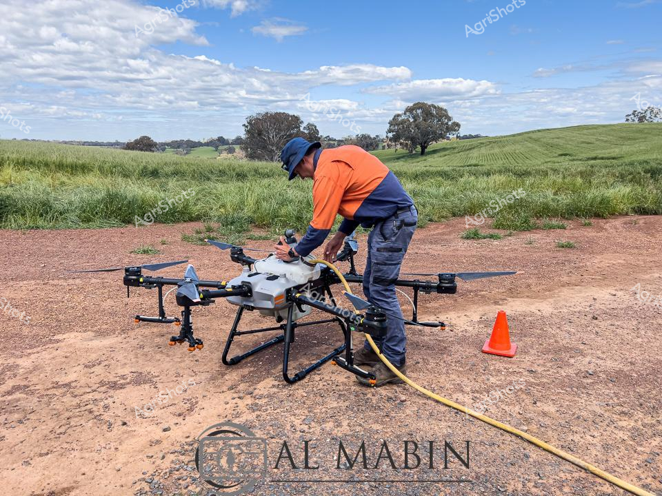
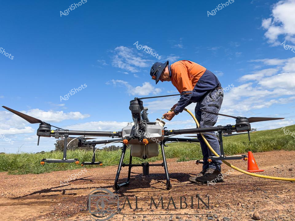
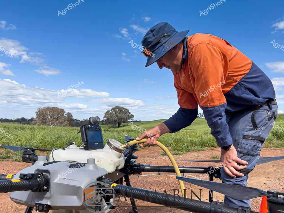
Agricultural drone technology transforms precision farming on a luminous wheat field in rural New South Wales. A skilled agricultural operator in high-visibility orange and navy workwear carefully prepares a large agricultural drone for crop spraying, positioned on a dusty dirt track with verdant grasslands stretching behind. The sophisticated multi-rotor drone stands ready, its robust metallic frame and extended landing gear indicating advanced agricultural engineering designed for efficient chemical application or crop monitoring. Wispy clouds drift across a brilliant azure sky, creating a pristine backdrop that highlights the cutting-edge technological intervention in traditional farming practices. The operator, wearing protective work attire and a safety cap, meticulously connects equipment, demonstrating the careful technical expertise required in modern agricultural operations. This scene encapsulates the intersection of technological innovation and agricultural science, representing how Australian farmers are leveraging sophisticated drone technologies to optimize crop management, improve yield, and enhance sustainable farming practices.
 Image
Image
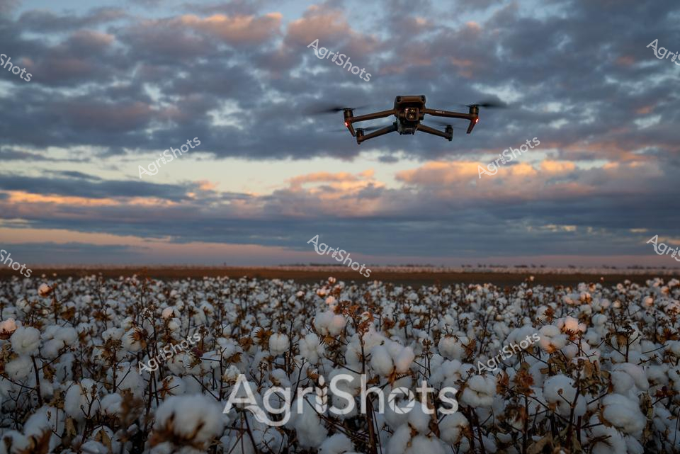
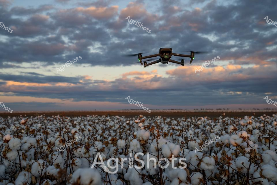
Twilight bathes a vast cotton field in soft amber and slate-blue hues, where pristine white cotton bolls blanket the landscape beneath a dramatic cloudscape. A sophisticated agricultural drone hovers precisely above the ripened crop, its sleek profile silhouetted against the luminous evening sky - a potent symbol of modern farming technology. The meticulously planted cotton field stretches horizontally across the frame, representing the precision and scale of contemporary Australian agricultural practices in the Liverpool Plains or Namoi Valley region. Delicate cotton plants display their fully mature bolls, a sea of pure white punctuated by dried brown stems, revealing the crop's readiness for harvest. The drone's positioning suggests advanced monitoring techniques, likely capturing detailed crop health data, soil moisture levels, or preparing for targeted agricultural interventions. This image powerfully illustrates the intersection of cutting-edge technological innovation and traditional agricultural productivity, showcasing how Australian farmers leverage sophisticated tools to optimize crop management in challenging environmental conditions.
 Image
Image
A cutting-edge agricultural drone from DJI Agriculture sits prominently displayed at the Henty Field Days, showcasing the latest precision farming technology in the Riverina region of New South Wales. The sophisticated unmanned aerial vehicle is mounted on a white exhibition stand, surrounded by blue corporate banners and equipment displays. Eucalyptus trees provide a soft, muted backdrop to the high-tech agricultural showcase, creating a compelling contrast between traditional rural landscapes and modern technological innovation. The drone's intricate mechanical design - with its multiple rotors, advanced sensors, and robust grey-and-white construction - highlights the sophisticated engineering behind modern agricultural monitoring and crop management tools. Nearby equipment and blue branded flags suggest this is part of a larger agricultural technology exhibition, where farmers and agricultural professionals can explore the latest innovations in precision farming. The setting captures the dynamic intersection of technology and agriculture, with the drone symbolizing how digital solutions are transforming traditional farming practices. Soft natural light and the textured ground of mulched earth beneath the display emphasize the practical, on-site nature of this technological demonstration at a prominent agricultural field day event.
 Image
Image
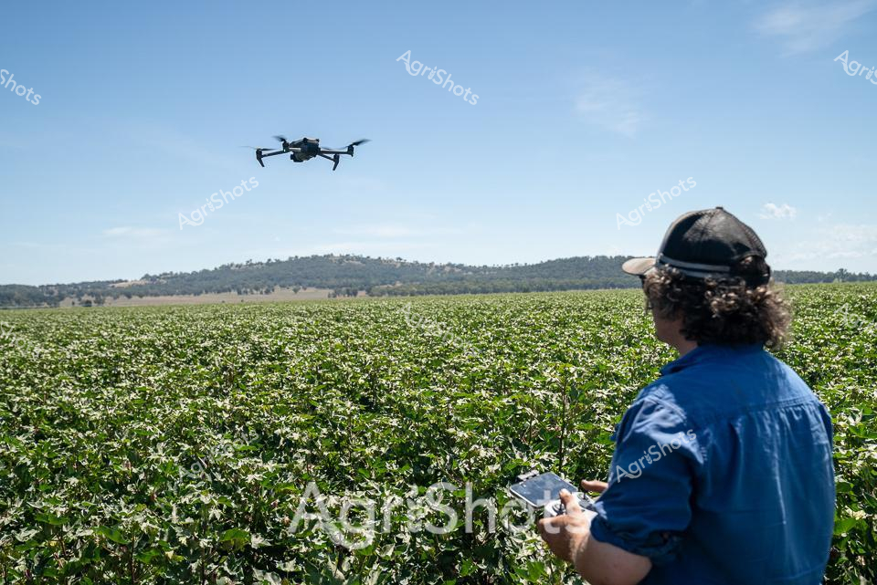
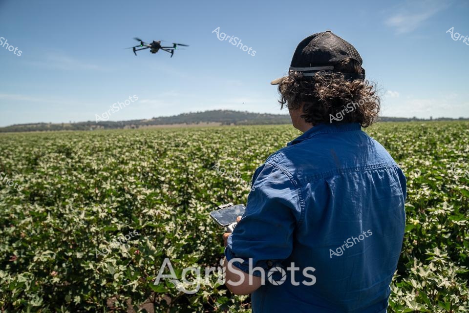
Modern Agricultural Precision: Drone Surveying in the Cotton Fields A farmer in a crisp blue work shirt and black cap operates a DJI drone across a lush green cotton field, scanning the expansive agricultural landscape of northern New South Wales. The sophisticated unmanned aerial vehicle hovers methodically above dense rows of thriving cotton plants, capturing critical data about crop health, irrigation needs, and potential environmental variations. Rolling hills frame the distant horizon, creating a quintessential Australian agricultural panorama under a brilliant clear blue sky. This cutting-edge technology represents the evolution of farming - where precision agriculture meets traditional land management, allowing farmers to monitor vast agricultural estates with unprecedented efficiency and detail. The scene epitomizes the technological innovation transforming contemporary farming practices, bridging generations of agricultural knowledge with state-of-the-art digital monitoring systems. Every movement of the drone represents a strategic approach to sustainable crop management, highlighting the sophisticated skills of modern agricultural professionals in regions like Walgett Shire.
 Image
Image
Twilight descends over a vast cotton field in the Walgett Shire region of New South Wales, where precision agriculture meets dramatic natural beauty. A sophisticated drone hovers above the expansive white landscape, its sleek dark form contrasting against the luminous sunset clouds painted in soft oranges and deep greys. Pristine cotton bolls blanket the horizon, their delicate white fibers creating a textural carpet that stretches to the distant treeline, embodying the meticulous care of modern agricultural practices. The drone represents cutting-edge agricultural technology, silently collecting critical data about crop health, irrigation needs, and potential pest impacts - transforming traditional farming methods with intelligent aerial monitoring. Soft evening light bathes the scene, casting long shadows across the field and highlighting the intricate textures of the cotton plants, their mature bolls signaling the approach of harvest season. This image captures the innovative spirit of Australian agriculture, where advanced technological solutions like drone surveillance are seamlessly integrated into the timeless rhythm of crop cultivation.
 Video
Video
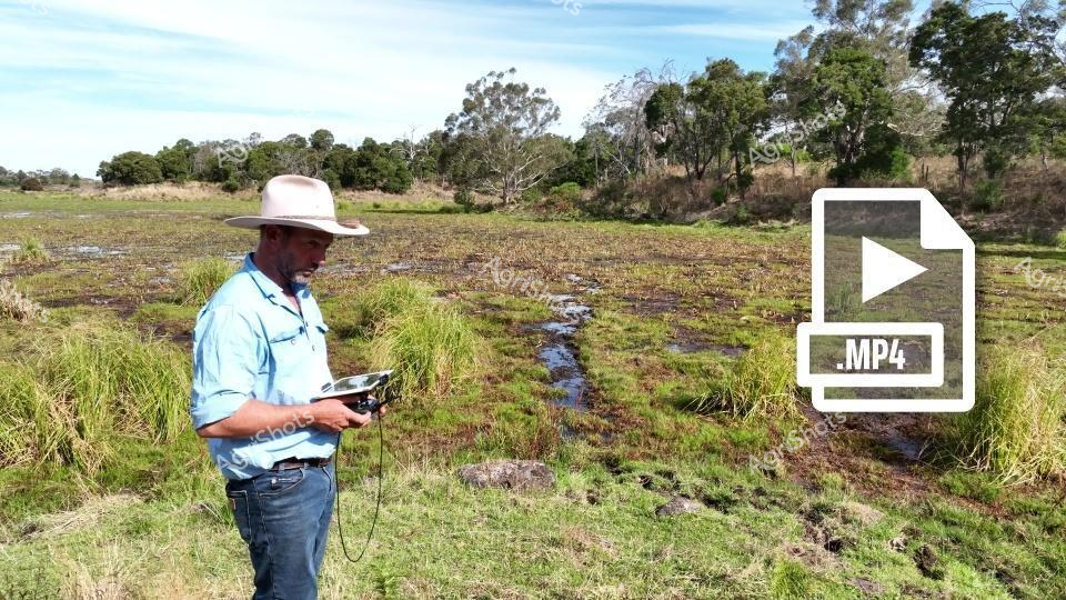
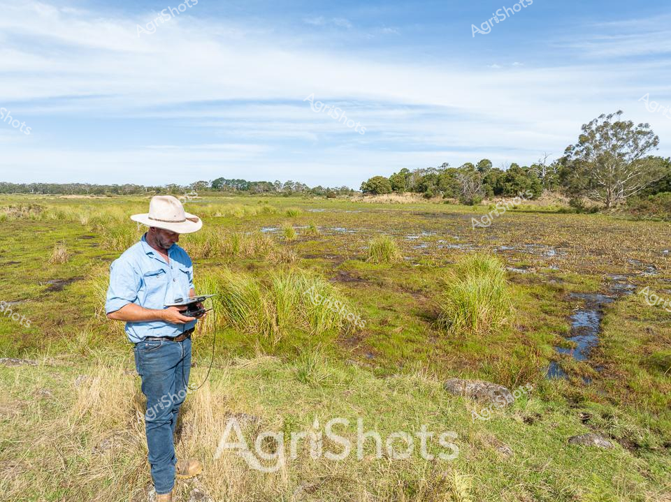
A seasoned agricultural professional surveys a waterlogged pasture in rural Victoria, wielding advanced monitoring technology to assess environmental conditions. Dressed in a light blue work shirt, classic wide-brimmed Australian sun hat, and sturdy denim jeans, the individual stands amid lush green grasses and a narrow water channel cutting through the marshy landscape. Sophisticated digital recording equipment in hand, he appears to be conducting detailed environmental research or land management assessment, capturing critical data about soil moisture, water flow, or ecosystem health. The background reveals a classic Australian rural setting - scattered eucalyptus trees, open grasslands, and a subtly undulating terrain typical of Victoria's agricultural regions. Soft blue skies and scattered cloud cover suggest a mild day, likely during late winter or early spring when seasonal water levels are high. The scene epitomizes modern agricultural practice, where technology and traditional land stewardship intersect, highlighting the sophisticated approach of contemporary Australian farmers and researchers in managing complex environmental systems.
 Image
Image
A station hand in a vibrant turquoise jacket and wide-brimmed straw hat stands sentinel at the sheep yards, wielding an iPad and operating a drone hovering above a vast merino flock. The expansive New South Wales landscape stretches out beneath overcast skies, a panorama of dusty earth, weathered wooden fencing, and sparse saltbush vegetation typical of Australian pastoral country. The drone glides methodically, capturing aerial data to assist in livestock management - a striking intersection of traditional agriculture and modern technological innovation. Hundreds of merino sheep, their woolly bodies pressed tightly together, occupy the yards - a testament to the region's renowned sheep farming heritage. The scene embodies the contemporary Australian agricultural spirit: resilient, adaptive, and increasingly sophisticated in its approach to land and livestock management. Every element speaks to the precision and care of modern farming - from the carefully positioned drone to the attentive stance of the worker monitoring the flock.
 Image
Image
Precision agriculture unfolds across a vast cotton field, where innovation meets traditional farming. A farmer in a deep blue work shirt and black cap stands with his back to the camera, operating a sophisticated DJI drone hovering above the verdant landscape. Rolling hills frame the horizon, while the cotton crop stretches in uniform green rows dotted with delicate white blossoms, signaling the early stages of the growing season. The crisp blue sky and bright sunlight highlight the advanced technological approach to modern agricultural management, with the drone serving as a critical tool for crop monitoring, irrigation planning, and yield assessment. Cutting-edge remote sensing technology allows the farmer to gather detailed insights about crop health, soil conditions, and potential areas requiring intervention, representing the sophisticated intersection of agricultural expertise and digital innovation. This scene captures the essence of contemporary farming in regional New South Wales, where technological precision meets the timeless rhythms of agricultural production.
 Image
Image
Agricultural precision takes flight in the golden wheat fields of rural New South Wales. A farmer in a high-visibility orange and navy work shirt and protective sun hat operates an advanced agricultural drone, carefully calibrating its spray mechanism on a dusty dirt track bordered by verdant grasslands. The sophisticated unmanned aerial vehicle stands ready for crop treatment, representing the cutting edge of modern farming technology where GPS-guided equipment enables targeted, efficient agricultural management. Wispy clouds drift across a brilliant blue sky, casting soft shadows on the undulating paddocks dotted with sparse eucalyptus trees - a quintessential Australian rural landscape. The drone's sleek white and grey mechanical design contrasts with the rugged earthen terrain, symbolizing the intersection of high-tech innovation and traditional agricultural practices. This image captures the meticulous care and technological sophistication of contemporary Australian broadacre farming, where precision agriculture helps maximize crop health and yield.
 Image
Image
Beneath an expansive blue Australian sky, an agricultural professional surveys a wetland pasture in rural Victoria. Wearing a classic wide-brimmed sun hat, light blue work shirt, and denim jeans, the researcher stands amidst lush green grasses and water-logged terrain, intently focused on a handheld drone control device. Thin streams of water meander through clumps of native grasses, creating a mosaic of green and blue textures across the marshy landscape. Distant tree lines and eucalyptus punctuate the horizon, suggesting this is likely a cattle grazing region used for Angus beef production. The scene captures the intersection of modern agricultural technology and traditional landscape management, with the drone potentially being used for land surveying, cattle monitoring, or environmental assessment. Soft cloud formations and gentle lighting indicate an early morning or late afternoon moment, typical of the contemplative work of agricultural researchers and land managers in the Australian countryside.
 Video
Video
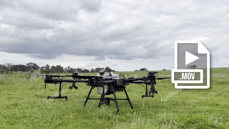
Agricultural Innovation in the Wheatlands A sophisticated agricultural drone stands poised on a lush green pasture, its complex hexacopter design ready for precision crop management. Overcast skies create a moody, diffused light across the expansive wheat fields of rural New South Wales, highlighting the advanced technological approach to modern farming. This sleek unmanned aerial vehicle represents the cutting edge of agricultural technology, with multiple rotors and specialized mounting points for advanced sensing and spraying equipment. The dark metallic frame of the drone contrasts dramatically against the verdant grassland, symbolizing the intersection of high-tech innovation and traditional agricultural landscapes. Surrounding tree lines and rolling fields stretch toward the horizon, creating a sense of vast agricultural potential waiting to be optimized by such advanced monitoring and treatment systems. The .MOV file icon suggests this is a dynamic capture of agricultural technology in motion, ready to revolutionize crop management with unprecedented precision and efficiency.
 Video
Video
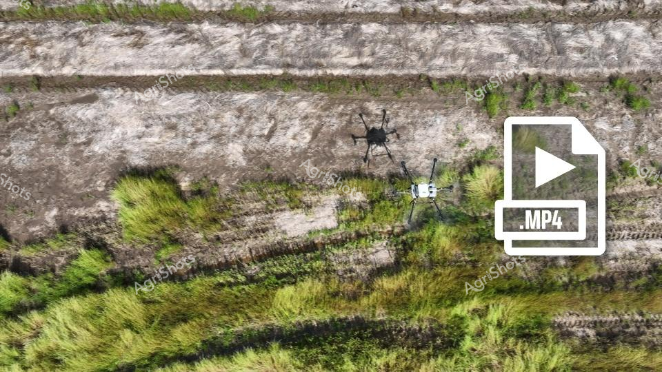
Precision agriculture unfolds across a vast wheat paddock in rural New South Wales, where advanced drone technology transforms crop management. Two unmanned aerial vehicles hover methodically above undulating terrain, their sleek white and black frames casting subtle shadows on the textured landscape of golden-green wheat and weathered earth. Cutting-edge agricultural spraying drones navigate strategically, delivering targeted treatments with millimeter-perfect accuracy, minimizing chemical use and maximizing crop health. Verdant wheat stalks ripple in gentle waves, creating a mesmerizing tapestry of natural and technological interaction, highlighting how modern Australian farmers are embracing innovative solutions to enhance agricultural productivity. The rugged, layered terrain tells a story of resilience, with patches of moss and wild grasses punctuating the cultivated fields, demonstrating the delicate balance between human intervention and natural ecosystem. This dynamic scene captures the essence of contemporary Australian agricultural innovation - precise, efficient, and deeply connected to the land.
 Image
Image
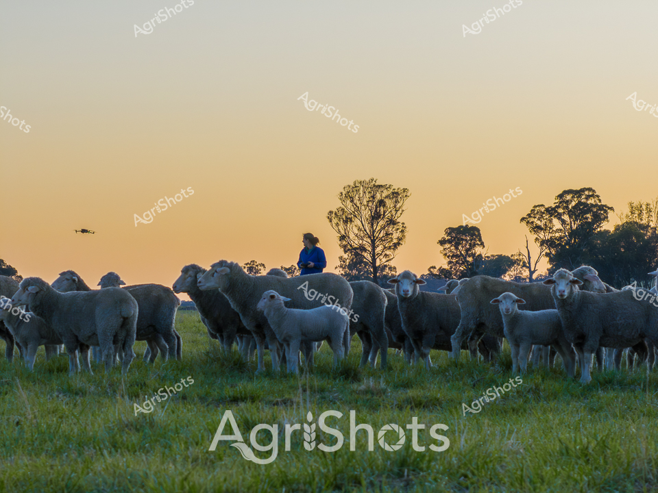
Golden light bathes a serene merino flock grazing on lush pastureland, with silhouetted trees framing the horizon during a crisp dawn in rural New South Wales. A stockwoman in a vibrant blue jacket stands among her woolly charges, surveying the landscape with quiet confidence as a drone hovers overhead - a modern tool in contemporary agricultural management. The merino ewes and lambs cluster together, their dense fleeces varying in shades of soft grey and white, presenting a testament to careful breeding and sustainable pastoral practices. Dew-laden grass provides a verdant carpet beneath the sheep, highlighting the rich agricultural ecosystem of this regional stud property. The early morning muster captures the essence of Australian agricultural skill - blending traditional livestock management with emerging technological approaches. This scene eloquently illustrates the connection between farmers, their animals, and the expansive, golden-hued landscape that defines rural Australian farming.
 Image
Image
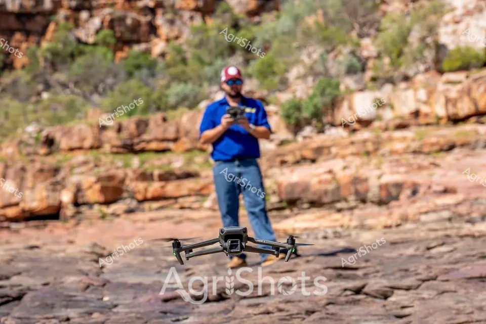
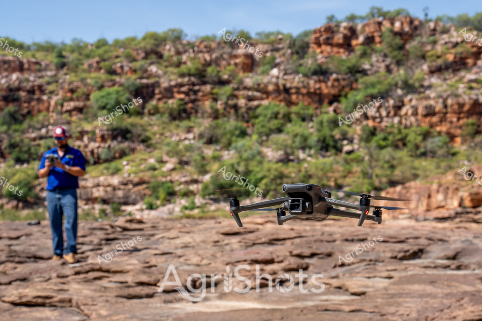
Agricultural drone technology transforms modern farming practices in the rugged Western Australian landscape. A skilled operator in a bright blue polo shirt and cap carefully navigates a professional-grade drone across a rocky terrain typical of inland station country. The sophisticated drone hovers just above the weathered, layered rock surface, demonstrating precision agricultural mapping and surveying capabilities. Surrounding rocky outcrops and sparse native vegetation create a quintessential Australian agricultural backdrop, highlighting the intersection of advanced technology and challenging rural environments. The operator maintains focused control, using remote technology to gather critical data about land conditions, crop health, or livestock monitoring. This scene epitomizes the cutting-edge approaches modern farmers and agricultural professionals employ to manage vast, complex landscapes with unprecedented accuracy and efficiency.
 Image
Image
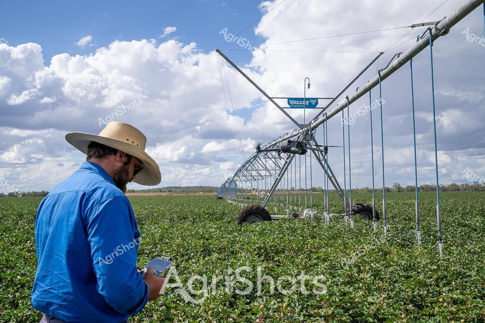
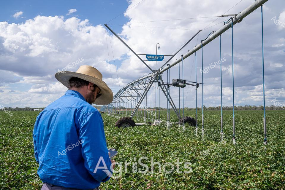
Valley pivot irrigation system transforms a lush cotton field under a dramatic Queensland sky, where billowing cumulus clouds create a stunning backdrop to modern agricultural precision. A farmer in a crisp blue long-sleeved shirt and protective straw hat stands surveying the landscape, smartphone in hand, demonstrating the seamless integration of digital technology with traditional agricultural practices. The massive silver-grey Valley center pivot irrigation rig stretches across verdant green cotton plants, its elegant steel framework supported on large wheeled towers that slowly traverse the field, delivering carefully measured water to each plant. Blue suspension cables dangle from the irrigation spine, creating a geometric symmetry against the natural landscape of green crops and distant treelines. The scene captures the essence of contemporary Australian agriculture - high-tech machinery, meticulous crop management, and a deep connection between farmer and land. Soft natural light and expansive cloudscape emphasize the scale and beauty of broad-acre farming in Queensland's rich agricultural regions.
 Video
Video
Golden light bathes a tranquil merino flock grazing in the misty pastures of New South Wales' Heathcote Region. A silhouetted figure - likely a female agricultural worker - stands watchful among the woolly herd, her form outlined by the warm dawn sunlight filtering through distant eucalyptus trees. The merino ewes and lambs cluster together, their varied fleece tones ranging from soft cream to rich oatmeal, creating a textural landscape of wool and muscle. This early morning scene captures the quiet intensity of rural agricultural life, where careful stock management begins well before most of the world awakens. Soft ground mist hovers around the sheeps' legs, lending an ethereal quality to the mustering moment and highlighting the connection between stock manager, livestock, and landscape. The backlit composition transforms an ordinary farm management task into a luminous portrait of Australian agricultural practice, showcasing the beauty of pastoral work at the magical threshold between night and day.
 Video
Video
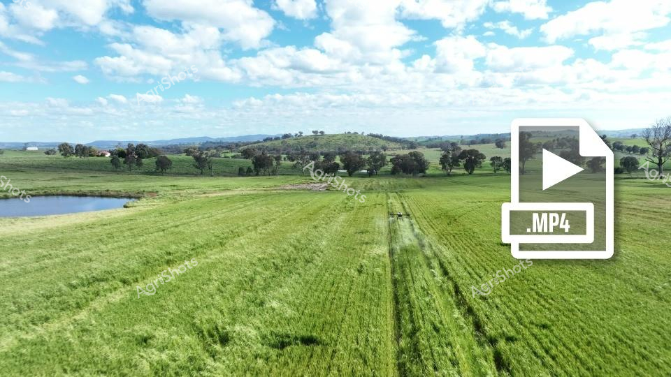
Agricultural drone technology transforms precision farming in the golden wheat fields of rural New South Wales. A sophisticated agricultural drone sits poised on a dusty earth landing zone, with a vivid safety cone marking its operational perimeter. The surrounding landscape undulates with lush green wheat crops, punctuated by scattered eucalyptus trees against a soft blue sky - quintessential Australian agricultural terrain. This cutting-edge unmanned aerial vehicle represents the future of crop management, equipped to capture high-resolution video and conduct detailed aerial surveys with millimeter precision. An operator dressed in practical workwear carefully prepares the drone, highlighting the intersection of advanced technology and traditional farming practices. The MP4 video file overlay emphasizes the drone's capacity to record and analyze crop data, enabling farmers to monitor field health, assess irrigation needs, and optimize agricultural interventions with unprecedented efficiency.
 Image
Image
Valley Pivot: Precision Agriculture in Queensland A farmer in a vibrant blue long-sleeved shirt and wide-brimmed sun hat surveys a lush green cotton field, standing near a gleaming Valley center pivot irrigation system. Brilliant white clouds drift across a expansive blue sky, casting soft shadows over the meticulously planted crop rows stretching to the distant horizon. The sophisticated irrigation infrastructure towers above the verdant landscape, its galvanized steel framework engineered to deliver precise water distribution across acres of developing cotton plants. Technological innovation meets agricultural expertise, with the farmer carefully monitoring the system's operation, likely using digital tools to optimize water and crop management. The metallic irrigation structure, mounted on large wheeled supports, represents modern agricultural precision - a testament to Queensland's advanced farming practices that balance environmental stewardship with productive agricultural output. The scene captures the intersection of human skill, technological innovation, and the natural rhythms of crop cultivation under the expansive Australian sky.
 Image
Image
Modern stock managering meets cutting-edge technology on a vast Australian sheep station. A skilled station hand in a bright turquoise work shirt and wide-brimmed protective hat operates a tablet while a drone hovers overhead, surveying a massive flock of Merino sheep stretching across the arid landscape. The expansive paddock reveals a seemingly endless sea of woolly bodies, their subtle movements creating a living, breathing landscape under a soft, overcast sky. Advanced agricultural technology blends seamlessly with traditional livestock management, demonstrating how innovative digital tools are transforming rural operations. The woman's braided hair and focused posture suggest expertise and connection to the land, capturing the spirit of contemporary Australian agricultural professionals who leverage technology to monitor and manage large-scale livestock enterprises. This image eloquently illustrates the intersection of heritage farming practices and 21st-century digital innovation, showcasing the sophisticated approach of modern agricultural workers.
 Video
Video
Capturing the cutting-edge intersection of agricultural tradition and modern technology, a seasoned farmer stands amid a lush pasture of grazing Angus cattle, operating a drone for precision livestock management. Wearing a classic wide-brimmed Australian stockman's hat and a crisp chambray work shirt, the farmer carefully navigates the drone's controls from a fenced paddock, overlooking a herd of black Angus cattle grazing on verdant grasslands. The rolling landscape, dotted with eucalyptus trees, speaks to the expansive Victorian countryside, where generations of farmers have refined cattle breeding and land management techniques. Modern drone technology allows for advanced herd monitoring, tracking animal movements, checking fence lines, and assessing pasture conditions with unprecedented efficiency and accuracy. The overcast sky casts a soft, diffused light across the scene, highlighting the rich textures of the agricultural landscape - from the weathered metal gates to the glossy black coats of the Angus cattle. This image embodies the progressive spirit of Australian agriculture, where time-honored farming practices seamlessly integrate with cutting-edge technological innovations.
 Video
Video
Agricultural drone precision mapping of a verdant wheat field in rural New South Wales captures the cutting-edge technology transforming modern farming. A sophisticated agricultural drone sits poised on the reddish-brown earth, its white frame contrasting against the lush green pastures and scattered eucalyptus trees of the surrounding landscape. An operator in blue work pants and an orange shirt carefully prepares the drone for a crop monitoring mission, positioned near a bright safety red cone marking a specific survey point. The sophisticated unmanned aerial vehicle represents the latest in precision agriculture technology, designed to capture detailed imagery and data about crop health, soil conditions, and potential irrigation needs across the expansive agricultural terrain. Rolling green wheat fields stretch to the horizon, punctuated by mature trees that provide natural landmarks in this quintessential Australian rural setting. The scene embodies the intersection of traditional farming landscapes and modern technological innovation, showcasing how digital tools are revolutionizing agricultural practices with unprecedented accuracy and efficiency.
 Image
Image
Precision livestock management unfolds across a windswept New England tablelands landscape. A seasoned cattle manager in a crisp blue work shirt and black cap operates a drone, surveying a herd of sleek Angus cattle grazing near a tranquil creek. The sophisticated aerial technology hovers above the undulating pasture, capturing critical data about the stud's livestock with cutting-edge efficiency. Soft spring light bathes the scene, casting long shadows across the verdant grasslands where black cattle move slowly between patches of native grasses and water-carved soil. The drone - a marvel of agricultural innovation - provides an eagle's eye perspective, allowing the experienced farmer to monitor herd health, movement, and grazing patterns with unprecedented accuracy. This moment captures the intersection of traditional pastoral wisdom and modern technological intervention, showcasing how Australian agricultural professionals are embracing sophisticated tools to enhance livestock management and environmental stewardship.
 Image
Image
Modern Australian merino sheep farming meets cutting-edge technology in this expansive pastoral landscape. A station hand in a vibrant turquoise shirt and wide-brimmed sun hat operates a remote-controlled drone above a vast flock of woolly merino sheep, carefully monitoring the herd from a raised wooden fence line. The drone hovers precisely against a soft, muted grey sky, while hundreds of sheep cluster tightly in the foreground, their dense fleece creating a uniform beige-white carpet across the arid paddock. The scene captures the intersection of traditional agricultural practices and innovative digital monitoring techniques, showcasing how modern farmers leverage technology to manage large livestock populations across Australia's challenging rural terrain. The wide-open landscape suggests a remote station in New South Wales, with sparse vegetation and an endless horizon underlining the scale of Australian sheep farming. The station hand's focused posture and high-tech equipment demonstrate the precision and technical skill required in contemporary agricultural management.
 Image
Image
A sleek blue helicopter rests on the rugged rocky terrain of a Western Australian landscape, accompanied by a modern quadcopter drone hovering nearby. The ancient, layered rock formations create a dramatic backdrop of ochre and tan, with weathered stone surfaces and sparse vegetation clinging to the craggy cliff faces. Advanced aerial technology stands in stark contrast to the timeless, primordial landscape - a powerful representation of modern agricultural and surveying techniques meeting the raw Australian wilderness. The drone, a sophisticated piece of precision equipment, demonstrates the cutting-edge technology now integral to agricultural mapping, land management, and remote area surveillance. This scene captures the intersection of high-tech innovation and the expansive, challenging terrain of rural Western Australia, where technology provides critical insights for station management, environmental monitoring, and agricultural planning. The blue helicopter and grey drone represent the evolving tools that help farmers and land managers navigate and understand the complex landscapes of the Australian outback.
 Video
Video
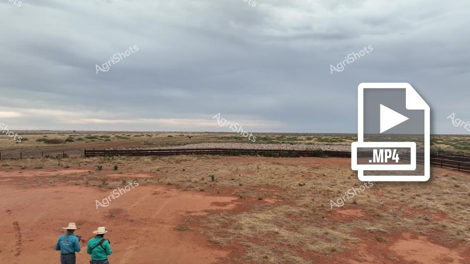
Beneath an expansive pewter-grey sky, two agricultural workers survey a rust-red pastoral landscape in central western New South Wales. Wearing broad-brimmed sun hats and practical workwear in teal and forest green, they stand in a remote sheep station yard, overlooking vast paddocks dotted with sparse native vegetation and bordered by robust wooden fencing. The terrain speaks of resilience - compacted earth the color of terracotta contrasts with muted grasses, revealing the harsh beauty of Australian rangelands. A distant boundary fence stretches toward the horizon, where flat grasslands merge with overcast skies, capturing the immense scale of this Merino sheep agricultural environment. The MP4 watermark suggests this is raw drone footage, hinting at modern agricultural technologies being employed to monitor and manage these expansive rural properties. Their stance - side-by-side, facing away - communicates a shared understanding of the landscape, two professionals quietly assessing the terrain and livestock management challenges of this iconic Australian agricultural setting.
 Image
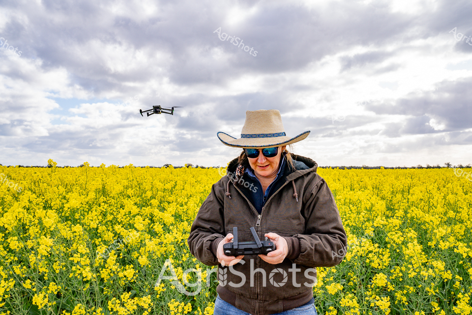
Image
Precision agricultural technology converges with vibrant spring canola in this dynamic rural landscape. A skilled operator wearing a classic wide-brimmed Australian agricultural hat and reflective sunglasses pilots a drone above a golden sea of flowering canola, her hands steady on the remote control. The expansive paddock stretches to a cloudy horizon, brilliant yellow blossoms creating a luminous carpet that signals the potential of the emerging crop. Dressed in a protective brown jacket against the variable spring weather, the operator demonstrates the modern farmer's expertise in integrating digital technology with traditional agricultural practices. The drone hovers methodically, capturing aerial data to assess crop health, plant density, and potential harvest yields - a testament to the sophisticated approach of contemporary agricultural management. This image encapsulates the innovation, skill, and technological sophistication of Australian agricultural professionals, highlighting how cutting-edge tools are revolutionizing farming practices across rural landscapes.
 Image
Image
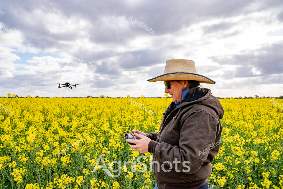
Sunlight bathes a vibrant canola field in golden-yellow splendor, stretching across the horizon under a dramatic clouded sky. A farmer in a broad-brimmed straw hat and weathered brown jacket operates a drone, carefully navigating the agricultural technology amid the brilliant flowering crop. The precise remote control movements suggest careful monitoring and data collection, showcasing modern precision agriculture techniques in action. Spring has transformed the landscape into a sea of bright yellow blossoms, with green stems providing textural contrast against the muted tones of the farmer's clothing and the soft gray cloudscape overhead. Advanced agricultural technology meets traditional farming wisdom, as the drone provides aerial insights into crop health, soil conditions, and potential management strategies. This image captures the innovative spirit of contemporary Australian agriculture, where technological sophistication and deep landscape knowledge intersect in the fertile fields of rural New South Wales.
 Image
Image
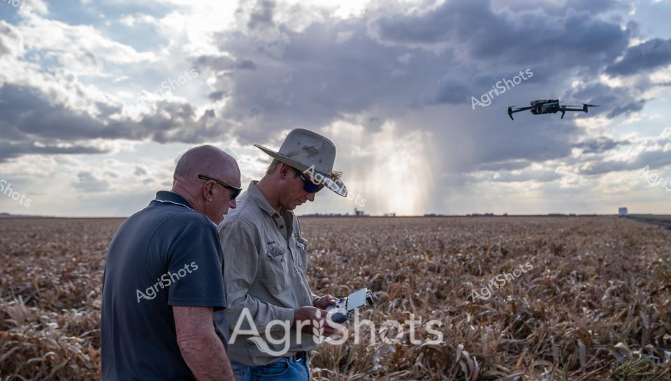
Dusty golden sorghum stretches to the horizon under a brooding sky where sunlight pierces storm clouds, creating a dramatic backdrop for precision agricultural technology. Two experienced farmers stand shoulder-to-shoulder, intently focused on a drone controller, their weathered hands guiding an aerial survey of the ripening crop. The individual in a classic Australian wide-brimmed work hat and faded work shirt represents generations of agricultural knowledge, while the sleek quadcopter represents cutting-edge farming innovation hovering above the field. Soft blue-grey tones of their clothing contrast against the sun-bleached wheat-colored landscape, capturing the quintessential collaboration between human expertise and technological advancement in modern Australian agriculture. A distant rain curtain adds atmospheric depth, suggesting the unpredictable climate challenges farmers constantly navigate. This image encapsulates the evolving story of Queensland's agricultural sector - resilient professionals using sophisticated drone technology to monitor crop health, assess harvest readiness, and make data-driven management decisions.
 Video
Video
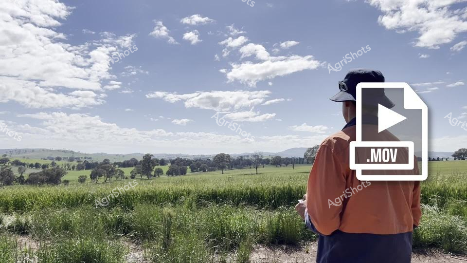
Scanning the golden wheat fields of New South Wales, a farmer in a rusty orange shirt and cap surveys the undulating agricultural landscape under a vast, cloud-dappled sky. Verdant green pastures intermingle with ripening wheat crops, creating a patchwork of agricultural productivity that stretches toward distant blue-hazed hills. Modern agricultural technology meets traditional farming wisdom, with a .MOV video file icon suggesting drone surveillance or digital crop monitoring techniques being employed to track field conditions. Scattered eucalyptus trees punctuate the horizon, providing natural windbreaks and ecological diversity within the cultivated terrain. The scene captures the quintessential Australian agricultural spirit - a solitary figure embedded in an expansive, fertile landscape that represents generations of farming innovation and connection to the land. The soft morning light and scattered clouds suggest early harvest season, with the wheat fields ready to be assessed for optimal cutting and processing.
 Image
Image
Agricultural surveillance takes flight across the rugged Kimberley landscape, where a sophisticated drone hovers above ancient rocky terrain. A professional in a vibrant blue shirt and cap operates the advanced unmanned aerial vehicle, capturing precision agricultural data in one of Western Australia's most challenging environments. The rocky foreground features layered sedimentary formations, typical of the region's dramatic geological structures, with scattered vegetation and rocky outcrops rising in the background. Modern drone technology enables farmers and land managers to conduct detailed terrain mapping, crop monitoring, and environmental assessments with unprecedented accuracy and efficiency. The scene captures the intersection of cutting-edge agricultural technology with one of Australia's most spectacular and unforgiving natural landscapes, highlighting how innovation supports agricultural management in remote regions. The drone's sleek black design contrasts beautifully against the earthy ochre and green tones of the rugged West Australian wilderness, symbolizing the sophisticated tools now employed in modern agricultural practice.
 Video
Video
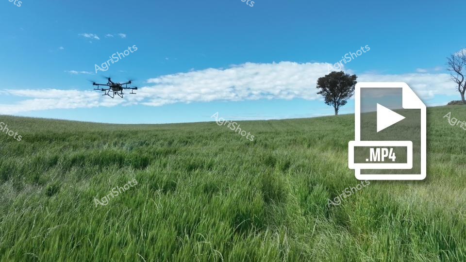
Agricultural drone technology transforms modern farming practices across the golden wheat fields of New South Wales. A sleek, professional-grade quadcopter drone hovers above undulating emerald-green grasslands, capturing precision agricultural data with cutting-edge MP4 video recording capabilities. The expansive landscape stretches toward a distant horizon, punctuated by a solitary, gracefully shaped tree standing as a sentinel against a pristine blue sky dotted with soft white clouds. This scene represents the sophisticated intersection of digital technology and traditional agricultural methods, where aerial surveillance and data collection enable farmers to monitor crop health, moisture levels, and potential pest or disease indicators with unprecedented accuracy and efficiency. The lush wheat field sways gently in what appears to be mid-morning light, suggesting early summer conditions ideal for crop monitoring and management. The drone's presence symbolizes the progressive, tech-forward approach of contemporary Australian agriculture, where innovation meets the timeless rhythms of rural landscape and cultivation.
 Image
Image
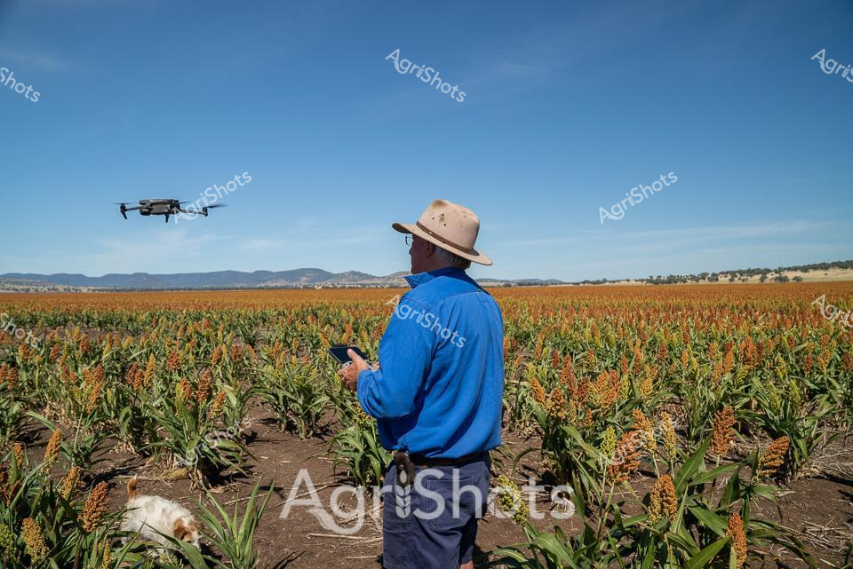
Modern Precision Agriculture: Sorghum Fields Under Azure Skies A farmer in a vibrant blue long-sleeved shirt and classic wide-brimmed Australian agricultural hat stands amid ripening sorghum fields, commanding a hovering DJI drone with precise digital control. Golden-orange sorghum crops stretch across undulating terrain, their mature heads creating a rich, textured landscape against dark soil and distant mountain ranges. The cloudless cerulean sky amplifies the scene's sense of technological innovation meeting traditional agricultural practices, with the compact drone capturing aerial data about crop health, growth patterns, and potential irrigation needs. This moment encapsulates contemporary farming—where cutting-edge technology enables farmers to monitor vast agricultural landscapes with unprecedented efficiency and accuracy. The carefully maintained crop rows and the farmer's controlled, professional stance reflect the strategic precision of modern Australian agricultural management, bridging generations of farming knowledge with sophisticated digital monitoring techniques.
 Video
Video
Verdant wheat fields stretch across a gently undulating pastoral landscape in rural New South Wales, capturing the precision of modern agricultural technology. A drone-mounted spraying system has created distinct parallel tracks through the lush green crop, demonstrating cutting-edge agricultural techniques that optimize crop management and protection. The expansive paddock is framed by scattered eucalyptus trees and a tranquil farm dam in the mid-distance, with soft rolling hills and a cloud-dappled azure sky completing the quintessential Australian agricultural panorama. Vibrant emerald and lime green hues of the young wheat crop contrast beautifully against the pale blue sky, showcasing the fertile potential of the region's agricultural land. The MP4 video icon suggests this is a dynamic agricultural documentation, highlighting the intersection of traditional farming landscapes and contemporary digital recording technologies. This scene epitomizes the innovation and natural beauty of Australian broadacre farming, where technology and landscape merge to create productive agricultural ecosystems.
 Video
Video
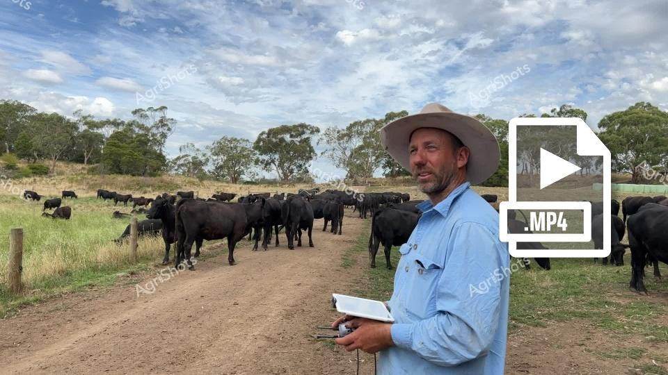
Black Angus cattle graze across a sprawling pastoral landscape under a soft, cloud-dappled sky in rural Victoria. A seasoned cattleman in a wide-brimmed agricultural hat and light blue work shirt stands amid the herd, holding a digital device and a notebook - signaling a modern approach to livestock management. The dirt track bisecting the paddock is lined with mature eucalyptus trees, creating a quintessential Australian rural scene of controlled natural beauty. Sleek black Angus cattle, renowned for their muscular build and premium beef genetics, cluster in disciplined groups, demonstrating the careful breeding and monitoring typical of high-performance agricultural operations. Lush green grass and dry golden groundcover indicate late spring or early summer conditions, with the landscape reflecting the delicate balance of environmental stewardship and agricultural productivity. This image captures the intersection of traditional farming wisdom and contemporary technological innovation, showcasing how Australian agricultural professionals leverage digital tools to manage livestock with precision and care.
 Image
Image
An experienced station hand in a bright turquoise shirt and wide-brimmed sun hat operates a drone over a vast Merino sheep flock, capturing precision agricultural data across an expansive western New South Wales pastoral landscape. The sweeping paddock stretches beneath an overcast, pewter-colored sky, with wooden stock yards and sparse native vegetation framing the dense woolly flock. Leaning against sturdy timber rails, the worker carefully maneuvers the quadcopter drone, likely collecting critical information about mob density, animal health, and grazing patterns using advanced aerial imaging technology. The sleek black drone hovers methodically above the sea of cream and tan-fleeced sheep, representing the sophisticated intersection of traditional livestock management and cutting-edge agricultural innovation. Merino rams and ewes cluster tightly, their fine wool suggesting a high-quality station with meticulous breeding practices. This scene eloquently captures the modern Australian agricultural approach - blending hands-on pastoral expertise with intelligent technological monitoring across the wide-open rangelands.
 Image
Image
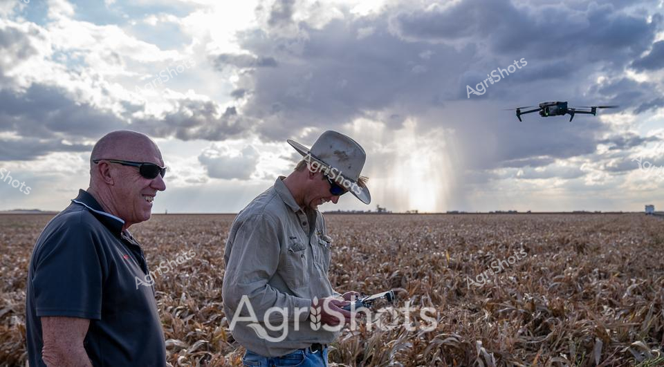
Thunderclouds loom over a vast sorghum field as two agricultural professionals survey the harvest landscape. A seasoned worker in a weathered cowboy hat operates a drone, its sleek form hovering against the dramatic sky, while his colleague in dark polo shirt and sunglasses observes the precision agricultural technique. The golden-brown crop stretches to the horizon, crisp and dry, ready for harvesting - a typical Queensland scene where modern technology meets traditional farming expertise. Moisture-laden clouds create a stunning backdrop, with a distant rain shaft adding dramatic texture to the expansive agricultural terrain. The drone represents cutting-edge farm management, allowing detailed crop assessment and monitoring without disrupting the delicate harvest environment. This moment captures the intersection of agricultural innovation and traditional farming knowledge, showcasing how technology is transforming rural productivity in Australia's agricultural heartland.
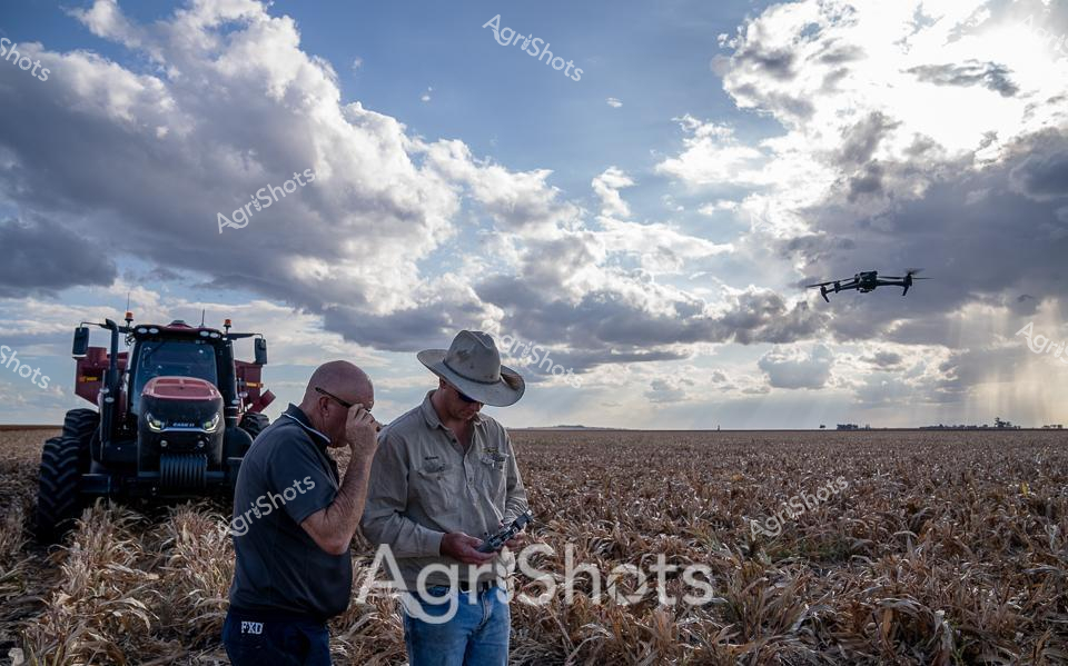 Image
Image
A golden sorghum field stretches to the distant horizon under a dramatic cloudscape of towering cumulus and streaming light. Two agricultural workers stand amid withered crop stalks, intently studying a mobile device while a sleek Case tractor waits nearby and a drone hovers overhead - capturing the precision agriculture technologies transforming modern farming. The workers represent generations of agricultural expertise, with one wearing a classic broad-brimmed Australian farm hat and the other in a dark shirt, their body language suggesting collaborative problem-solving and data-driven decision making. Soft browns and tans of the harvested field contrast with the deep blue-grey of the threatening sky, creating a powerful visual narrative of human resilience and technological innovation in agricultural landscapes. The drone symbolizes the cutting-edge monitoring and management techniques revolutionizing crop production in regions like Queensland, where large-scale farming demands increasingly sophisticated approaches to yield and resource management.
 Image
Image
A lone station hand stands resolute in a windswept landscape, surveying a massive flock of Merino sheep behind an industrial steel livestock fence. Wearing a vibrant blue work shirt and an iconic Australian wide-brimmed hat, the worker operates a drone hovering overhead - a striking juxtaposition of traditional pastoral practice and modern agricultural technology. The expansive New South Wales station stretches to a distant horizon, with rusty red earth, sparse saltbush, and weathered wooden yards creating a textured backdrop of authentic rural Australia. Merino sheep, their woolly fleeces dense and uniform, crowd together in remarkable numbers, representing the backbone of the region's agricultural economy. The overcast sky suggests early morning or late afternoon, casting a soft, diffused light that emphasizes the vastness of the landscape and the scale of contemporary sheep farming. This image captures the innovative spirit of Australian agriculture - where cutting-edge technology like drone monitoring seamlessly integrates with time-honored farming traditions.
Well, you've ploughed through the whole field!
No more crops to harvest here, mate.
Try searching for something else in our library of 50,000+ royalty-free media: