Related Images & Videos
View All Similar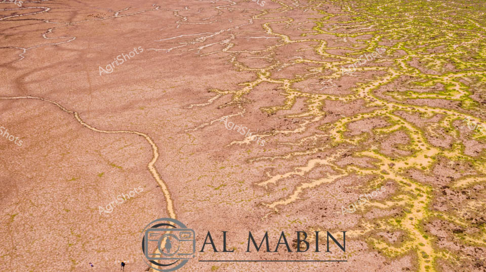

Purchase This Image
Get unlimited downloads with a subscription
View Subscription PlansAbout This Image
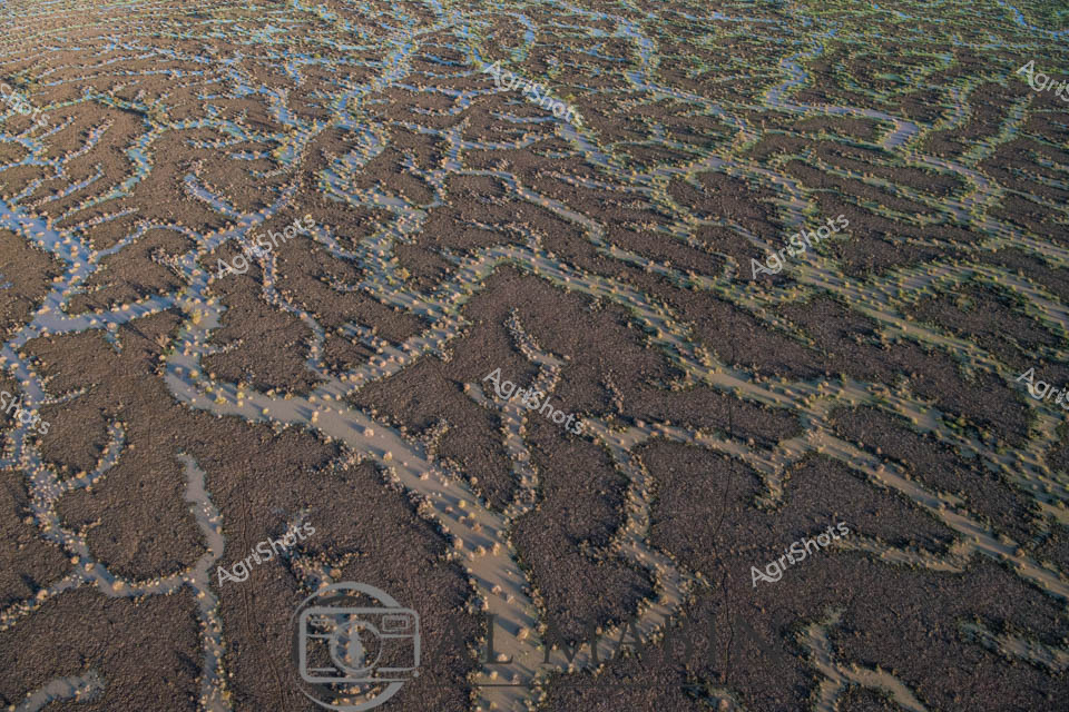
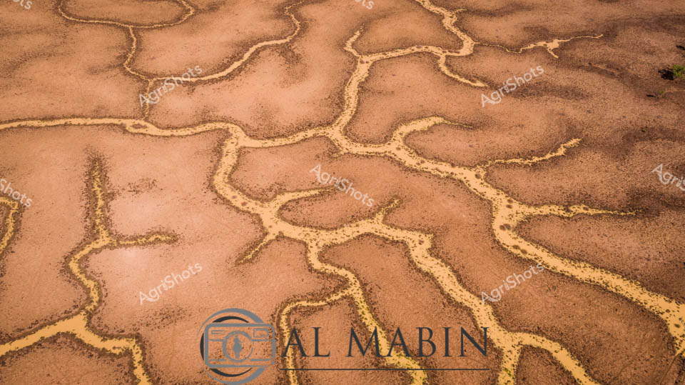
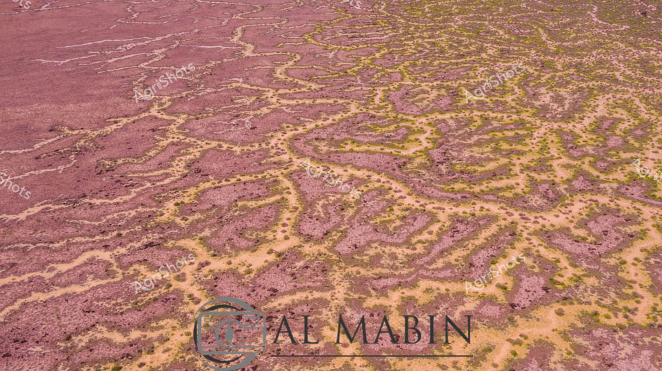
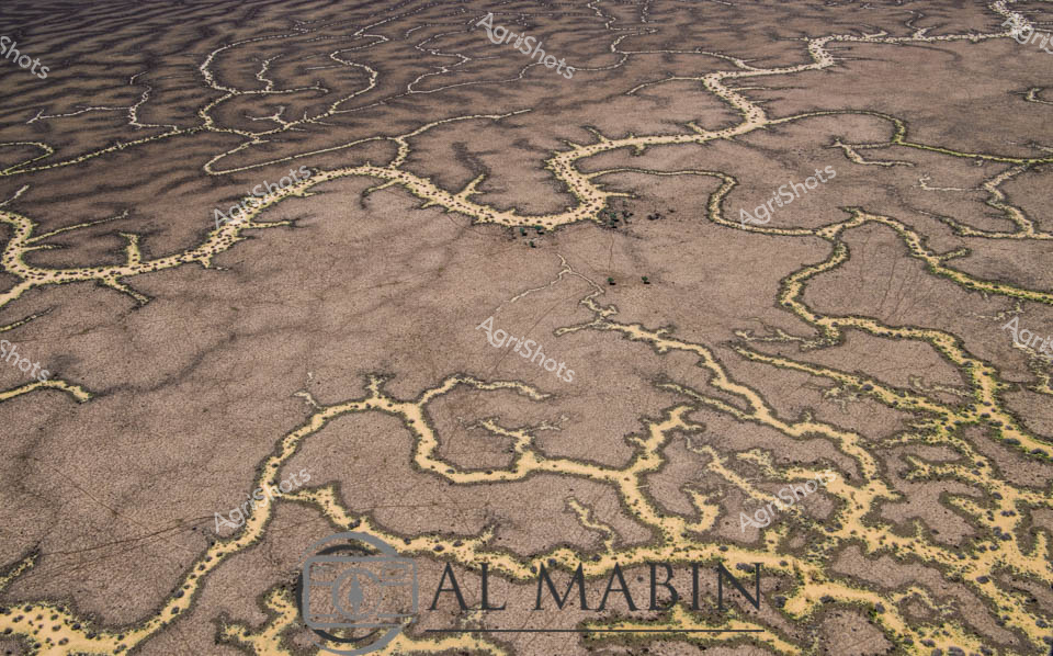
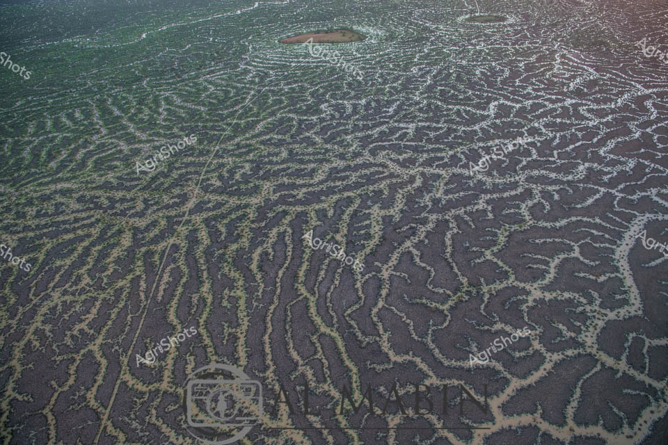
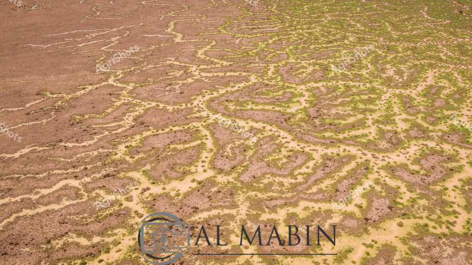
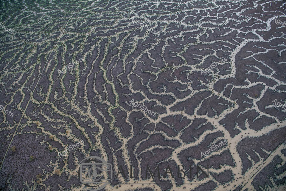
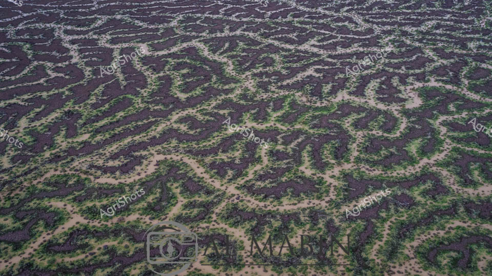
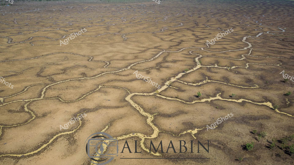
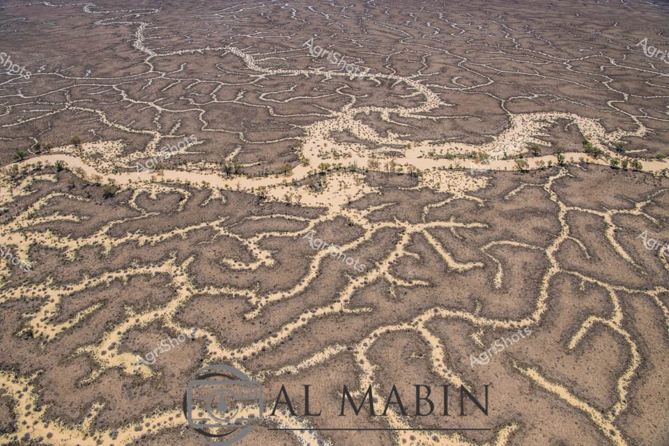
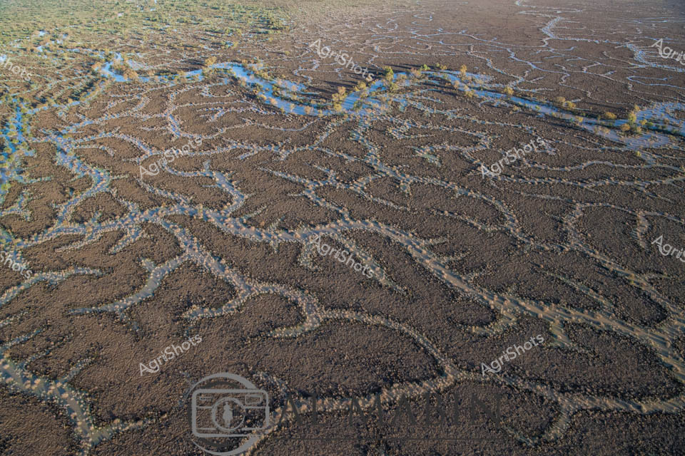
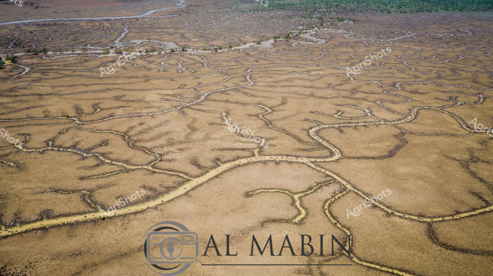
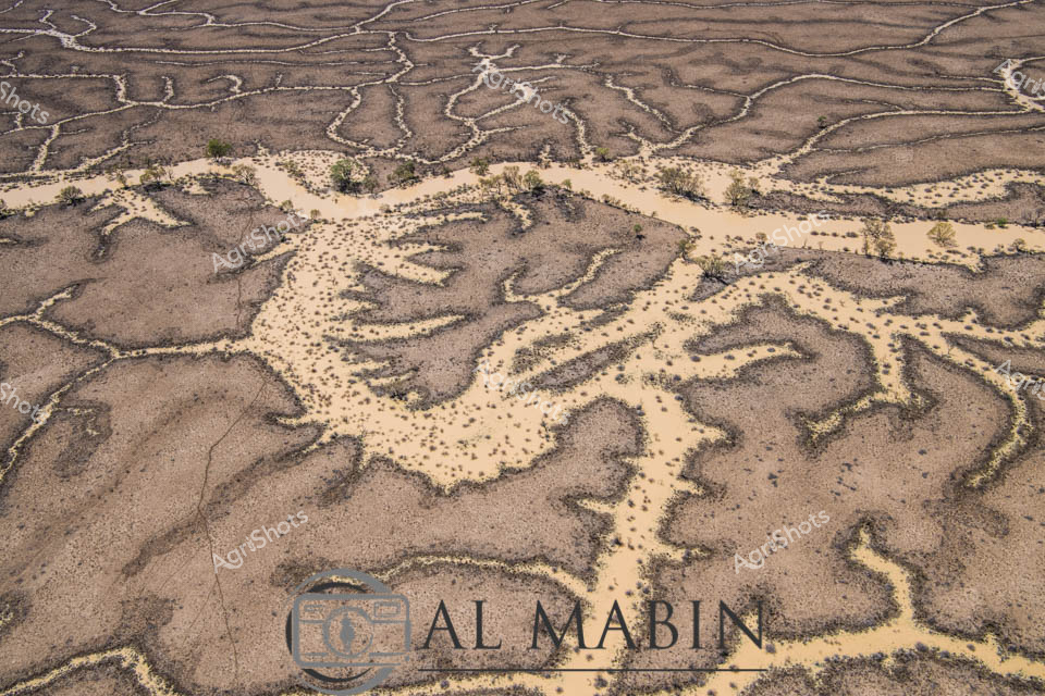
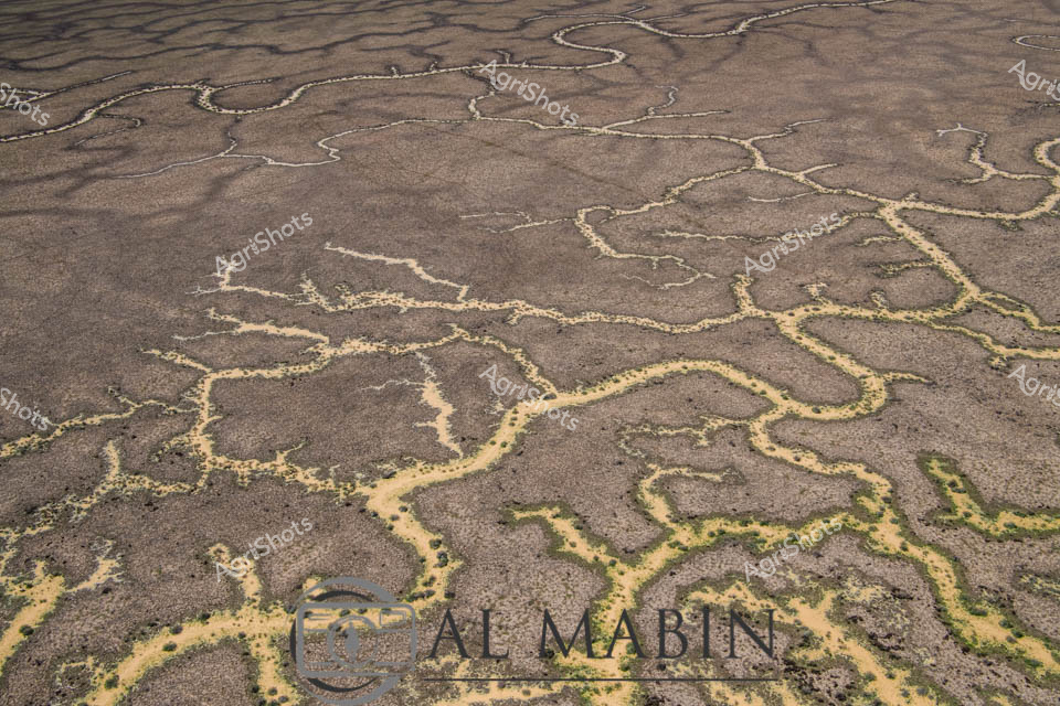
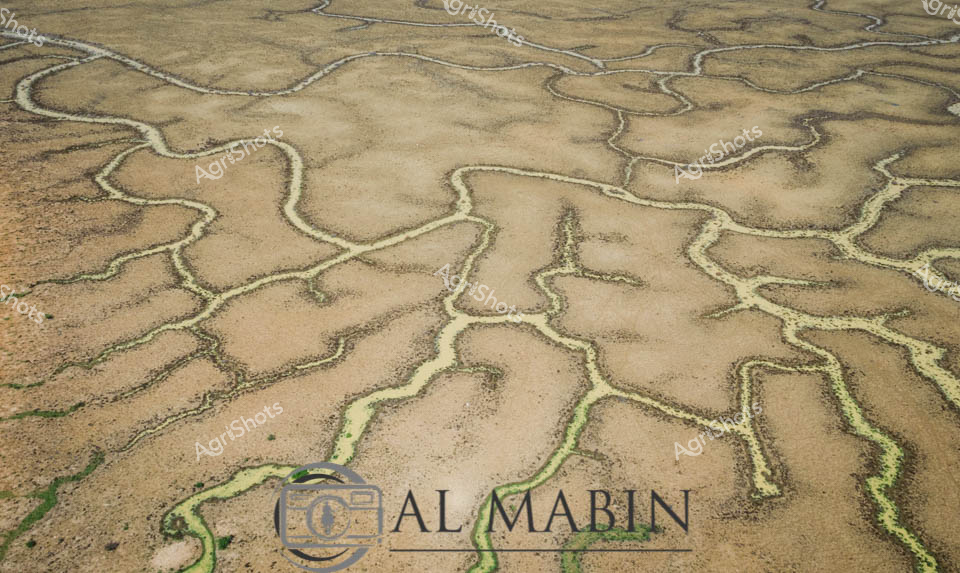
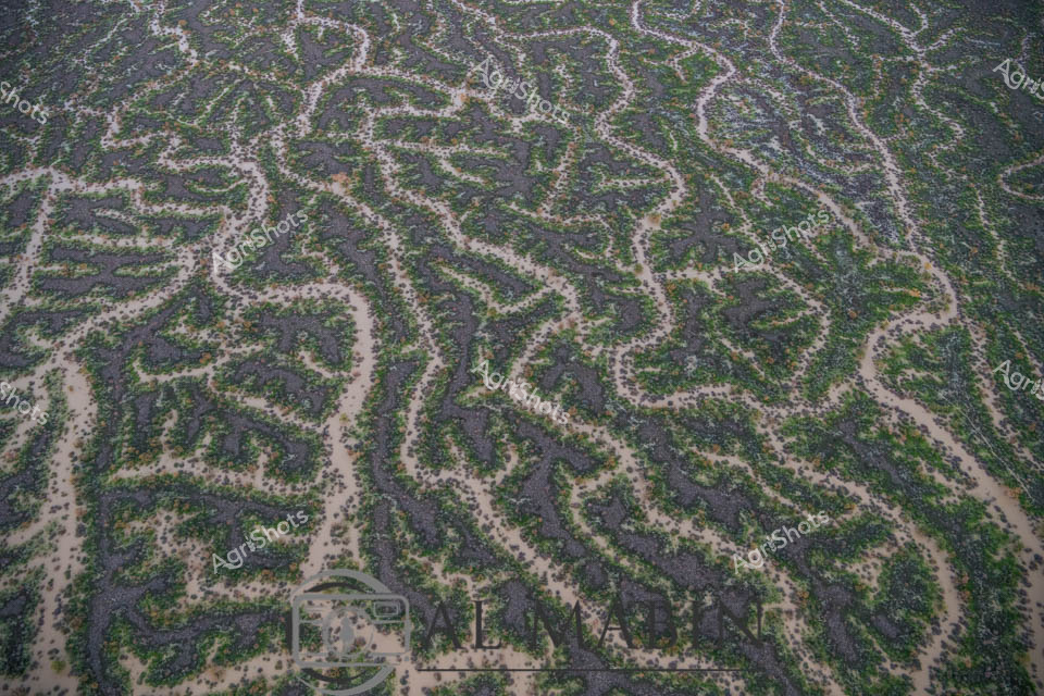
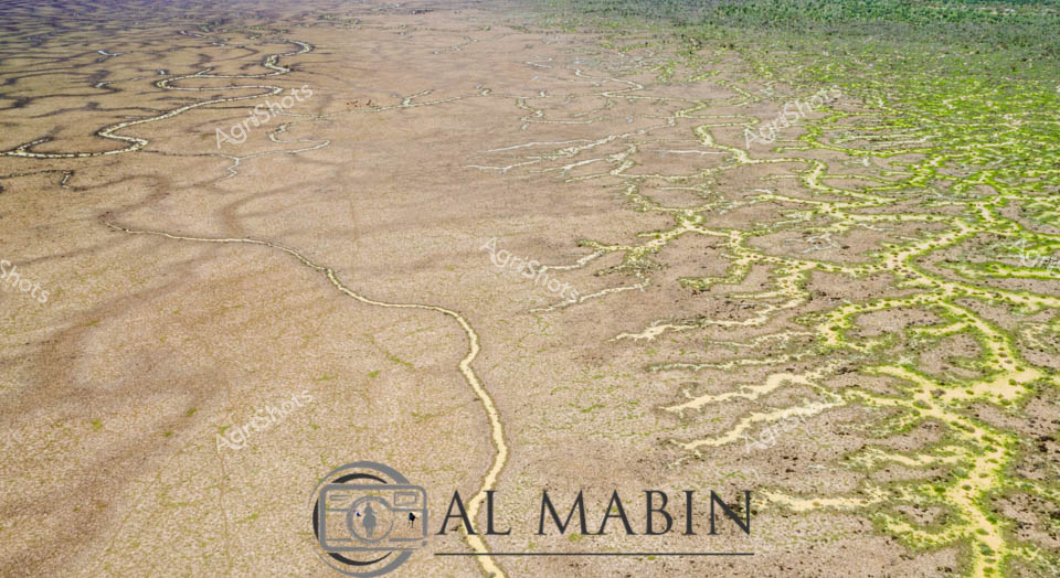
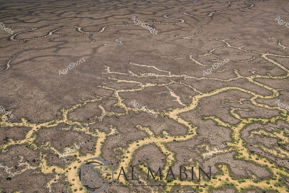
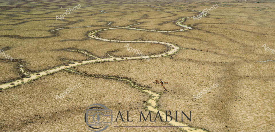
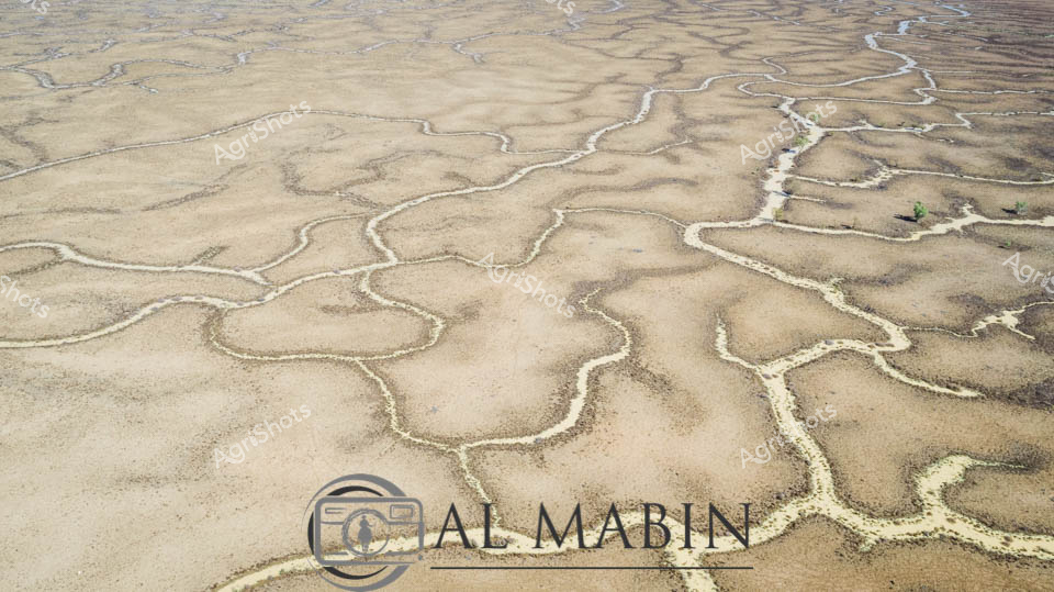
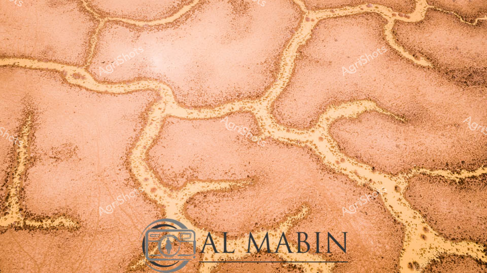
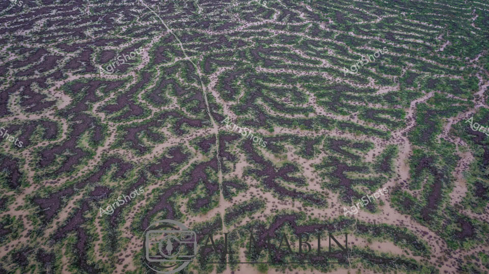
Serpentine waterways thread through the arid Channel Country landscape, capturing the ephemeral beauty of flooding season in remote Queensland. Intricate blue-brown rivulets carve delicate patterns across the parched earth, revealing the dynamic hydrology of this harsh pastoral region. Small stones and pebbles line the sinuous water channels, creating natural borders that highlight the water's meandering journey across the station's expansive terrain. The aerial perspective transforms the landscape into an abstract canvas, showcasing how water transforms this typically dry landscape into a complex network of life-giving streams. Subtle variations of brown, tan, and blue tones create a mesmerizing topographical map that speaks to the resilience of Australia's inland ecosystems. This extraordinary image captures the fleeting moment when flood waters breathe temporary life into the seemingly barren outback, illustrating the critical role of seasonal water flows in sustaining pastoral lands and indigenous ecological systems.