 Image
Image
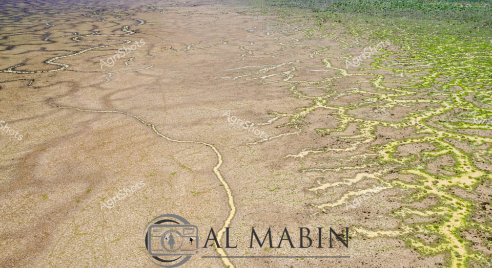
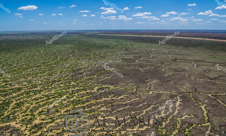
Ephemeral Waters of Channel Country Aerial perspective reveals the mesmerizing topography of Queensland's Channel Country, where delicate water channels trace intricate patterns across an arid landscape. Sinuous waterways branch like silvery veins, transforming the dusty terrain with seasonal flooding. The gradient shifts from muted tan and ochre on the left to vibrant green vegetation on the right, capturing the dynamic ecological transformation triggered by rare desert rainfall. Thin streams wind through the parched earth, creating complex networks that sustain fragile ecosystems in this harsh inland region. The waterways demonstrate nature's remarkable capacity for renewal, with sparse green vegetation sprouting along moisture-rich corridors. This extraordinary landscape represents the resilient heartland of Australian pastoral regions, where water is a precious, transformative force that brings life to seemingly barren expanses.
 Image
Image
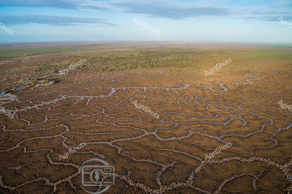
Aerial view of Australia's mesmerizing Channel Country, revealing an intricate network of ephemeral waterways carved across the arid landscape near Windorah in Queensland. Delicate branching patterns of pale sand and sediment contrast against the dark earth, creating a natural topographical map that traces the fluid dynamics of seasonal flooding. These sinuous channels - remnants of recent river flows - showcase the extraordinary hydraulic choreography of inland water systems, where every rainfall creates temporary arteries across the drought-prone terrain. The landscape appears almost fractal in its complexity, with each tributary and rivulet telling a story of water's transformative power in this harsh agricultural region. Soft green and brown tones blend subtly, highlighting the resilience of this ecosystem where pastoral stations manage cattle across massive, unpredictable landscapes. This extraordinary aerial perspective captures the raw beauty of Queensland's inland waterways, revealing the intricate geological and hydrological processes that define Australia's remarkable agricultural frontier.
 Image
Image
Serpentine channels of milky-tan water wind through the parched ochre landscape of Channel Country, revealing the lifeblood of this remote Queensland pastoral ecosystem. A network of ephemeral waterways branches across the arid terrain, lined with resilient remnant trees clinging to the saturated banks during a rare flooding event. The aerial perspective captures the intricate hydraulic arteries that define this harsh yet dynamic agricultural landscape, where water transforms the dusty expanses into a temporary network of life-sustaining corridors. Sparse vegetation and weathered earth tones dominate the scene, punctuated by the sinuous, almost organic flow of water that reflects the region's extreme seasonal variations. This is the raw, unfiltered essence of Australian beef station hydrology - a delicate dance between aridity and sudden abundance, where every drop of water represents survival and potential for pastoral enterprise. The Al Mabbit watermark subtly anchors this remarkable documentation of Australia's inland water systems, a critical resource for livestock and agricultural sustainability.
 Image
Image
Aerial panorama of Channel Country's intricate water channels near Windorah, Queensland, revealing the mesmerizing natural irrigation patterns of arid western landscapes. Deep purple-brown earth intertwines with delicate green vegetation, creating an organic, lace-like topography that demonstrates the resilient ecosystem of Australia's inland waterways. Serpentine waterways trace complex networks across the terrain, highlighting the ephemeral nature of water in this challenging environment, where every drop is precious for sustaining pastoral life. The seasonal flooding has transformed the stark landscape into a vibrant, interconnected system of life-giving channels, showcasing the remarkable adaptation of both landscape and agricultural practices to extreme climatic conditions. Soft sandy edges blend with dark soil and scattered greenery, creating a natural camouflage that speaks to the subtle beauty of Queensland's remote interior. This breathtaking aerial perspective captures the delicate balance between aridity and abundance in one of Australia's most distinctive agricultural regions.
 Image
Image
Aerial view of intricate water channels spreading across an arid Queensland landscape, capturing the mesmerizing patterns of flood irrigation in Channel Country. Sinuous lines of water weave through dark and green-tinted earth, creating a natural labyrinth that resembles delicate veins across the barren terrain. The complex network of waterways reveals the transformative power of seasonal flooding, where ephemeral rivers and creeks spread nutrients and moisture across the harsh outback landscape. Subtle gradients of green, brown, and grey blend together, showcasing the delicate balance of water management in Australia's remote beef production regions. This extraordinary perspective highlights the resilience of pastoral landscapes, where strategic water distribution enables livestock grazing in some of the continent's most challenging environments. The image captures the raw beauty of Queensland's inland hydrology, where every water channel represents a lifeline for agricultural survival in an unforgiving ecosystem.
 Image
Image
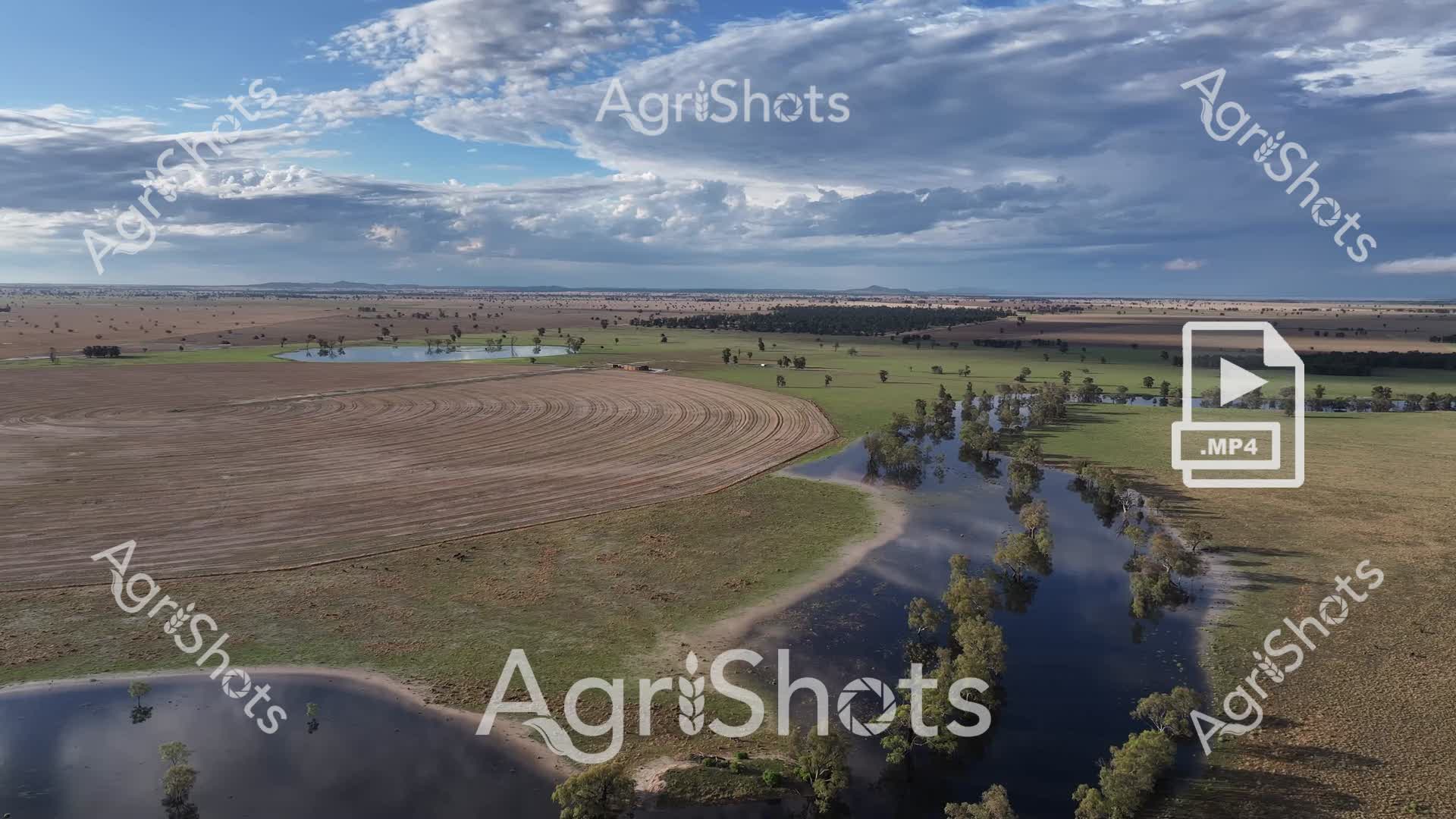
Storm-darkened skies hover over a waterlogged pastoral landscape in the Riverina region of New South Wales, where recent flooding has transformed the grasslands into a reflective inland sea. Scattered eucalyptus trees punctuate the vast, saturated plain, their silvery-green foliage standing sentinel over a small mob of merino sheep grazing amid the shallow waters. The dramatic cloudscape creates a moody, slate-blue backdrop that stretches across the horizon, casting an atmospheric tension over the sodden paddock. Floodwaters mirror the turbulent sky, creating a seamless blend of grey and blue that highlights the resilience of the Australian agricultural landscape during extreme weather events. Sparse vegetation emerges through the water's surface, suggesting the underlying pasture's capacity to endure and regenerate. This evocative scene captures the raw beauty and challenging conditions of rural Australian farming, where livestock and landscape must adapt to the mercurial nature of the continent's climate.
 Image
Image
Serpentine waterways slice through the parched Channel Country landscape, revealing the intricate hydrology of Queensland's remote inland region. Murky sandy-colored floodwaters wind between drought-scorched earth, creating sinuous channels lined with sparse, resilient eucalyptus and acacia trees. The aerial perspective captures the delicate network of ephemeral creek systems that are vital lifelines for pastoral stations during rare flooding events, transforming the arid terrain into a complex hydraulic mosaic. Pale sediment-laden streams contrast dramatically with the burnt sienna and charcoal tones of the surrounding landscape, highlighting the dynamic seasonal transformations of this harsh yet beautiful inland ecosystem. These waterways represent critical infrastructure for beef cattle stations, providing essential water resources across thousands of square kilometers of remote Australian outback. The image powerfully illustrates the challenging environmental conditions that define agricultural operations in Queensland's most extreme pastoral zones, where water management is crucial for survival.
 Image
Image
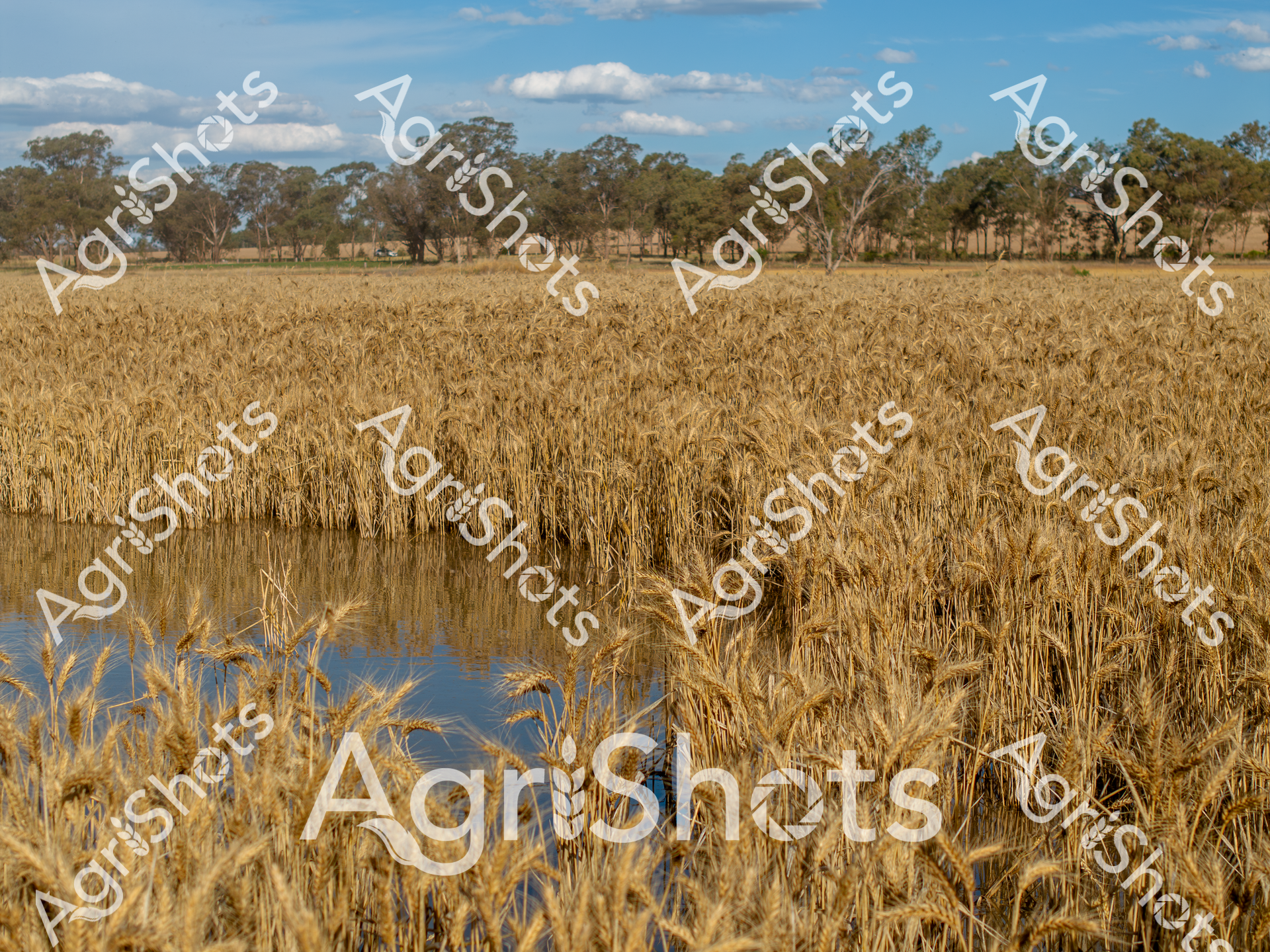
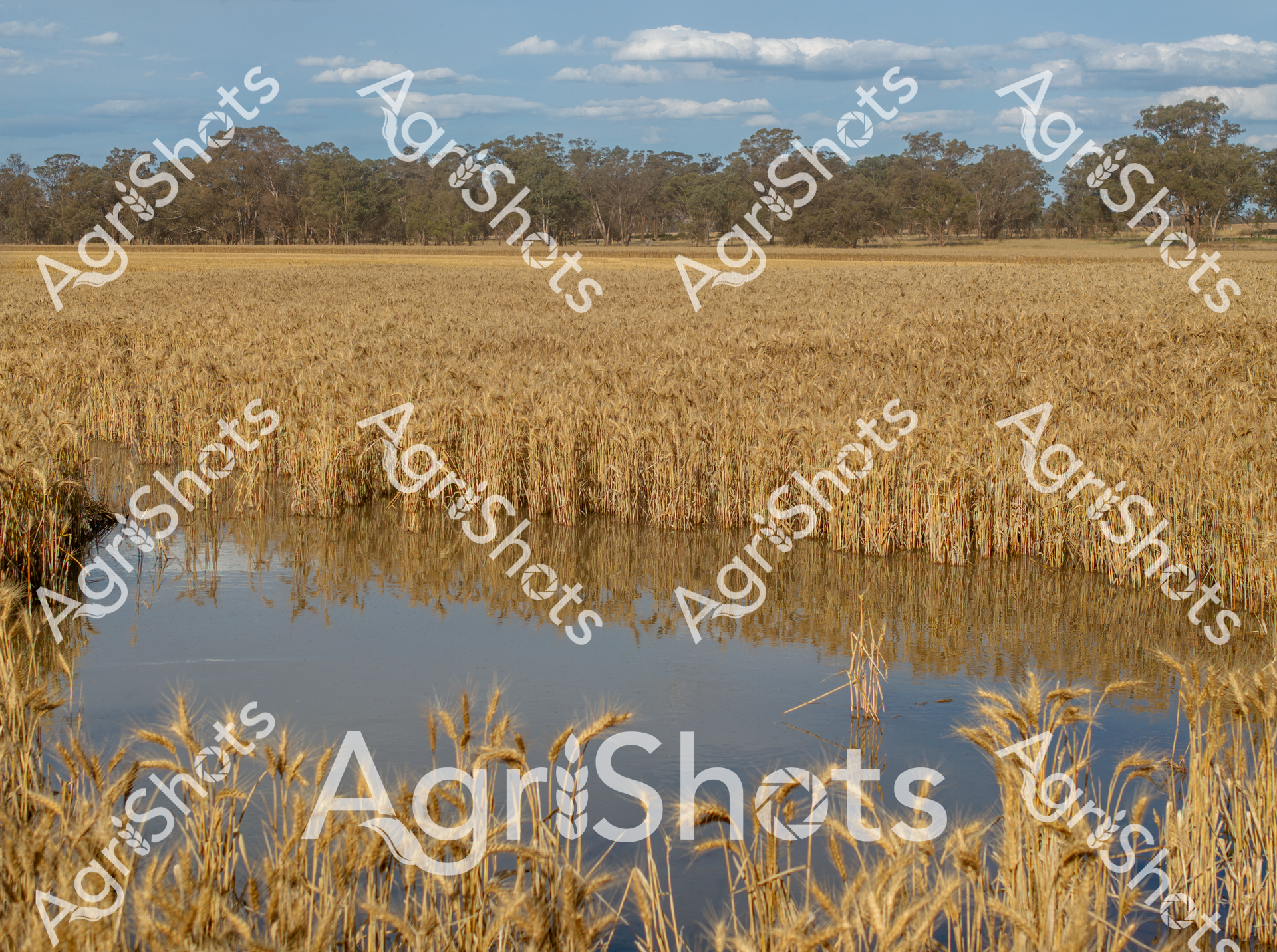
Golden wheat stalks rise from water-logged ground, creating a stark contrast between agricultural abundance and environmental challenge. Recent flooding has partially submerged a mature wheat field, with the golden grain heads still visible above the reflective blue water. Scattered eucalyptus trees line the distant horizon, typical of a New South Wales agricultural landscape, under a soft blue sky dotted with wispy clouds. The scene captures the resilience of Australian farming, where crops must withstand unpredictable environmental conditions. Mature wheat plants stand partially underwater, their rich amber tones reflecting in the still surface, demonstrating both the vulnerability and adaptability of dryland farming systems. The image embodies the delicate balance between agricultural production and natural water cycles, a narrative deeply embedded in the Australian rural experience.
 Image
Image
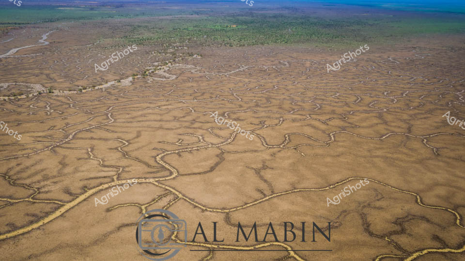
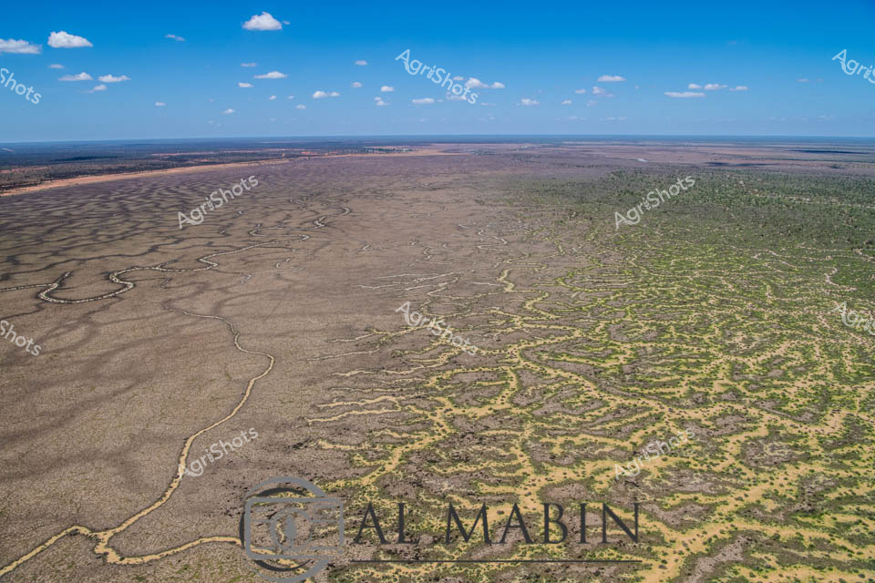
Serpentine waterways carve an intricate network across the arid Channel Country landscape, revealing the complex hydrology of Australia's remote western Queensland. A vast floodplain stretches toward distant green woodland horizons, its surface etched with sinuous creek lines and sandy channels that capture ephemeral water flows during rare rainfall events. The aerial perspective showcases the delicate branching patterns of natural drainage systems, where seasonal flooding transforms this seemingly barren terrain into a dynamic ecological canvas of golden browns and subtle earth tones. These meandering waterways are lifelines for pastoral stations, providing critical moisture to support sparse vegetation and sustain livestock across this challenging semi-arid environment. The intricate geographic texture tells a story of geological patience, where water has slowly sculptured the landscape over millennia, creating a remarkable topographical fingerprint visible only from high above. This expansive view captures the raw beauty of Australia's inland waterways, demonstrating the resilient and adaptive nature of the continent's interior ecosystems.
 Image
Image
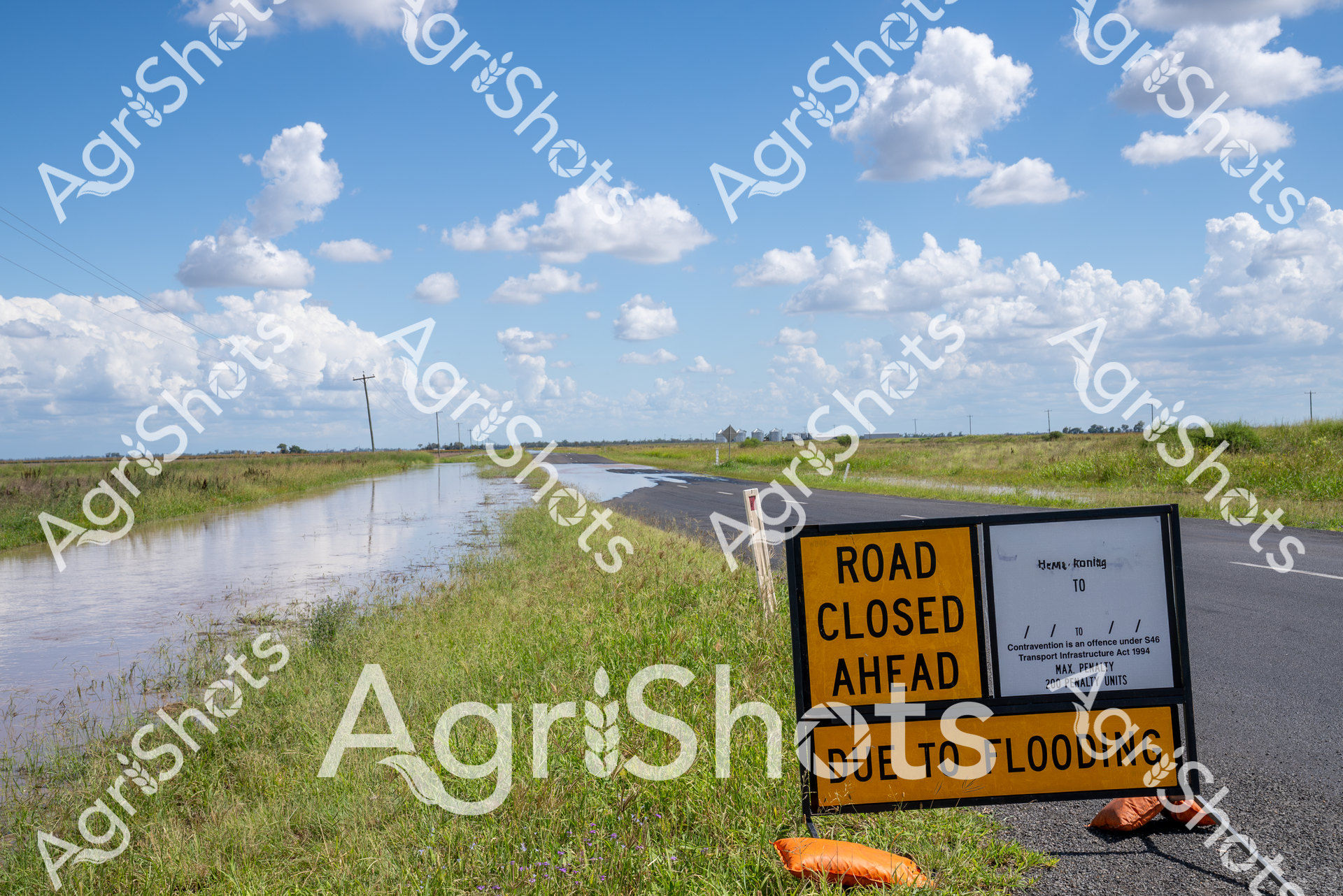
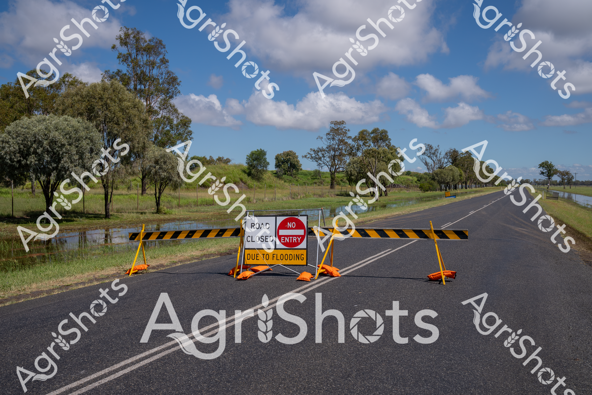
Rural Queensland Flood Inundation: Landscape of Disruption Floodwaters consume the roadway in this stark representation of environmental challenge across the Darling Downs agricultural region. A vivid yellow "ROAD CLOSED" sign stands sentinel at the edge of an asphalt road now partially submerged, its bright warning contrasting against the lush green grasslands and expansive blue sky dotted with billowing cumulus clouds. The landscape stretches horizontally, punctuated by distant electricity poles and the subtle contours of agricultural terrain, revealing the immense scale of water encroachment. Grassy verges blend into the flooded roadside, creating a seamless transition between land and impromptu waterway, while the crisp signage communicates the immediate practical impact of natural inundation on rural infrastructure. The pristine white clouds and brilliant blue sky offer an ironically serene backdrop to the ground-level disruption, highlighting the unpredictable power of seasonal flooding in Queensland's agricultural heartland.
 Image
Image
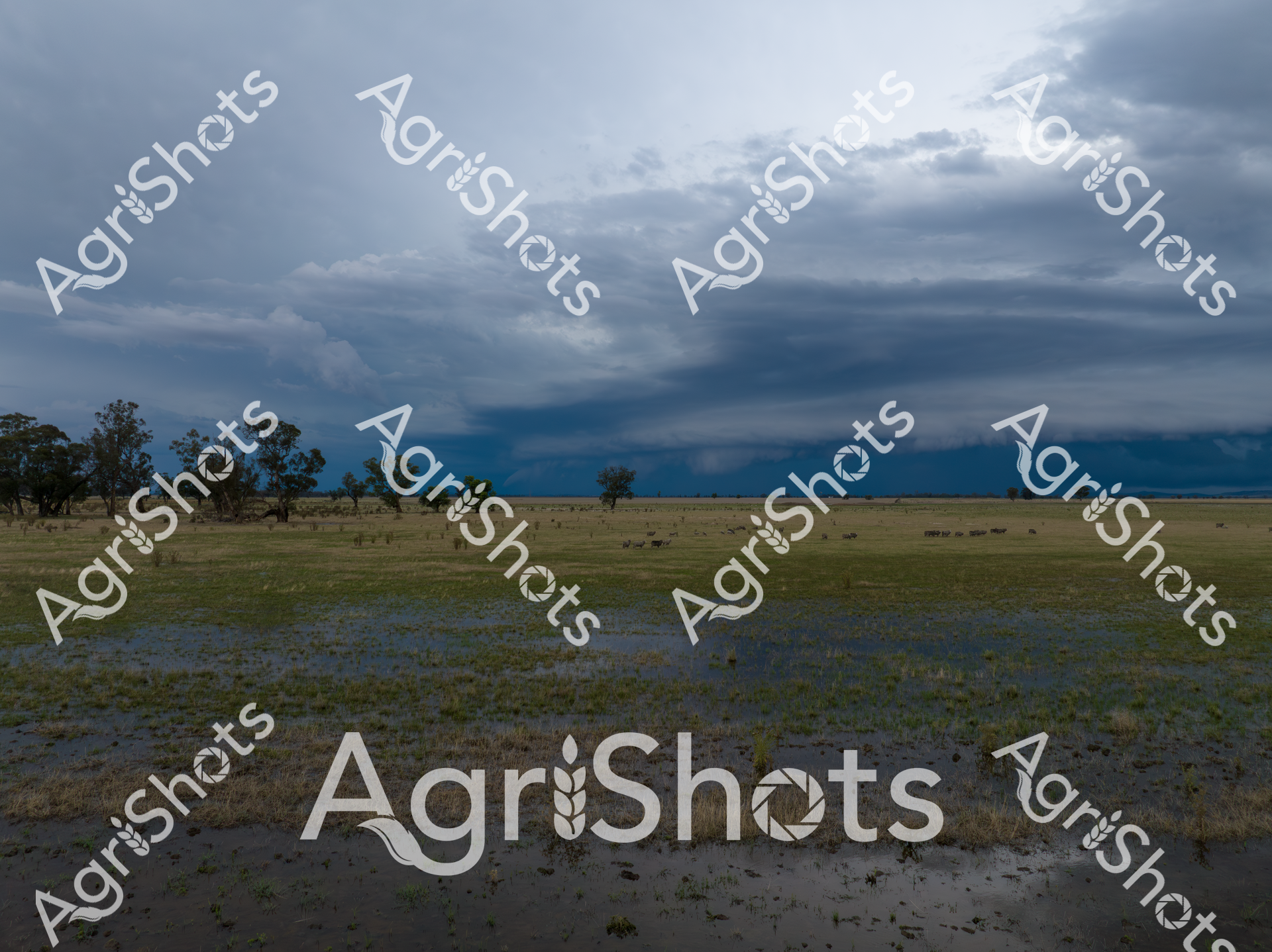
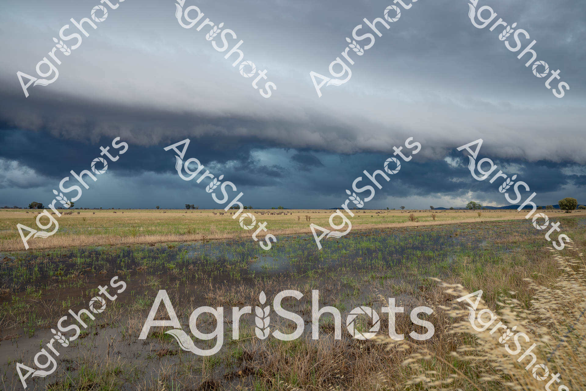
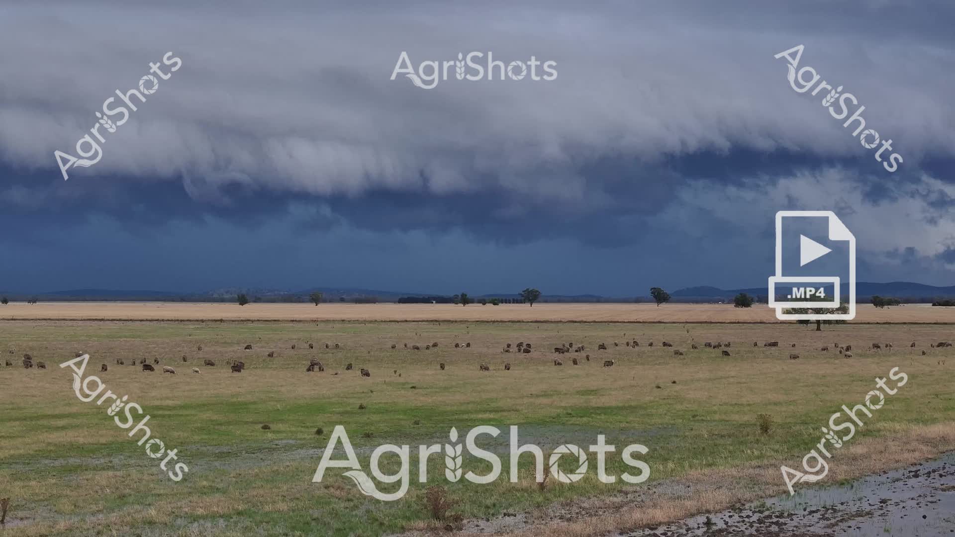
Thunderclouds gather with brooding intensity over a waterlogged pastoral landscape in the Riverina, a testament to the dramatic seasonal extremes of New South Wales. Floodwaters reflect the turbulent sky, creating a mirror of steel and silver across the grazed paddock, where scattered eucalyptus trees stand as stoic witnesses to nature's raw power. The saturated ground speaks to the region's unpredictable summer conditions, where drought can quickly give way to sudden inundation, challenging the resilience of agricultural communities. Soft greys and deep blues dominate the cloudscape, creating a powerful visual tension between the saturated earth and the threatening sky, with a hint of distant landscape visible through the storm's edge. This powerful image captures the volatile beauty of Australian agricultural landscapes, where farmers constantly negotiate the delicate balance between abundance and adversity. The scene embodies the spirit of rural adaptability - a quiet strength beneath the dramatic meteorological display.
 Image
Image
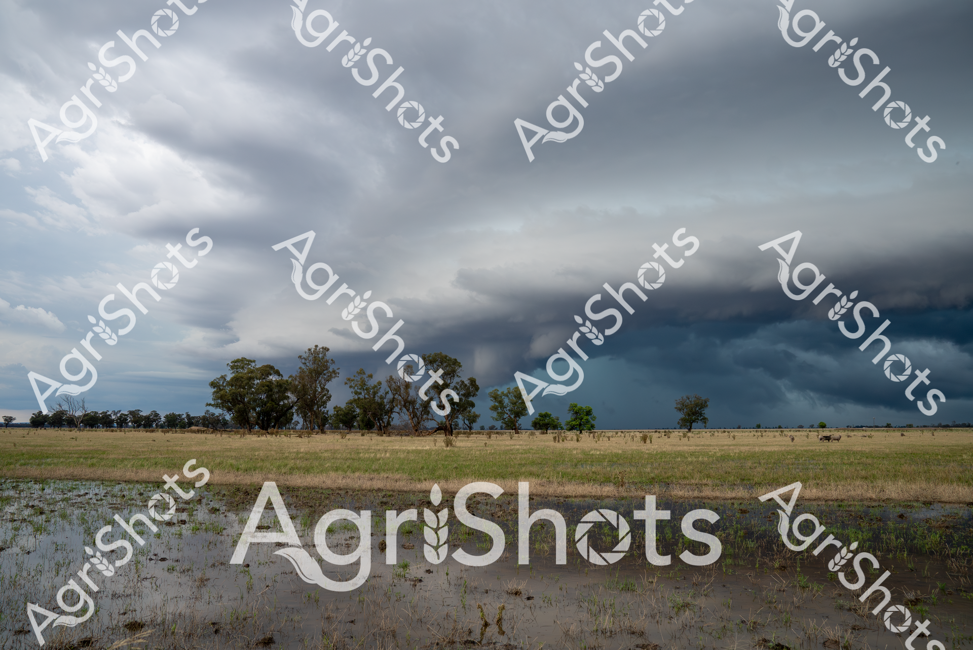
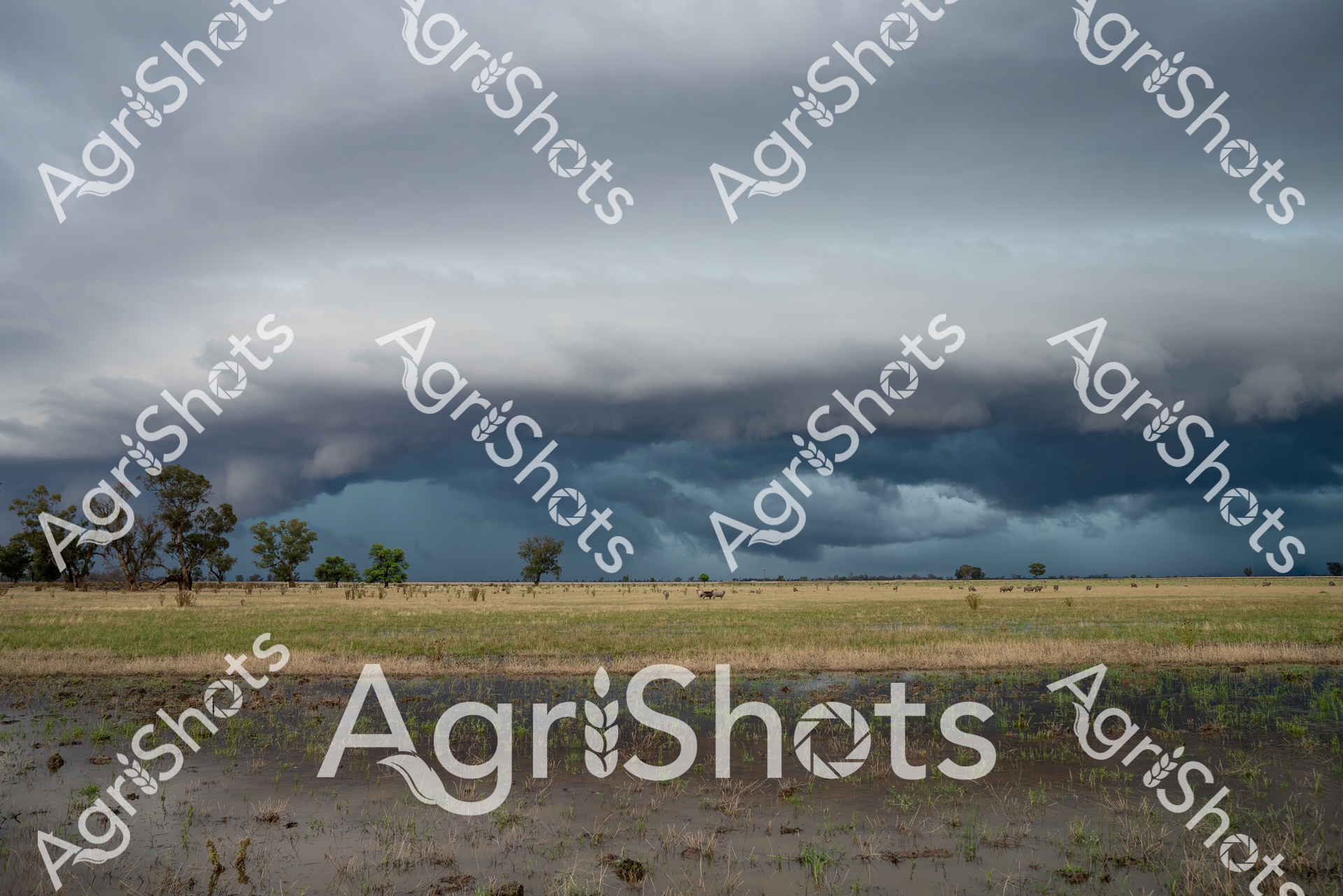
Thunderous monsoon clouds roll across the Riverina's expansive plains, casting an ominous steel-blue shadow over waterlogged agricultural terrain. Recent flooding has transformed the golden wheat stubble and dry grasslands into a reflective wetland, with murky water pooling between sparse vegetation and creating a dramatic landscape of agricultural resilience. The storm's leading edge presents a remarkable shelf cloud - a dark, imposing meteorological phenomenon that signals intense atmospheric turbulence and potential agricultural challenge. Scattered trees punctuate the distant horizon, standing as silent witnesses to the dramatic meteorological transformation sweeping across this New South Wales agricultural landscape. Delicate green shoots emerge from the saturated soil, hinting at the regenerative potential of the land even in the face of extreme weather conditions. The image captures the raw, unpredictable essence of Australian rural environments - where farming exists in constant negotiation with powerful natural forces.
 Image
Image
Thunderclouds gather with brooding intensity over the waterlogged Riverina landscape, transforming the pastoral grasslands into a reflective mirror of impending meteorological drama. Floodwaters spread across the paddock, creating silvery pools that capture the slate-gray sky's dramatic luminescence, while scattered trees stand as silent sentinels against the approaching storm. The expansive horizontal plane speaks to the region's characteristic wide-open terrain, where agricultural resilience meets nature's raw power in a breathtaking display of environmental dynamism. Saturated grasses blend from muted green to pewter, suggesting recent heavy rainfall that has transformed the agricultural terrain into a transient wetland. The horizon line dramatically separates the dark, roiling cloudscape from the subdued earth, creating a powerful visual tension that epitomizes the unpredictable nature of Australian rural environments. This image captures a moment of sublime meteorological transition, where water, land, and sky converge in a powerful testament to the Riverina's dramatic seasonal transformations.
 Image
Image
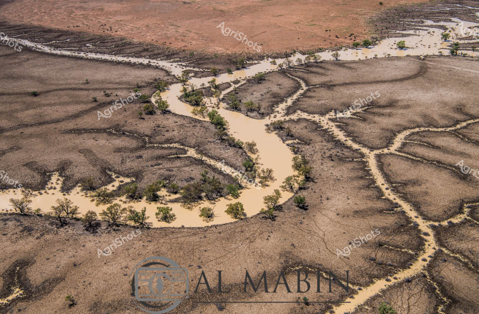
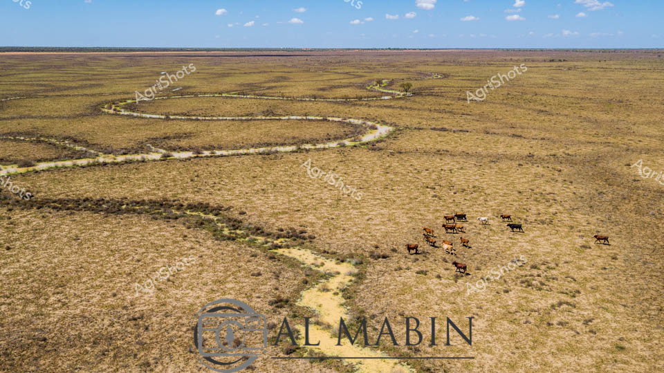
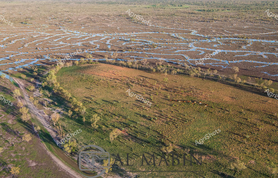
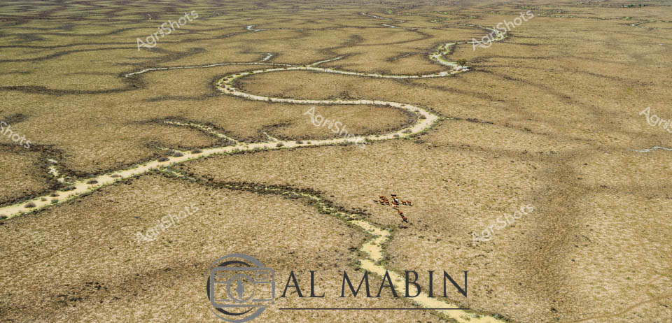
Meandering through the expansive Channel Country of Queensland, a serpentine waterway cuts a vibrant path across the golden-brown grasslands, breathing life into the arid landscape. A small herd of robust beef cattle graze near the water's edge, their rich brown coats contrasting against the sun-bleached pastures, embodying the resilience of Australian livestock in this challenging environment. The winding creek, likely swollen from seasonal flooding, creates a lifeline through the seemingly endless horizon, its banks lined with subtle hints of green vegetation marking the water's influence. The aerial perspective reveals the magnificent scale of this remote pastoral setting, where the sky stretches endlessly in soft blue hues dotted with wispy clouds. The landscape speaks to the harsh yet beautiful nature of outback Queensland, where survival depends on strategic water management and adaptable cattle breeds. The subtle watermark of "Al Mabin" suggests this is a carefully captured moment documenting the agricultural heritage of the region, highlighting the intricate relationship between land, water, and livestock in one of Australia's most challenging agricultural frontiers.
 Image
Image
Rural Queensland Road Closure: Nature's Intervention Floodwaters have transformed this Darling Downs roadway into an impassable barrier, with stark yellow and black barricades blocking forward progress. Vibrant safety signage declares "ROAD CLOSED DUE TO FLOODING" and "NO ENTRY", creating a dramatic punctuation across the asphalt ribbon cutting through lush pastoral landscape. Expansive blue skies with billowing white clouds provide a stark contrast to the flooded grasslands and tree-lined roadside, where water pools alongside the bitumen surface. The yellow barricades and orange base supports stand in sharp relief against the grey road and green vegetation, highlighting the critical safety message during this natural event. Native eucalyptus trees stand sentinel in the background, their grey-green foliage a testament to the resilient Australian landscape that simultaneously nurtures and challenges agricultural communities. This image captures the unpredictable relationship between infrastructure and environment, where seasonal flooding can rapidly transform a straightforward rural thoroughfare into an unexpected obstacle.
 Video
Video
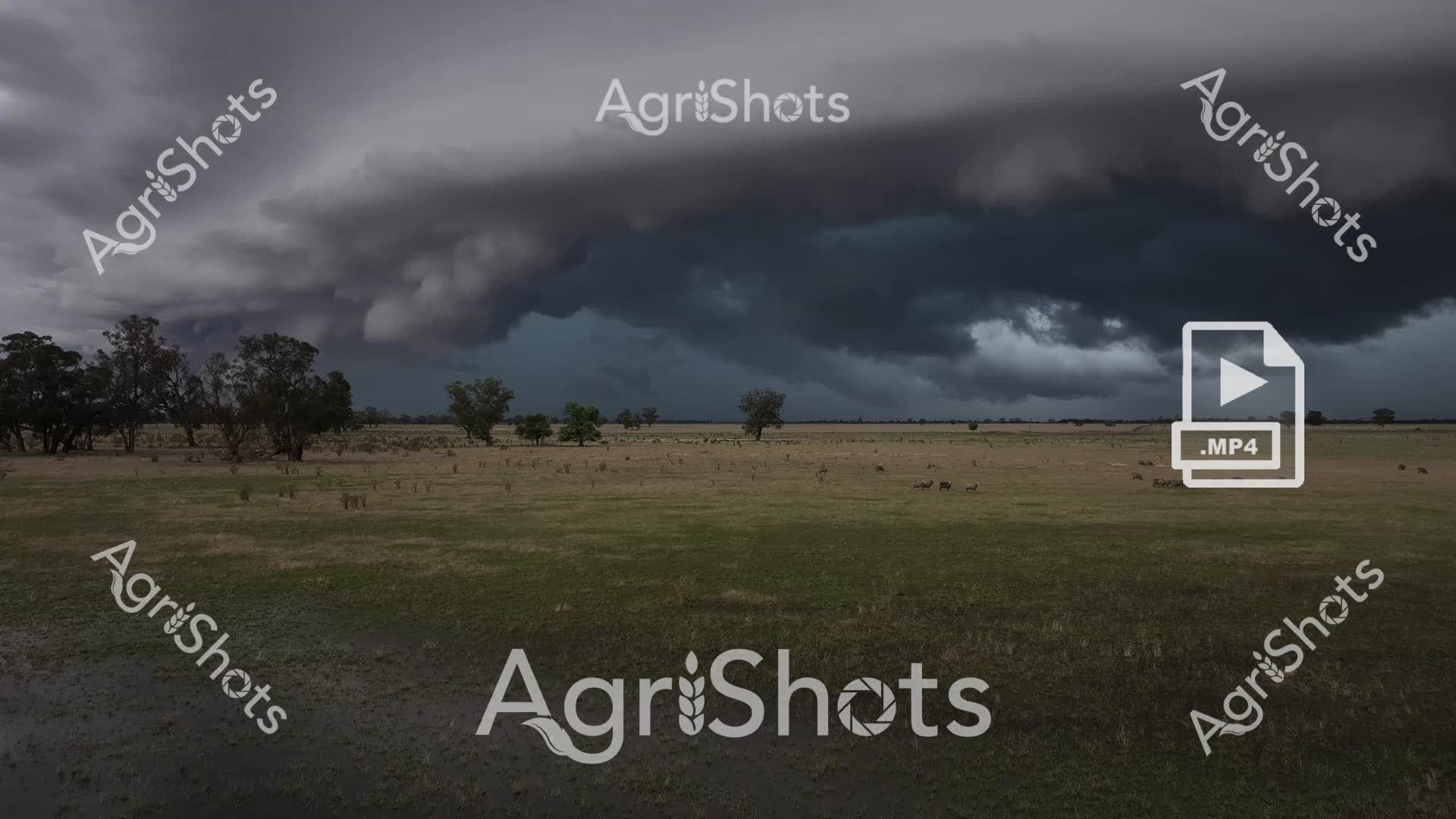
Thunderous storm clouds gather over a vast Riverina grassland, casting an ominous slate-grey palette across the expansive pastoral landscape. Scattered eucalyptus trees punctuate the flat, drought-stressed pasture, their silhouettes stark against the brewing meteorological drama overhead. A small mob of livestock - likely merino sheep or beef cattle - graze cautiously, their forms diminutive against the immense meteorological canvas. The grassland transitions from parched yellow-brown to muted green, suggesting recent minimal rainfall has sparked tentative regeneration. Turbulent cloudforms billow and churn, promising potential deluge, their layered textures ranging from deep pewter to soft charcoal, creating a dramatic atmospheric tension that speaks to the unpredictable climate of rural New South Wales. This raw video capture epitomizes the volatile beauty of Australian agricultural environments, where survival depends on reading the mercurial signals of impending weather systems.
 Image
Image
Aerial vista of Channel Country's mesmerizing landscape near Windorah, Queensland, revealing the intricate hydraulic networks carved by seasonal floodwaters across an expansive arid terrain. Serpentine waterways branch and meander through the dusty ochre plains, creating complex dendritic patterns that pulse with life-giving moisture across the seemingly barren landscape. The image captures the extraordinary resilience of Australia's inland geography, where ephemeral creek systems transform dry grasslands into temporary wetlands during rare flooding events. Subtle gradations of brown, tan, and muted green reveal the delicate ecological balance of this harsh yet breathtaking environment, where water is the critical architect of survival. Wispy clouds drift across a brilliant azure sky, providing a luminous backdrop to the textured ground below, highlighting the dramatic contrast between aridity and potential abundance. This landscape epitomizes the dramatic seasonal transformations of Queensland's remote beef station country, where water's momentary presence sculpts the very essence of the terrain.
 Image
Image
Aerial panorama of Channel Country in western Queensland during flood season, where intricate blue waterways weave across the ochre landscape like delicate capillaries. Lush green pastures curve alongside serpentine water channels, creating a mesmerizing natural tapestry that epitomizes the dynamic ecosystem of Australia's inland pastoral regions. Sparse eucalyptus trees punctuate the floodplain, their silvery-green foliage providing subtle texture against the expansive brown and blue terrain. This extraordinary vista captures the resilience of beef cattle stations during seasonal inundation, where strategic water management transforms seemingly arid landscapes into temporary aquatic networks that nourish grasslands and sustain livestock production. The image reveals the breathtaking scale of Queensland's remote agricultural frontiers, where water becomes a transformative force reshaping the terrain and supporting complex ecological systems. Golden morning light bathes the landscape, highlighting the nuanced topographical details of this remarkable inland watershed.
 Image
Image
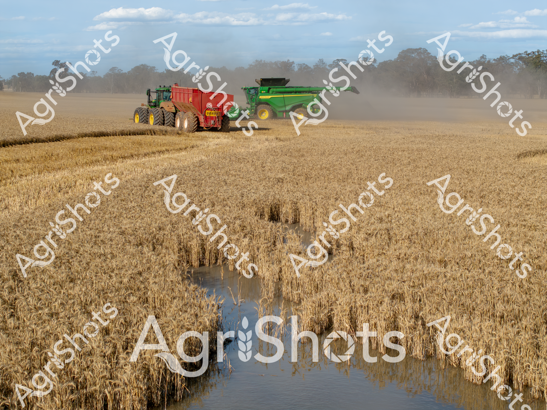
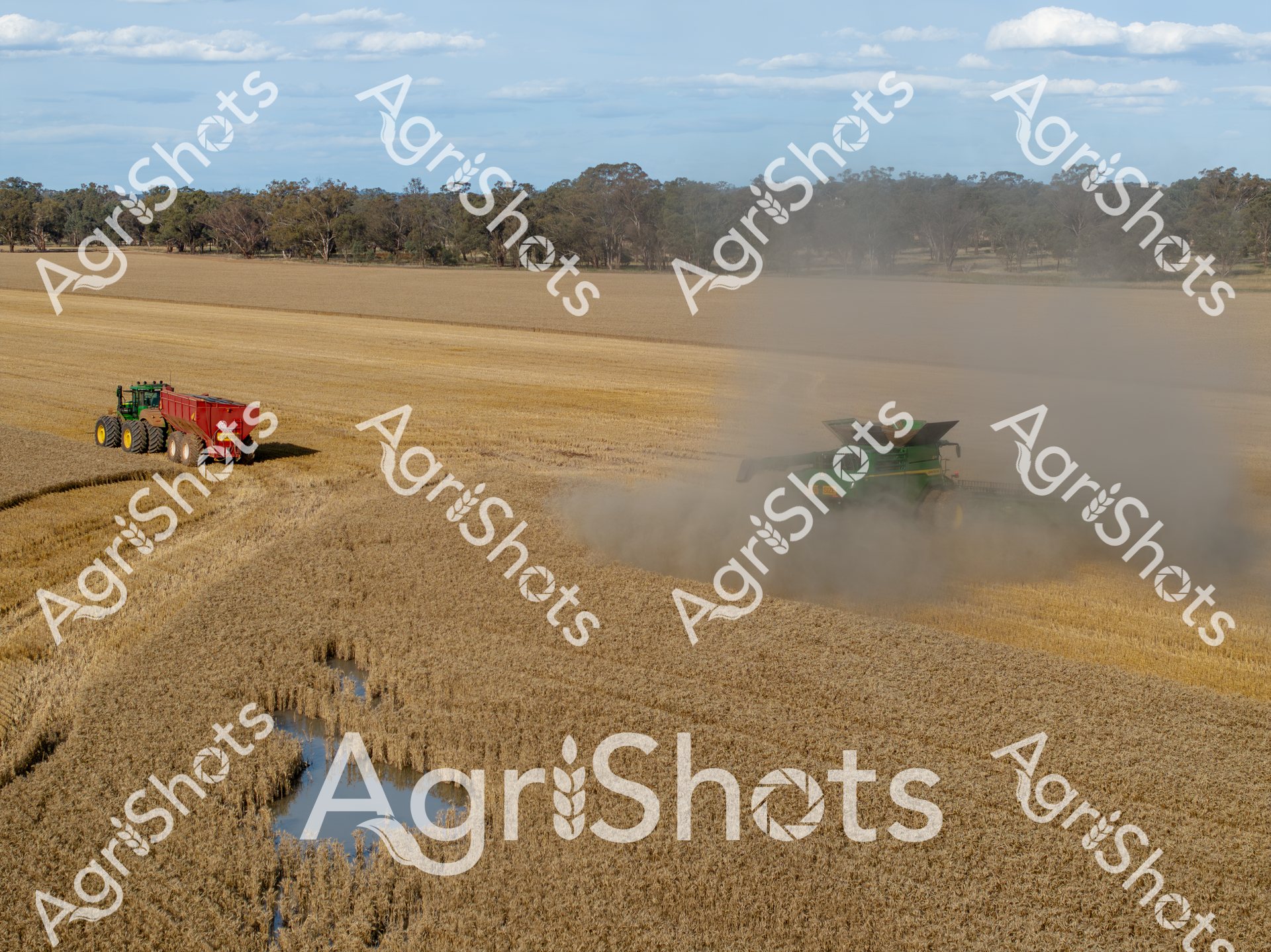
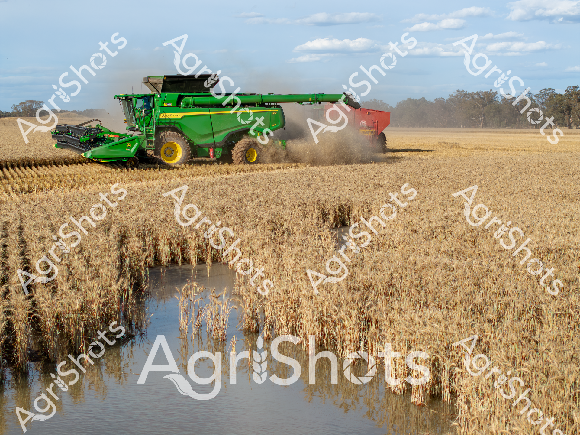
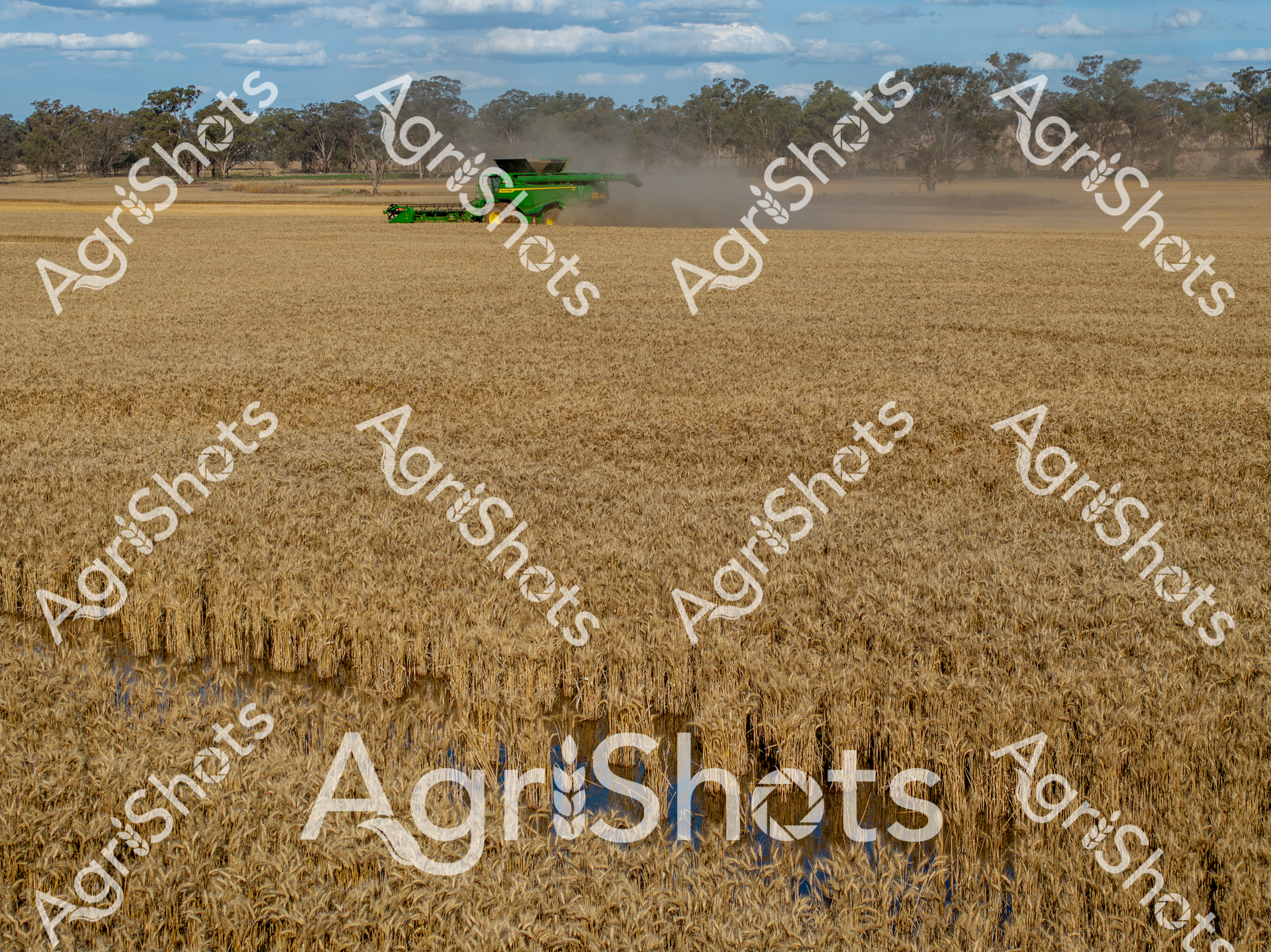
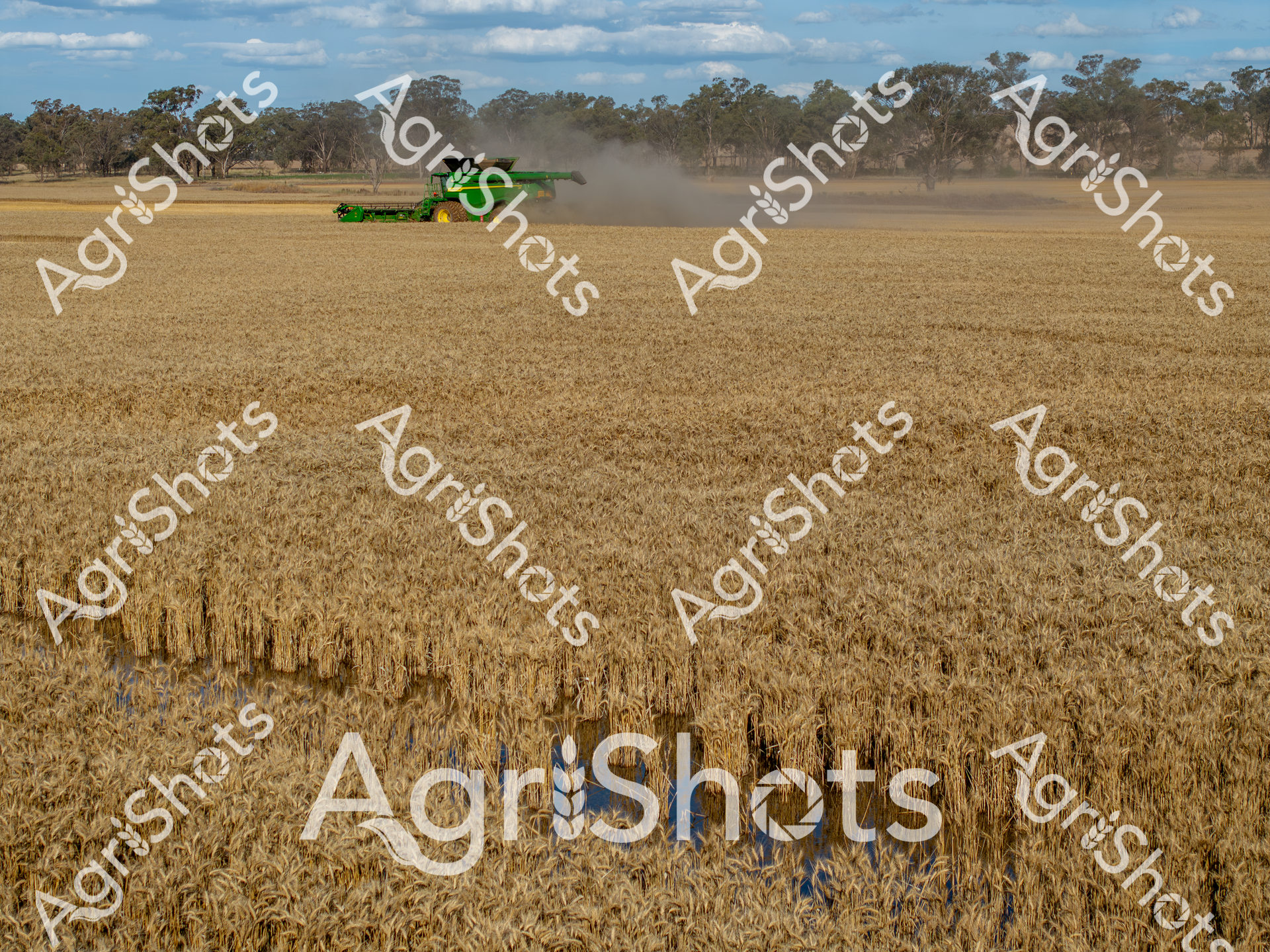
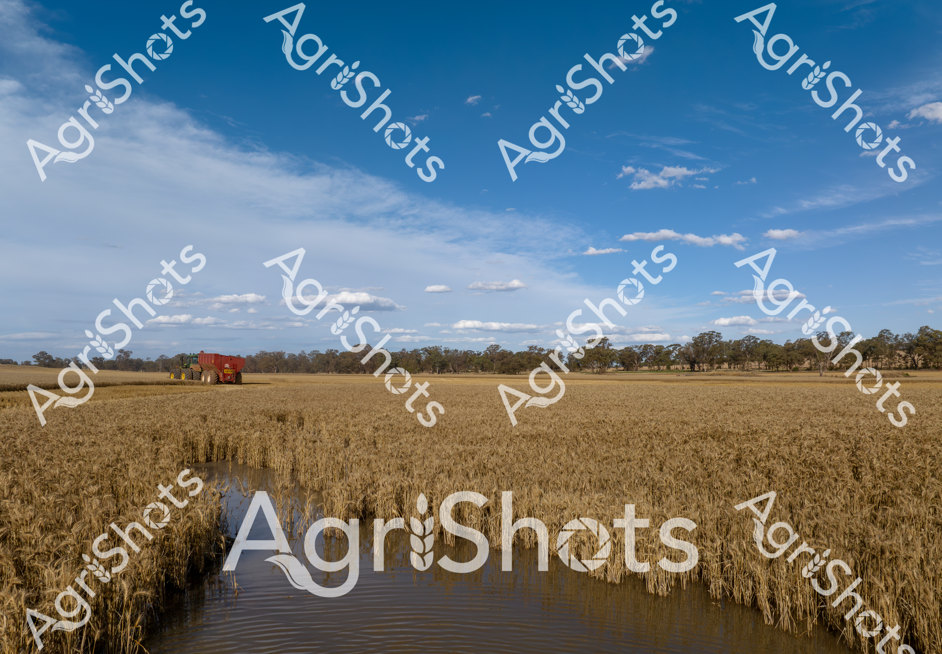
Swirling dust billows across a golden wheat field as a powerful John Deere header and tractor navigate the challenging harvest terrain. A vivid red chaser bin stands in stark contrast to the green harvesting equipment, while a water-filled channel cuts through the ripened wheat, revealing the impact of recent flooding on the crop. The late summer landscape captures the resilience of Australian agricultural practices, with mature wheat stalks standing tall despite water damage, demonstrating the farmers' ability to work through challenging environmental conditions. The dual-wheeled tractor moves methodically, its massive tires leaving distinctive tracks through the dry, golden field, while the header continues its precise harvesting path. Soft blue skies and distant tree lines frame the scene, highlighting the expansive nature of this New South Wales agricultural landscape. The image encapsulates the delicate balance between agricultural machinery, natural challenges, and the ongoing work of crop harvesting - a powerful narrative of rural Australian farming resilience.
 Image
Image
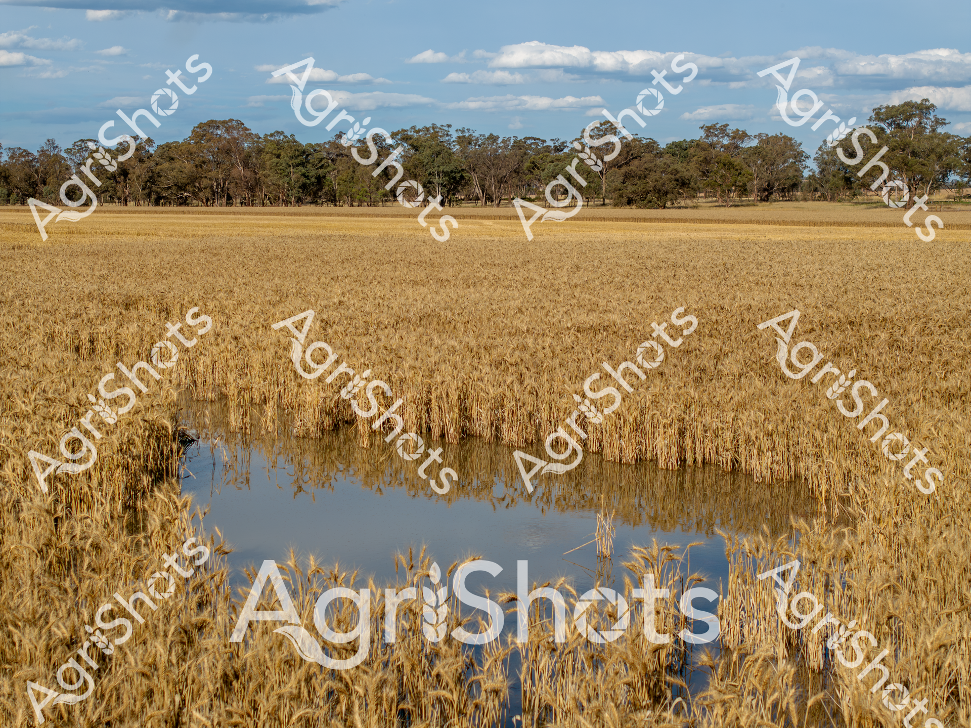
Floodwaters bisect a golden wheat field under an expansive blue sky, revealing the delicate balance of agricultural resilience in rural New South Wales. Mature eucalyptus trees line the distant horizon, framing a landscape where nature's unpredictability meets agricultural determination. The wheat crop, ripened to a rich amber hue, stands tall around a reflective pool of water, demonstrating the impact of seasonal flooding on dryland farming. Stark lines of wheat stalks create a powerful visual contrast with the blue water, highlighting the vulnerability and adaptability of Australian broadacre farming. The luminous summer sky and perfectly linear field edges speak to the precision of modern agricultural practices, even in the face of environmental challenges. This compelling image captures a moment of agricultural tension - where water threatens yet also sustains, and where crop management requires both technical skill and philosophical acceptance of natural rhythms.
 Video
Video
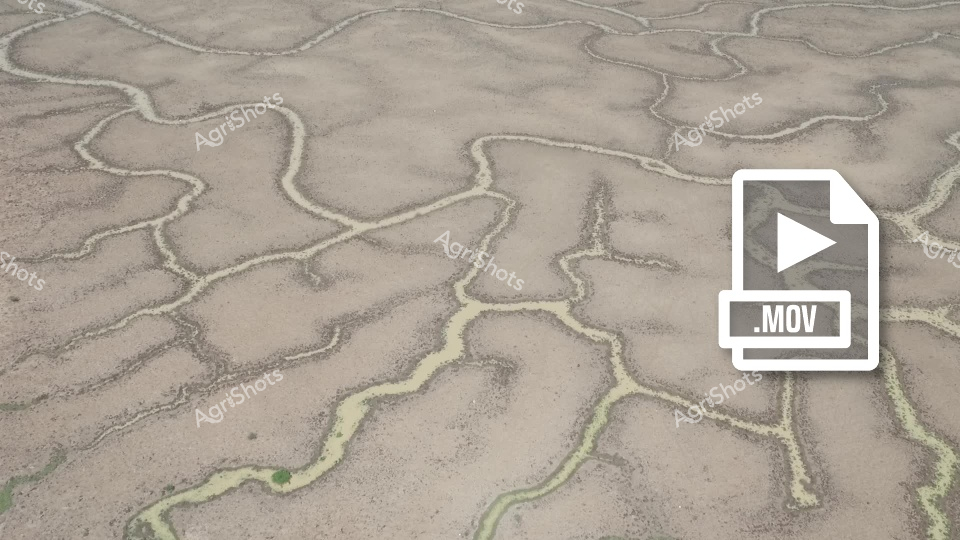
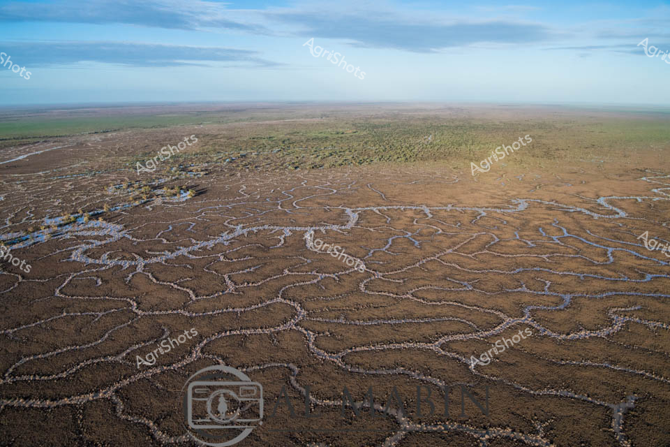
This video footage captures an extraordinary aerial perspective of a dry, cracked landscape, revealing intricate natural patterns resembling a complex network of dried waterways or eroded soil channels. The video clip showcases an expansive terrain with winding, interconnected lines in varying shades of beige and subtle green, creating a mesmerizing topographical texture that highlights the harsh environmental conditions. The footage appears to document a drought-affected agricultural landscape, likely in an arid or semi-arid region of Australia. The intricate network of cracks and channels suggests prolonged water scarcity, with the ground's surface displaying a fragmented, almost arterial pattern of dried earth. Some of the channels have a slight greenish tinge, indicating minimal vegetation or mineral deposits within the cracked terrain. The color palette is predominantly neutral - soft browns, tans, and muted greens - which emphasizes the parched, weathered nature of the landscape. The video seems to be shot from a high vantage point, possibly using drone technology, which allows viewers to appreciate the full complexity and scale of the environmental conditions. This compelling footage provides a stark visual representation of the challenges faced by Australian agricultural regions during periods of significant drought, illustrating the profound impact of water scarcity on land surfaces.
 Image
Image
Aerial panorama of Channel Country's mesmerizing floodplain landscape in remote Queensland, revealing an intricate network of ephemeral waterways weaving across arid terrain. Sinuous blue channels snake through sun-baked earth, creating a complex hydrological tapestry that sustains vast pastoral stations during seasonal inundations. A subtle raised landform emerges, edged with sparse vegetation - likely a strategic cattle station vantage point positioned to monitor livestock movements during critical flooding periods. The landscape displays a sophisticated natural irrigation system, where seasonal rains transform this seemingly harsh environment into a dynamic ecosystem supporting extensive beef production. Muted earthy tones of ochre, dusty brown, and subtle green blend seamlessly, showcasing the resilient adaptability of Queensland's agricultural landscape. This remarkable aerial perspective captures the delicate balance between water, land, and agricultural management in one of Australia's most challenging yet productive pastoral regions.
 Video
Video
Riverina's Liquid Landscape: Floodwaters Reshape the Agricultural Canvas Sweeping aerial vision captures the dramatic transformation of a classic New South Wales agricultural landscape during an extraordinary flooding event. Sinuous blue waterways breach their traditional boundaries, spreading across meticulously cultivated paddocks in serpentine patterns that redefine the terrain's geometry. Rich ochre and amber fields, recently harvested, now blend seamlessly with reflective water surfaces, creating a mesmerizing patchwork of agricultural resilience. Storm clouds gather on the horizon, their slate-gray and brilliant white formations providing a dynamic backdrop to this moment of elemental reconfiguration. Scattered eucalyptus trees punctuate the expansive view, their stoic presence a testament to the cyclical nature of rural environments. The Riverina's remarkable ability to absorb and adapt to natural rhythms is powerfully illustrated in this breathtaking panorama, where water becomes both a potential threat and a crucial regenerative force.
 Image
Image
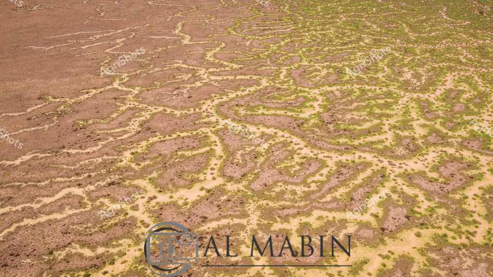
Serpentine waterways trace delicate green veins across the arid ochre landscape of Queensland's Channel Country, revealing the ephemeral life-giving networks that define this extraordinary inland ecosystem. These sinuous channels—bright emerald against the sandy beige terrain—represent the intricate river systems that periodically flood, transforming seemingly barren ground into a complex biological canvas. The aerial perspective captures the organic, branching patterns of waterways that sustain vast pastoral stations, documenting the remarkable hydrology of Australia's inland rivers during seasonal inundation. Each meandering green line represents a potential lifeline for livestock and native wildlife, highlighting the remarkable resilience of agricultural landscapes in one of the continent's most challenging environments. The Al Marin watermark subtly acknowledges the photographic documentation of this remarkable natural phenomenon, where water creates delicate, ever-changing maps across the expansive Queensland terrain. This image encapsulates the profound relationship between water, land, and survival in Australia's remote interior.
 Image
Image
Harvesting wheat under the expansive blue skies of New South Wales, a John Deere tractor pulls a vibrant red chaser bin across a golden wheat field, working in tandem with a header kicking up a billowing dust cloud. The late summer landscape reveals the rugged beauty of Australian agricultural terrain, with weathered eucalyptus trees lining the field's horizon and a small water channel cutting through the ripened crop, highlighting the challenging environmental conditions farmers navigate. The powerful green and red agricultural machinery stand in stark contrast to the wheat's pale golden hues, creating a dynamic visual narrative of modern farming technology conquering potentially flood-damaged sections of the field. Dust swirls around the header, a testament to the dry, intense conditions of the harvest season, while the machinery moves with precision across the undulating paddock. This scene captures the resilience and technological sophistication of Australian grain farming, where every pass of the header represents months of careful cultivation and the delicate balance between agricultural productivity and environmental constraints.
 Video
Video
Turbulent storm clouds gather over the expansive Riverina grasslands, casting a moody slate-blue shadow across a sea of grazing livestock. The paddock stretches toward distant mountains, dotted with hundreds of robust merino sheep grazing methodically across verdant and golden pasture zones. A dramatic weather system builds on the horizon, promising imminent rainfall - the landscape charged with atmospheric tension and the potential for sudden transformation. Floodplain grasses transition from deep green to pale straw colors, indicating late summer or early autumn conditions typical of New South Wales agricultural regions. Scattered eucalyptus trees punctuate the distant treeline, providing sparse shelter against the approaching storm front. The raw, unfiltered MP4 video format captures the dynamic environmental conditions, preserving the dramatic interplay between pastoral landscape and powerful meteorological forces.
 Image
Image
Aerial view of Channel Country's intricate waterways near Windorah, Queensland, revealing the mesmerizing natural irrigation system of this arid pastoral landscape. Sinuous blue channels weave through the russet-brown earth like delicate silver threads, tracing the ephemeral path of seasonal floodwaters across the expansive plains. The landscape transforms into a complex network of braided streams, creating natural water distribution channels that sustain sparse vegetation and support extensive beef cattle stations during rare flooding events. Soft blue skies blend with the earthy tones of the terrain, highlighting the stark beauty of Australia's inland waterways and the remarkable adaptability of its agricultural ecosystems. These natural water management systems demonstrate the intricate relationship between water, land, and livestock survival in one of the continent's most challenging agricultural environments. The photograph captures the subtle resilience of Channel Country - a testament to the sophisticated hydrological patterns that enable pastoral agriculture in remote Queensland's unforgiving landscape.
 Image
Image
An ominous summer storm sweeps across the Riverina landscape, casting dramatic pewter and slate cloudscapes over a deserted highway cutting through expansive agricultural terrain. Swollen cumulus formations billow and brood, promising imminent rainfall that pools in the roadside paddock edges, reflecting the turbulent sky. The bitumen road stretches arrow-straight between golden dry grasslands and scattered eucalyptus trees, creating a stark contrast between the brooding atmospheric conditions and the parched rural environment. Subtle hints of seasonal transition emerge in the landscape - grasses faded to pale straw colors, water collecting in low-lying areas, suggesting the challenging climatic conditions facing agricultural communities. Distant mountain ranges blur into the stormy horizon, creating a sense of vast, uninterrupted space characteristic of New South Wales' agricultural heartlands. This powerful image captures the raw, unpredictable beauty of rural Australian weather, where farmers constantly negotiate the delicate balance between drought and deluge.
 Image
Image
Turbulent pewter-gray clouds gather menacingly above the expansive Riverina floodplain, casting an ominous atmosphere over the waterlogged landscape. Recent summer storms have transformed the pastoral terrain into a reflective inland sea, with shallow waters stretching across the grasslands and pooling around sparse, resilient trees. A flock of sheep grazes stoically in the distance, their forms partially submerged, demonstrating the remarkable adaptability of livestock in this challenging environment. The flat horizon is punctuated by distant blue-tinged mountains, their silhouettes softened by the approaching storm front. Murky water reflects the dramatic cloudscape, creating a complex tapestry of grays, blues, and muted greens that speaks to the unpredictable nature of agricultural life in rural New South Wales. This powerful image captures the raw beauty and harsh resilience of the Australian agricultural landscape during a moment of natural transformation.
 Image
Image
A John Deere header harvests golden wheat beneath a soft summer sky in rural New South Wales, navigating a challenging landscape where flood waters have carved unexpected channels through the ripened crop. The brilliant green harvester moves with precision, its wide cutting deck sweeping across the field while kicking up a cloud of dust, accompanied by a red chaser bin collecting the freshly harvested grain. Wheat stalks stand partially submerged in reflective water, creating a striking visual contrast between the golden crop and the blue-silver surface, highlighting the impact of recent flooding on the agricultural landscape. The machinery's vibrant green and yellow paintwork stands out dramatically against the warm wheat tones and pale blue horizon, capturing the resilience of Australian farming during unpredictable seasonal conditions. Trees line the distant horizon, providing a soft backdrop to this quintessential Australian agricultural scene that speaks to the challenges and technological sophistication of modern grain production. The image embodies both the beauty and harsh realities of farming, where advanced machinery and natural environments intersect in a delicate dance of productivity and survival.
 Image
Image
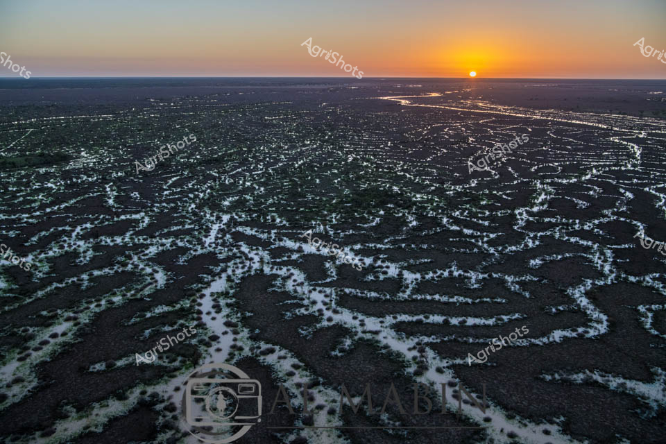
Dawn breaks over Channel Country's mesmerizing landscape, revealing an intricate network of ephemeral waterways stretching across dark earth at sunrise. The braided creek systems of western Queensland glow with silvery-white ribbons of water, creating an extraordinary natural irrigation pattern that transforms the arid landscape into a complex hydological tapestry. Soft golden light crests the horizon, illuminating the serpentine water channels that wind through the dark soil, capturing the essence of this remote Australian inland ecosystem. These seasonal flood plains, characteristic of Queensland's western regions like Windorah, demonstrate nature's extraordinary capacity for water distribution across seemingly inhospitable terrain. The aerial perspective highlights the delicate balance of water and land, where each sinuous stream represents potential life and regeneration in this challenging agricultural environment. The image captures the raw, elemental beauty of Australia's interior - a landscape of extreme conditions where water is both rare and transformative.
 Image
Image
Thunderclouds gather with apocalyptic intensity over a waterlogged grassland in the Riverina, a landscape transformed by summer's capricious elements. Scattered gum trees stand as stoic sentinels across the sodden pasture, their silhouettes stark against the turbulent slate-grey sky. Floodwaters spread across the foreground, creating a reflective surface that mirrors the brewing storm, with sparse grass shoots emerging from the inundated earth. Distant livestock, barely visible, graze with resolute calm amid the dramatic meteorological tableau, their forms blending into the muted palette of wheat-gold ground and bruised atmospheric tones. The scene captures the raw, untempered essence of Australian rural resilience - a landscape simultaneously threatened and nourished by water, where extreme weather is not a catastrophe but a natural cycle of renewal. This image embodies the dramatic environmental conditions that define agricultural life in the Riverina, where farmers and livestock alike must adapt to nature's unpredictable rhythms.
 Video
Video
Sweeping aerial vista of the Riverina's expansive agricultural landscape captures a dramatic moment of seasonal transformation. Sinuous waterways curve through verdant green and amber-toned paddocks, revealing the intricate hydrology of this New South Wales floodplain. Scattered trees punctuate the broad horizon, their silhouettes standing sentinel amid the rising waters that reflect the turbulent sky's pewter and azure palette. Billowing cumulus clouds gather overhead, casting dynamic shadows across the undulating terrain and highlighting the agricultural resilience of this challenging environment. The meandering river system demonstrates nature's powerful capacity to reshape and nourish the agricultural ecosystem, with flood waters spreading nutrients across carefully cultivated fields. This panoramic view encapsulates the raw, elemental relationship between water, land, and agricultural practice in the Australian inland, where farmers navigate the cyclical rhythms of drought and flood with remarkable adaptability.
 Video
Video
Thunderous storm clouds gather with ominous intensity over a drought-stricken agricultural landscape in the Riverina region of New South Wales. Skeletal gum trees stand as silent sentinels across the parched grasslands, their weathered branches stark against the approaching meteorological drama. The expansive paddock stretches toward a bruised horizon, where layers of slate-gray and charcoal clouds build with menacing vertical development, suggesting imminent heavy rainfall. Subtle variations of green and brown in the landscape reveal the challenging environmental conditions - ground cracked and vegetation sparse, hinting at prolonged dry seasons. This raw video capture epitomizes the extreme and unpredictable climate challenges facing Australian farmers, where moments of potential deliverance and destruction coexist in the same atmospheric breath. The MP4 format suggests dynamic documentation of a landscape poised between desperate drought and the potential redemption of storm-born precipitation.
 Image
Image
Aerial vista of Channel Country, Queensland, revealing the intricate water management system of a vast cattle station. Serpentine channels carved into the arid landscape trace delicate green-edged patterns across burnt sienna and olive terrain, capturing the ingenious hydrology that sustains pastoral operations in this harsh inland region. Flood irrigation networks spread like capillaries, transforming seemingly barren ground into productive grazing lands, demonstrating the resilience of Australian agricultural practices. Soft white clouds drift across an expansive blue sky, providing a luminous backdrop to this remarkable landscape of strategic water distribution. The image captures the complex relationship between land, water, and agricultural innovation - a testament to the sophisticated environmental understanding of modern beef production in Queensland's remote interior. This aerial perspective reveals the extraordinary engineering and ecological adaptation required to transform challenging terrain into sustainable pastoral ecosystems.
 Image
Image
Floodwaters engulf the rural landscape of Queensland's Darling Downs, transforming the bitumen road into a watery barrier. A stark yellow "ROAD CLOSED" sign stands sentinel, warning travelers of the imminent danger ahead, with murky waters lapping at the road's edges. Electrical poles punctuate the expansive grasslands, stretching towards a horizon softened by billowing cumulus clouds that dominate the azure sky. The saturated grasslands blend into the flood waters, creating a seamless palette of green and steel-blue that speaks to the region's vulnerability to seasonal inundation. An orange safety marker adds a splash of warning color against the muted landscape, emphasizing the critical nature of the road closure. This evocative scene captures the raw power of nature and the resilience of rural communities facing the unpredictable challenges of agricultural landscapes during flood season.
 Image
Image
Sinuous channels of water weave across the parched Channel Country landscape near Windorah, Queensland, revealing the complex hydrology of this remote pastoral region. Seasonal floodwaters from distant rainfall trace intricate pathways through the golden-brown grasslands, creating natural irrigation networks that sustain cattle stations and delicate ecosystem dynamics. The aerial perspective highlights the meandering waterways, their pale edges contrasting against the dried earth, showcasing the resilience of Australian pastoral landscapes during dry seasons. Sparse vegetation and undulating terrain demonstrate the challenging environmental conditions that define beef production in Australia's inland territories. The Al Mabin watermark suggests this is a professionally captured agricultural documentary image, offering an intimate glimpse into the sophisticated natural systems that support remote livestock operations. The soft ochre and amber tones communicate the arid beauty of Queensland's interior, where water is both precious and transformative.
 Image
Image
Golden wheat stretches across the undulating paddock, its ripe heads bowing under the intense summer sun of New South Wales. A brilliant green John Deere header moves purposefully through the field, kicking up a billowing cloud of dust that dances against the backdrop of scattered eucalyptus trees and a soft blue sky. The wheat's uniform golden-brown texture creates a mesmerizing landscape of agricultural precision, revealing the careful cultivation of this critical grain crop. Harvesting is in full swing, with the header methodically cutting and collecting the wheat, transforming the ripened field into a patchwork of cut and uncut sections. The machinery moves with mechanical grace, a testament to modern agricultural technology that allows farmers to efficiently gather their season's yield under the expansive Australian rural landscape. The scene captures the essence of Australian agricultural productivity - a moment of transformation where months of careful nurturing culminate in the critical harvest season.
 Image
Image
Golden wheat fields stretch to the horizon under a soft blue sky dotted with wispy clouds, capturing the essence of a quintessential Australian summer harvest. A green John Deere header moves methodically across the ripened wheat, kicking up a fine dust cloud that billows behind the powerful machine. The wheat stands in rich golden hues, its dense stalks bending slightly, revealing the subtle damage from what appears to be flooding or extreme weather conditions earlier in the season. Eucalyptus trees line the distant treeline, providing a classic rural Australian backdrop to this agricultural scene of precision farming. The header moves with mechanical purpose, transforming the standing crop into a harvested field, representing the critical moment of agricultural productivity that sustains rural communities. This image encapsulates the resilience of Australian farmers - working with sophisticated machinery against challenging environmental conditions to bring in a crucial wheat harvest.
 Video
Video
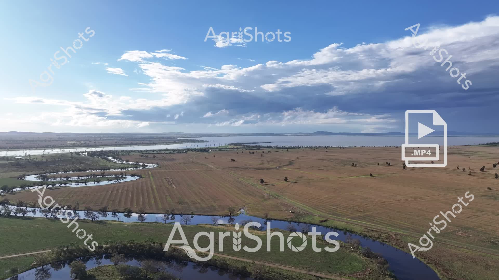
Flooded farmlands carve a dramatic narrative across the Riverina's expansive agricultural landscape, where storm-laden skies cast silvered light over inundated paddocks and winding waterways. A pivot-irrigated field, meticulously planted in precise circular patterns, sits partially submerged beside a swollen river, its geometric precision contrasting sharply with the organic, serpentine flow of floodwaters. Scattered eucalyptus trees stand as silent sentinels, their reflections rippling in the expansive pools that have transformed the typically arid terrain into a temporary inland sea. The agricultural resilience of the region is palpable - even as water encroaches, the carefully cultivated land speaks to generations of farming expertise and adaptation to Australia's unpredictable climate. Soft greys, muted greens, and rich earth tones blend beneath a turbulent cloudscape, capturing the raw, elemental power of water reshaping the rural landscape. This drone perspective reveals the intimate dance between agricultural infrastructure and natural forces, a quintessential Australian scene of environmental drama and human persistence.
 Image
Image
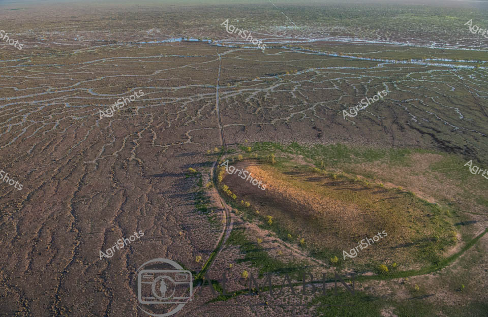
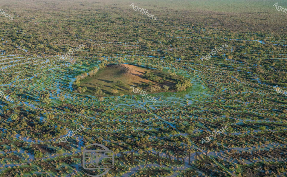
Aerial vista of Channel Country in Queensland during peak flood season, a mesmerizing landscape of interconnected waterways and verdant floodplains stretching to the horizon. A solitary elevated landmass—likely a cattle station's strategic high ground—emerges like an island sanctuary amidst the expansive blue-green aquatic terrain. The intricate network of water channels weaves between sparse vegetation, creating a mosaic of azure and olive hues that characterize this unique Australian inland ecosystem. Seasonal flooding transforms the arid landscape into a dynamic, life-sustaining environment, critical for supporting cattle grazing and native biodiversity in this remote region. The subtle undulations of the terrain reveal the complex hydrology of Channel Country, where water becomes the defining element of survival and agricultural potential. This breathtaking aerial perspective captures the raw, untamed beauty of Queensland's inland waterways, showcasing the resilience and adaptive nature of Australia's agricultural landscapes.
 Image
Image
Flooded Wheat Field at Harvest - New South Wales Golden wheat stretches across a vast agricultural landscape, its ripened stalks reflecting in the unexpected mirror of floodwaters. A classic NSW summer scene reveals the harsh unpredictability of rural farming, where carefully nurtured crops meet sudden environmental challenge. Eucalyptus trees line the distant horizon, their weathered forms standing sentinel over the water-interrupted wheat field, creating a poignant tableau of agricultural resilience. The luminous blue sky and puffy white clouds contrast sharply with the saturated golden wheat and blue-gray flood waters, capturing the delicate balance between agricultural potential and natural disruption. Wheat heads lean towards the water's surface, their mature, sun-bleached stalks creating intricate reflective patterns that speak to the season's complex narrative of growth, expectation, and unexpected transformation. This image embodies the quintessential Australian agricultural experience - a story of hope, hard work, and nature's ultimate authority.
 Image
Image
Golden wheat stalks emerge from reflective floodwaters, creating a striking visual of agricultural resilience in the New South Wales summer landscape. A vibrant red chaser bin stands sentinel in the background, poised for harvest amidst the waterlogged field, symbolizing farmers' adaptability in challenging conditions. Soft blue skies and scattered clouds provide a serene counterpoint to the water's intrusion into the wheat paddock, highlighting the delicate balance of agricultural productivity. The wheat's rich amber tones contrast sharply with the standing water, revealing the potential impact of environmental challenges on crop yields. Native eucalyptus trees line the distant horizon, grounding the scene in a quintessential Australian agricultural setting. This powerful image captures the unpredictability of farming - where water can both threaten and nurture, and where agricultural machinery stands ready to respond to nature's unexpected interventions.
 Image
Image
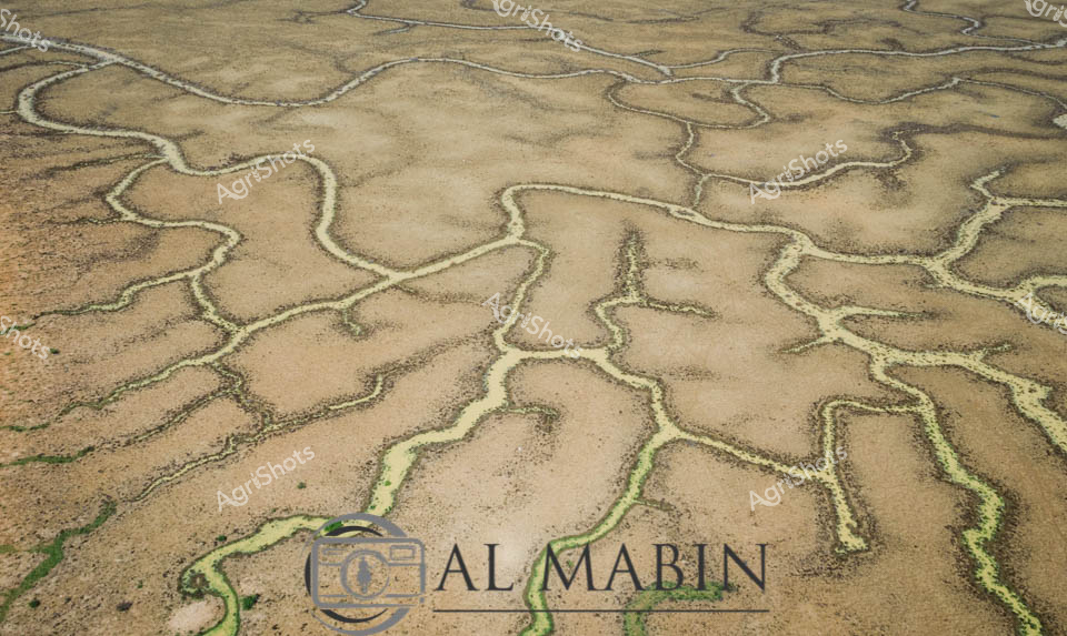
Aerial watershed mapping reveals the intricate hydrology of Channel Country in remote Queensland, where ephemeral creek systems snake across arid landscapes like delicate silver veins. Sandy-colored flood channels spread in mesmerizing fractal patterns, capturing the transient water movements that sustain this harsh inland ecosystem. Sparse vegetation clusters along the lighter sandy ridges, contrasting against the weathered brown earth, demonstrating the remarkable resilience of desert flora. The waterways, etched into the landscape like ancient arteries, illustrate the complex hydrology that supports pastoral operations in this challenging environment. Al Mabin's photographic documentation captures the subtle beauty of Australia's inland water systems, revealing how these seemingly barren terrains pulse with intricate life-sustaining networks during rare flooding events. The image is a testament to the geological and ecological sophistication of Queensland's remote beef station regions, where water management is critical to survival.
 Image
Image
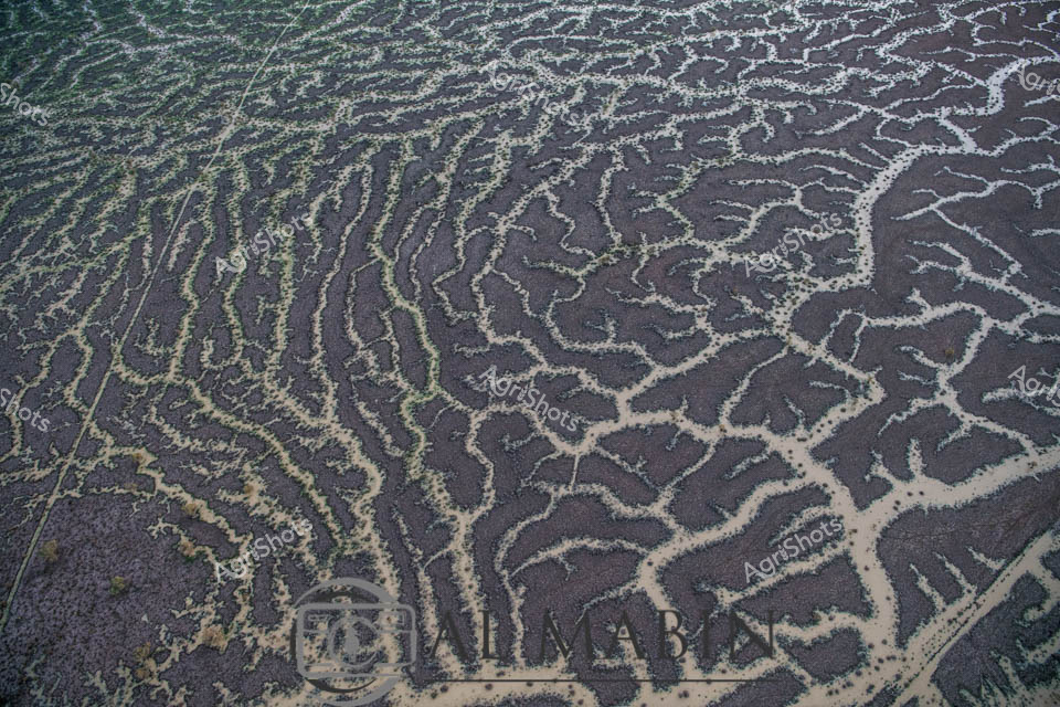
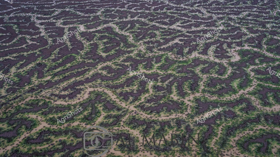
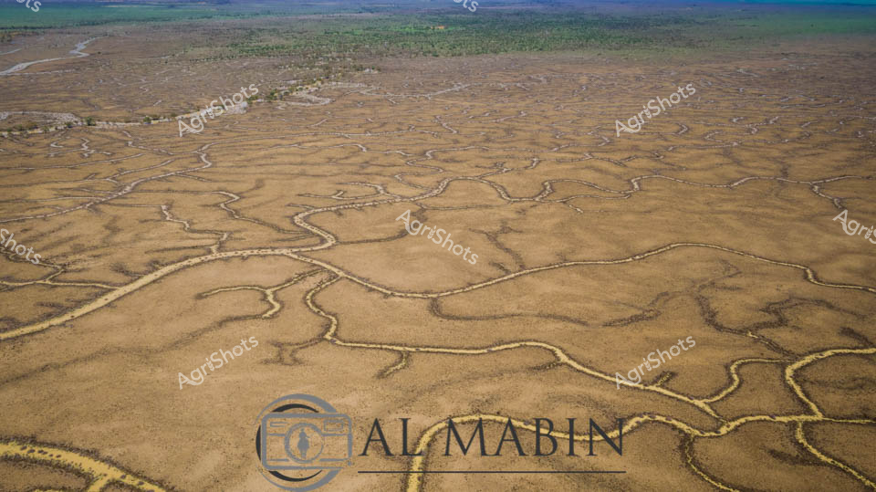
Serpentine waterways thread through the arid Channel Country of Queensland, capturing the ephemeral beauty of this remote pastoral landscape. Intricate river channels meander across the ochre-brown earth, creating a complex network of water tributaries that pulse with life during seasonal flood events. The aerial perspective reveals the stunning geological artistry of natural water distribution, where each sinuous channel carves delicate pathways across the expansive floodplains. Sparse vegetation in muted greens and yellows punctuates the broader landscape, highlighting the resilient ecosystem of this harsh yet magnificent Australian outback region. Soft blue skies with gentle cloud formations stretch endlessly above the terrain, providing a luminous backdrop to the earth's remarkable hydological patterns. This extraordinary landscape represents the lifeblood of beef stations in Queensland's remote interior, where water management and natural flooding cycles are critical to sustainable pastoral agriculture.
 Image
Image
Aerial vista of Channel Country's ephemeral waterways near Windorah, Queensland, revealing the intricate capillary-like network of seasonal creek systems during a rare flooding event. Silvery-white water tendrils fracture the ochre and umber landscape, tracing delicate branching patterns across the arid terrain like living arteries. The main watercourse glows with a burnished golden-brown hue, carrying life-giving moisture through the parched plains, with sparse vegetation clinging to its edges in resilient clusters of olive and sage green. This extraordinary landscape demonstrates the transformative power of water in Australia's harsh interior, where brief moments of abundance reshape the seemingly dormant ecosystem. The complex hydrological system illustrates the remarkable adaptation of beef stations in Queensland's remote Channel Country, where pastoral management relies on understanding these dynamic, intermittent water flows. From this elevated perspective, the landscape appears almost abstract - a stunning natural cartography of survival and renewal in one of the world's most challenging agricultural environments.
 Image
Image
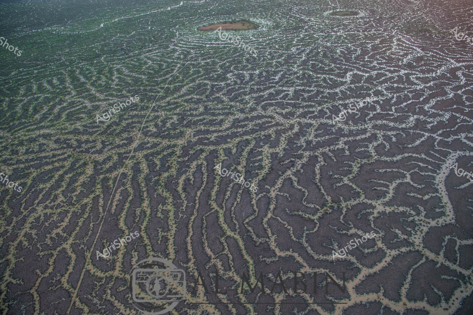
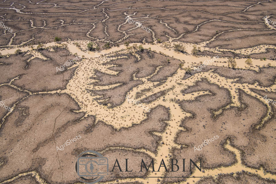
An aerial view reveals the intricate, serpentine waterways of Channel Country in Queensland, where dry creek beds and floodplains create a mesmerizing network of sinuous lines across the arid landscape. The branching water channels, etched into the dusty earth, showcase the complex hydrology of this remote Australian region, highlighting the resilient geography that supports pastoral activities during seasonal flooding. Green vegetation clusters along the horizon, contrasting with the golden-brown tones of the expansive, water-carved terrain.
 Image
Image
Aerial vista of Channel Country's ephemeral river system near Windorah, Queensland, revealing nature's intricate hydraulic artistry. Serpentine waterways trace delicate green-edged channels across an ochre landscape, demonstrating the extraordinary hydrology of Australia's arid interior. Seasonal flooding has transformed the dusty terrain into a complex network of interconnected streams, where sparse vegetation follows the moisture's meandering path. The landscape displays a mesmerizing pattern of brown earth interwoven with subtle green vegetation, highlighting the resilient ecosystem's adaptation to extreme environmental conditions. Each sinuous watercourse represents a lifeline through this harsh pastoral region, illustrating how water shapes and sustains life in one of the continent's most challenging agricultural environments. This remarkable aerial perspective captures the dynamic interaction between water, soil, and sparse vegetation in Queensland's remote Channel Country, a critical region for extensive beef cattle stations.
Well, you've ploughed through the whole field!
No more crops to harvest here, mate.
Try searching for something else in our library of 50,000+ royalty-free media: