Related Images & Videos
View All Similar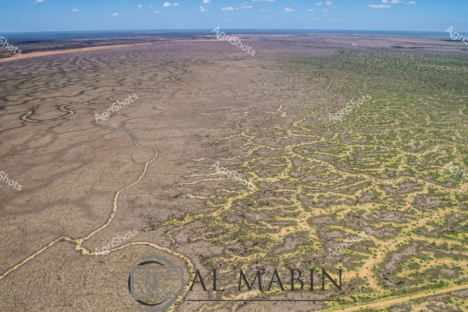


Purchase This Image
Get unlimited downloads with a subscription
View Subscription PlansAbout This Image
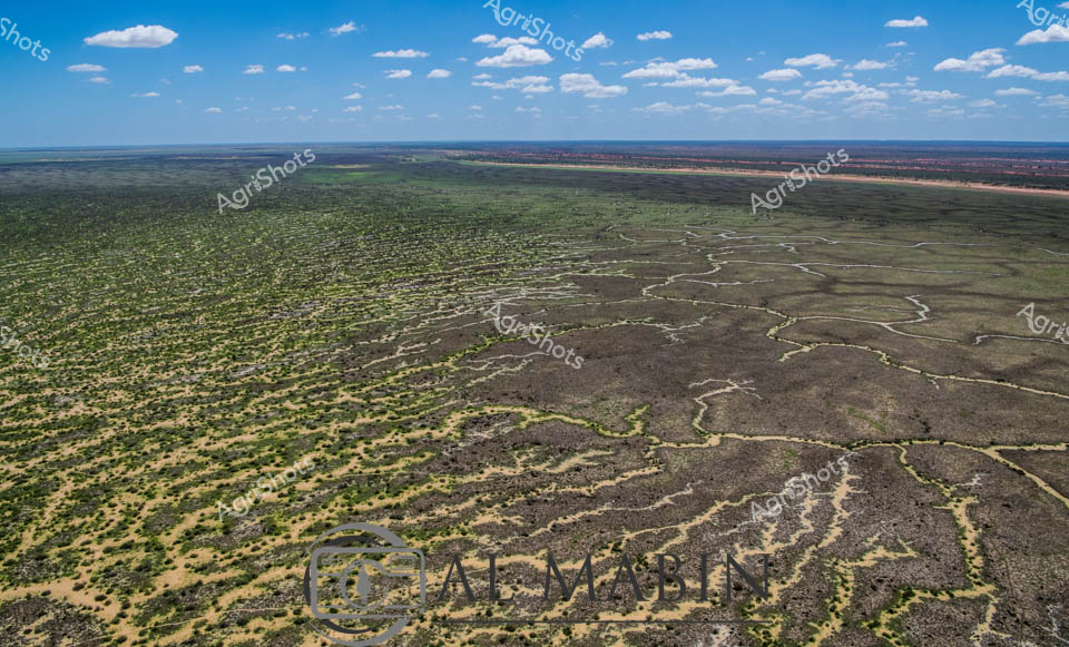
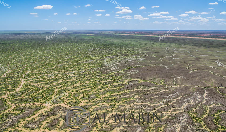
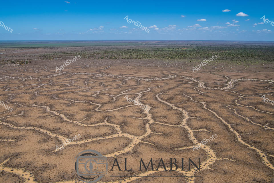
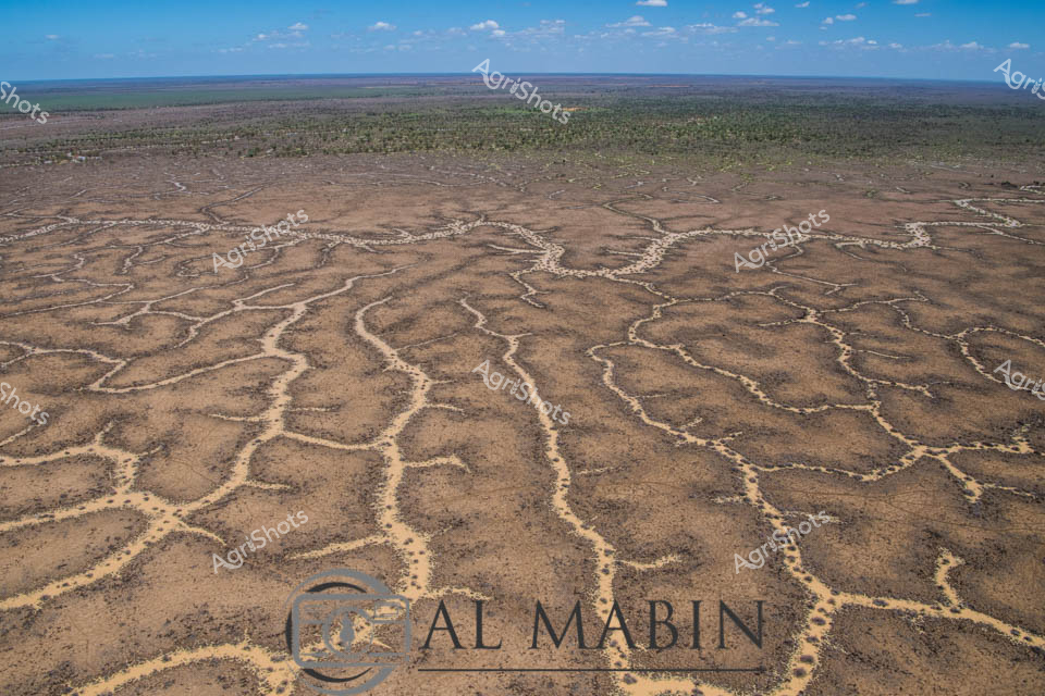
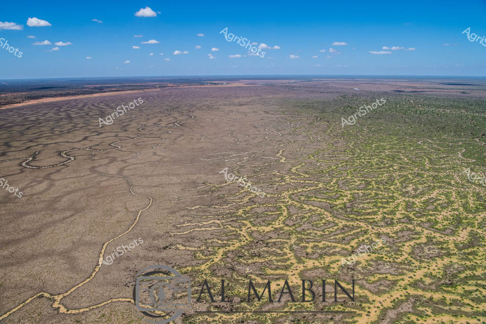
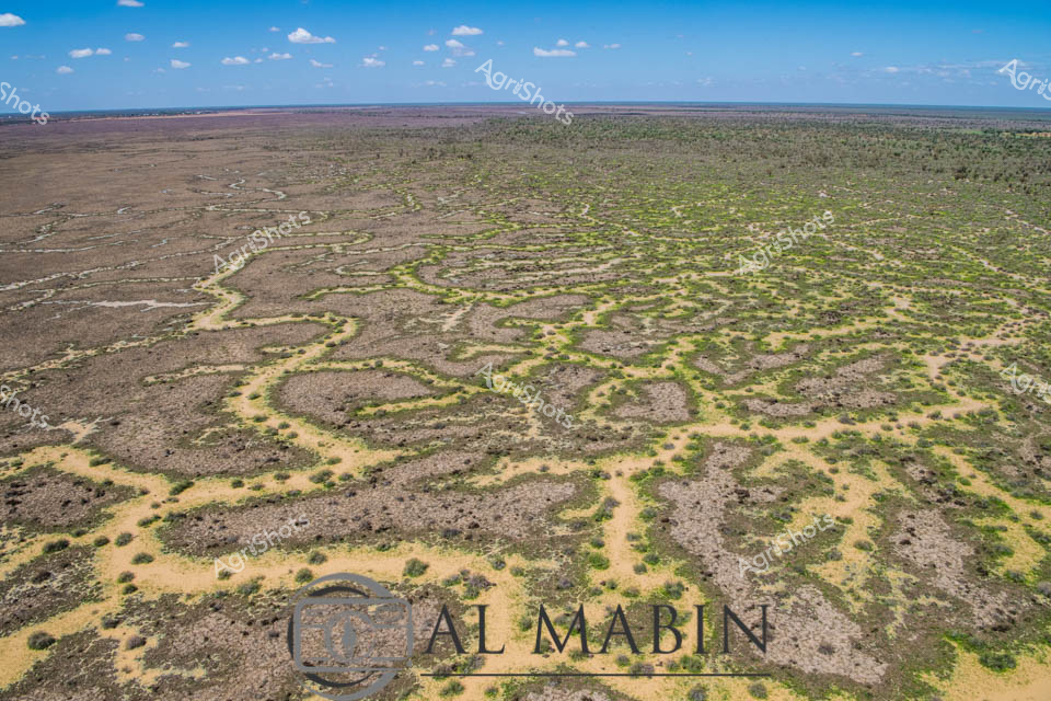
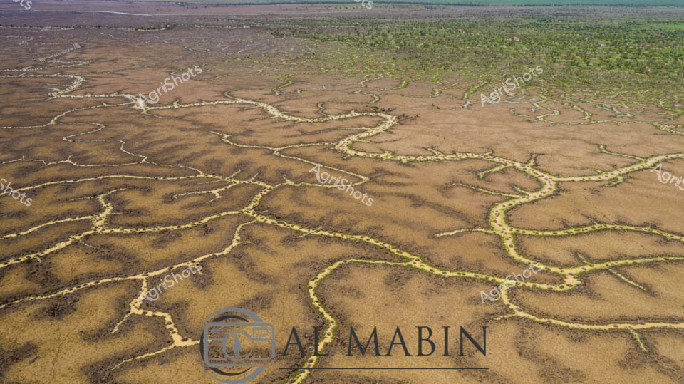
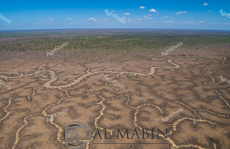
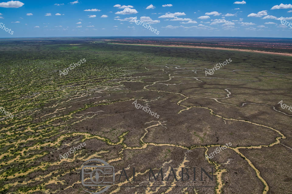
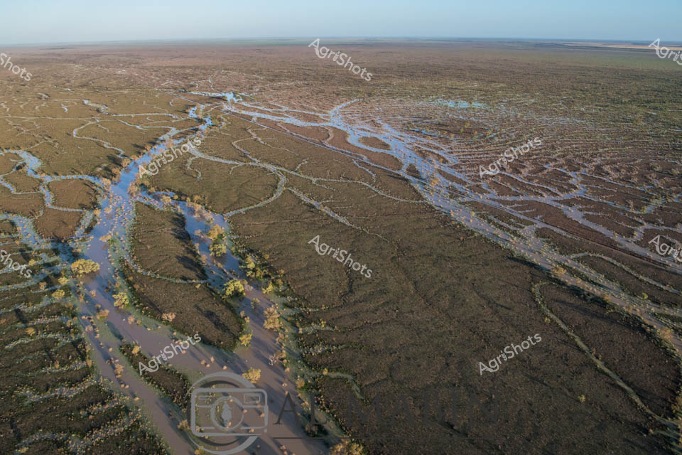
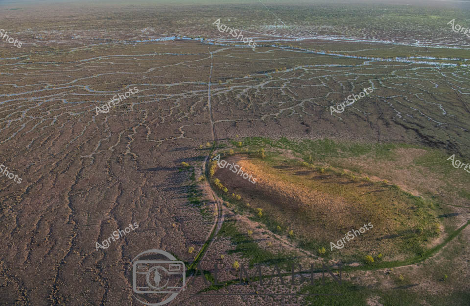
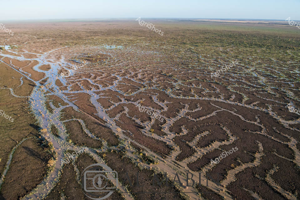
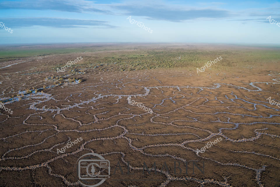
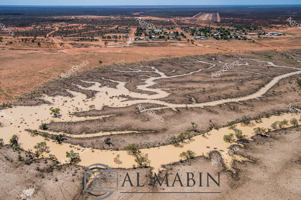
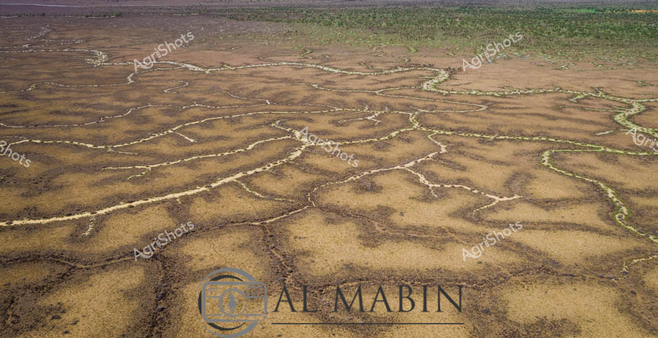
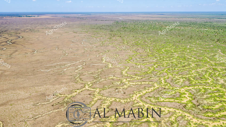
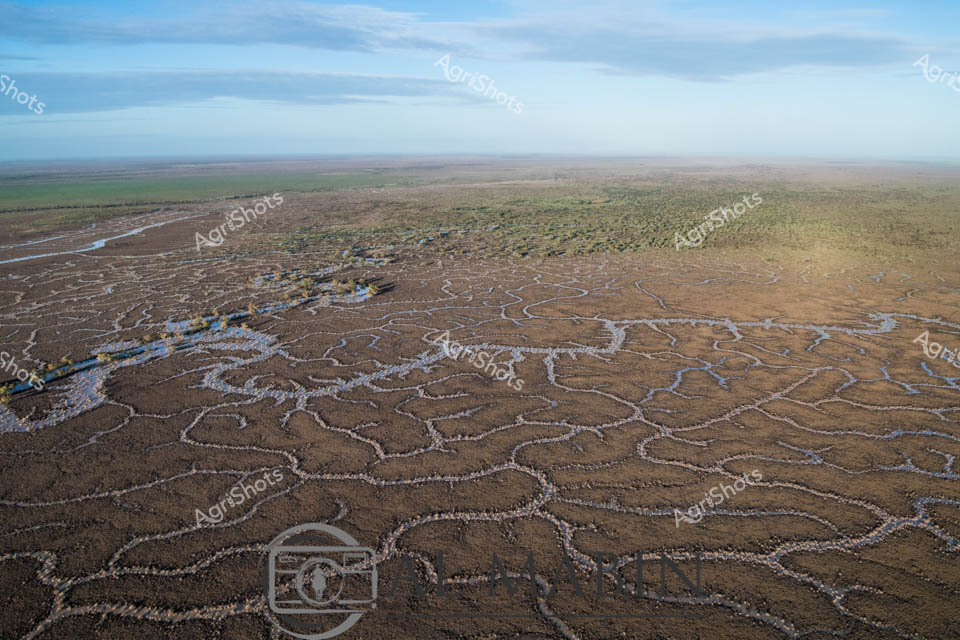
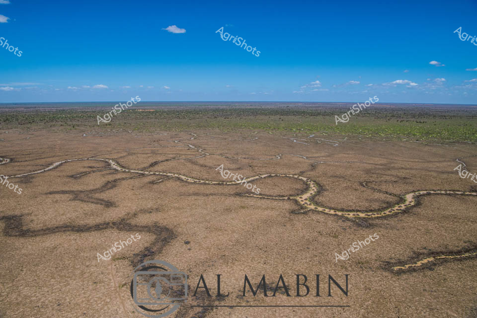
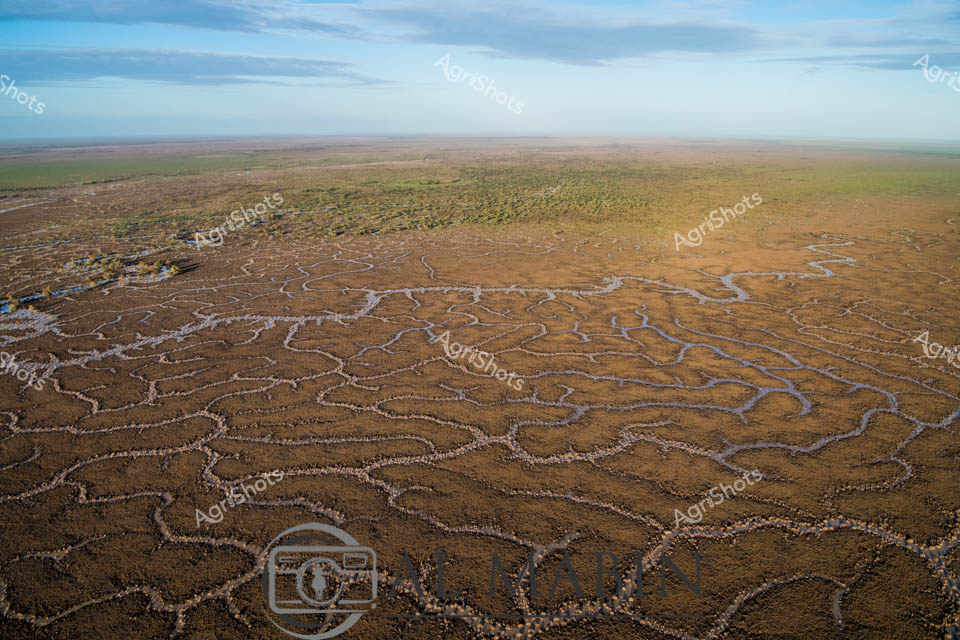
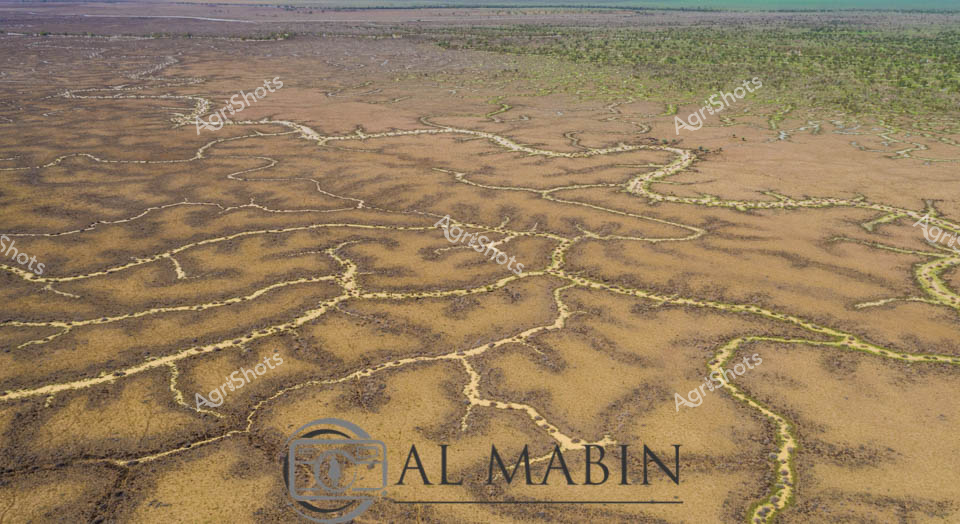
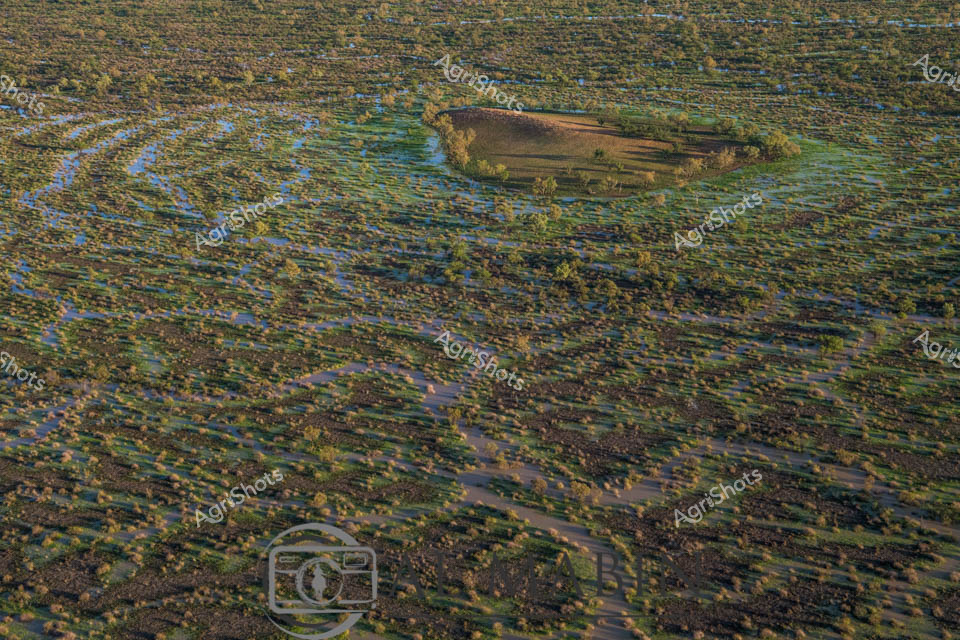
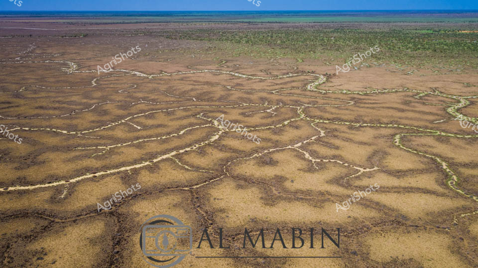
Aerial vista of Channel Country, Queensland, revealing the intricate water management system of a vast cattle station. Serpentine channels carved into the arid landscape trace delicate green-edged patterns across burnt sienna and olive terrain, capturing the ingenious hydrology that sustains pastoral operations in this harsh inland region. Flood irrigation networks spread like capillaries, transforming seemingly barren ground into productive grazing lands, demonstrating the resilience of Australian agricultural practices. Soft white clouds drift across an expansive blue sky, providing a luminous backdrop to this remarkable landscape of strategic water distribution. The image captures the complex relationship between land, water, and agricultural innovation - a testament to the sophisticated environmental understanding of modern beef production in Queensland's remote interior. This aerial perspective reveals the extraordinary engineering and ecological adaptation required to transform challenging terrain into sustainable pastoral ecosystems.