Related Images & Videos
View All Similar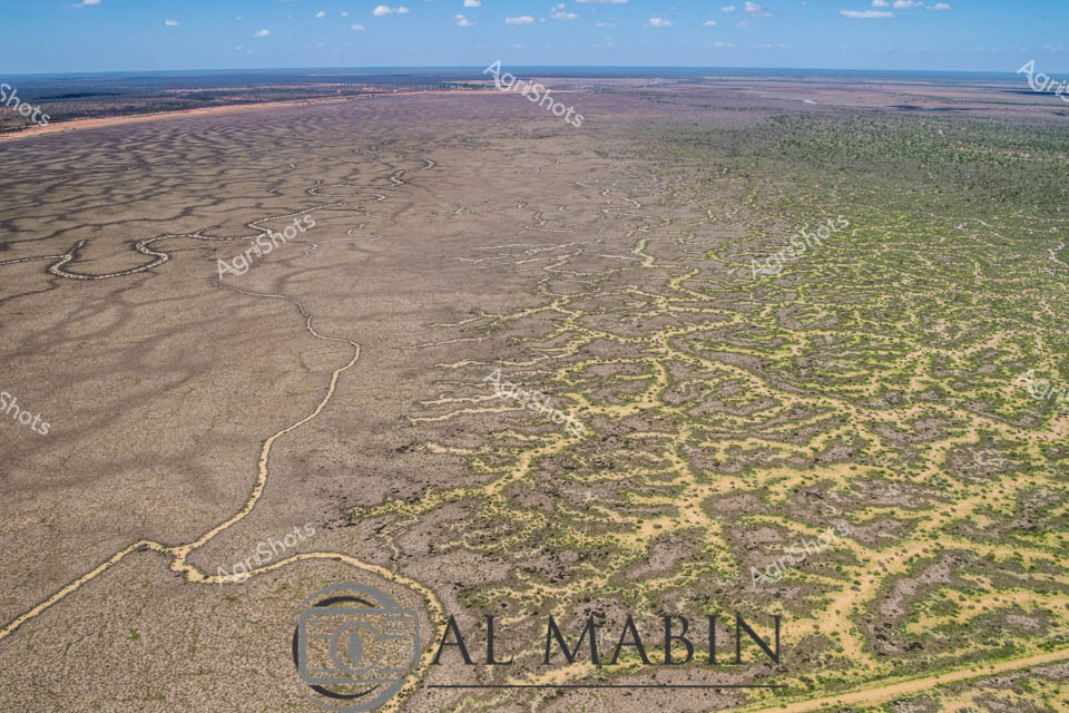


Purchase This Image
Get unlimited downloads with a subscription
View Subscription PlansAbout This Image
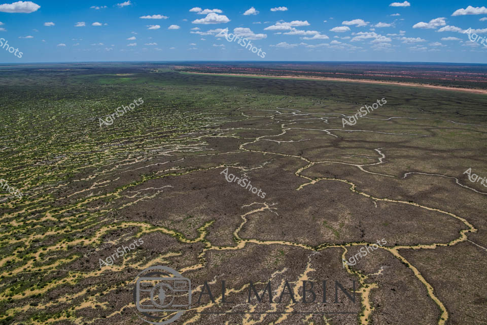
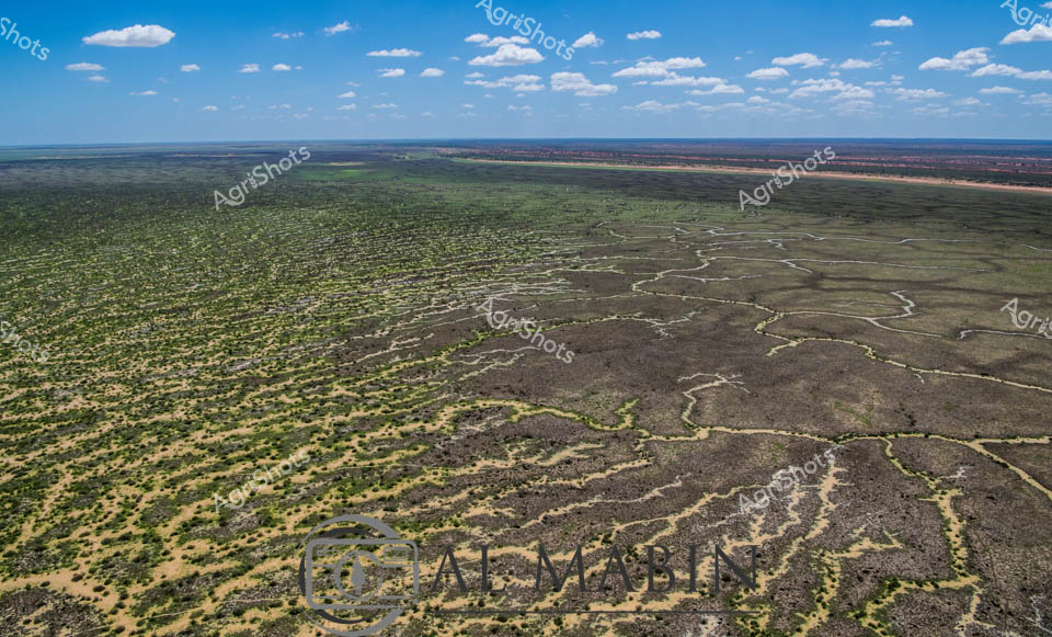
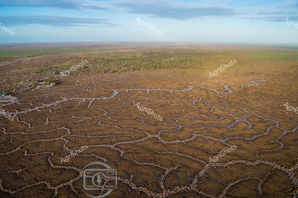
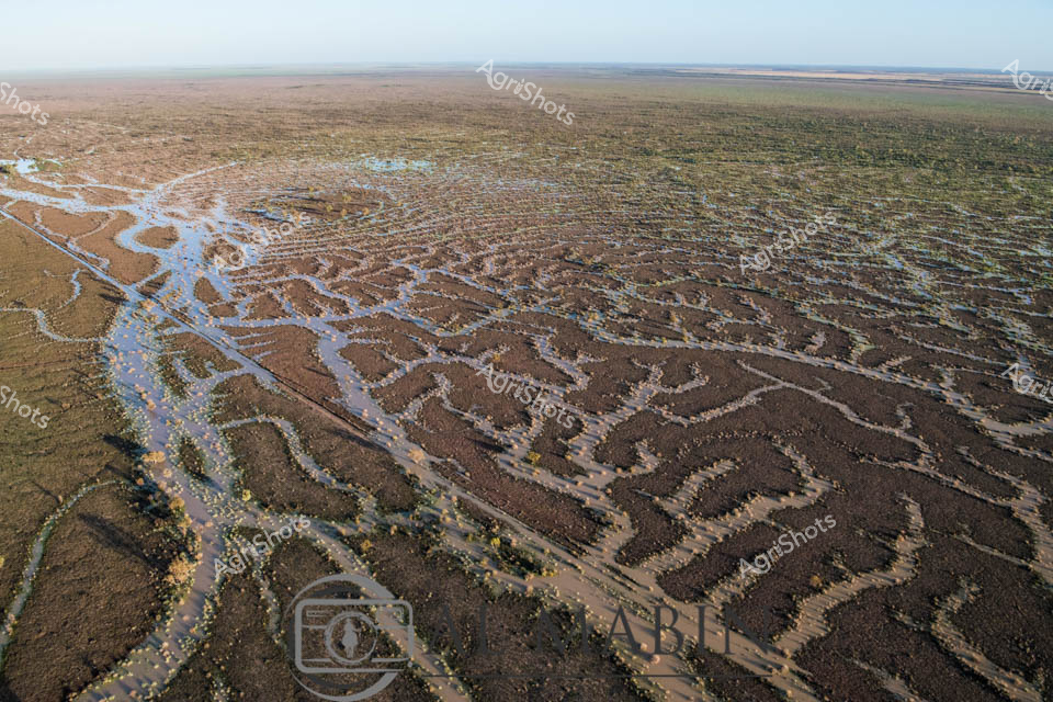
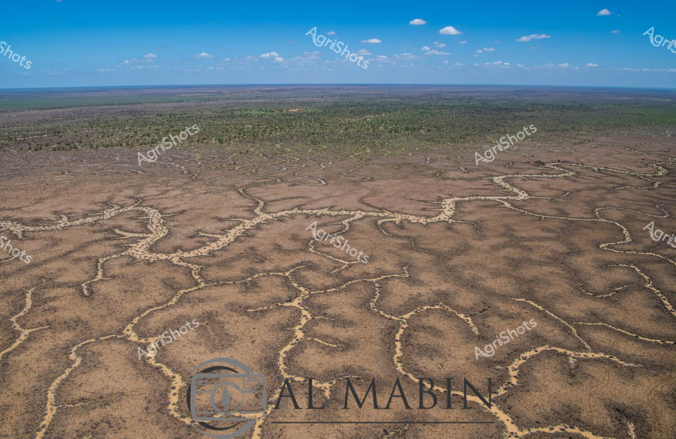
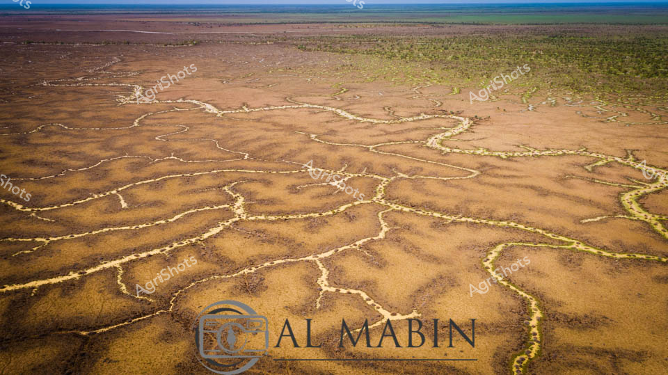
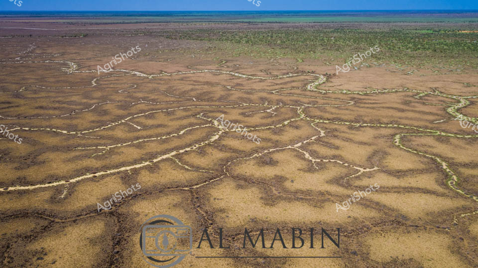
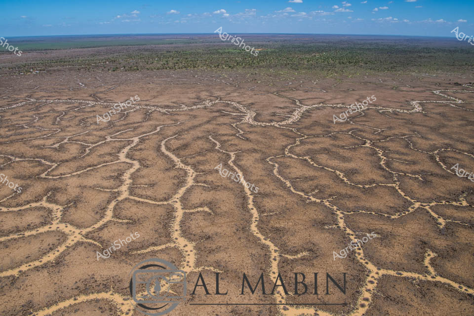
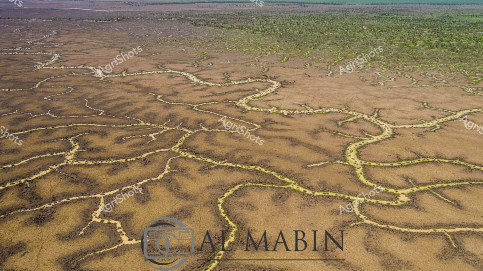
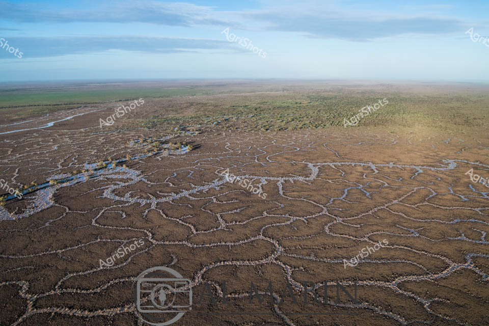
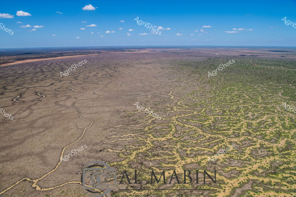
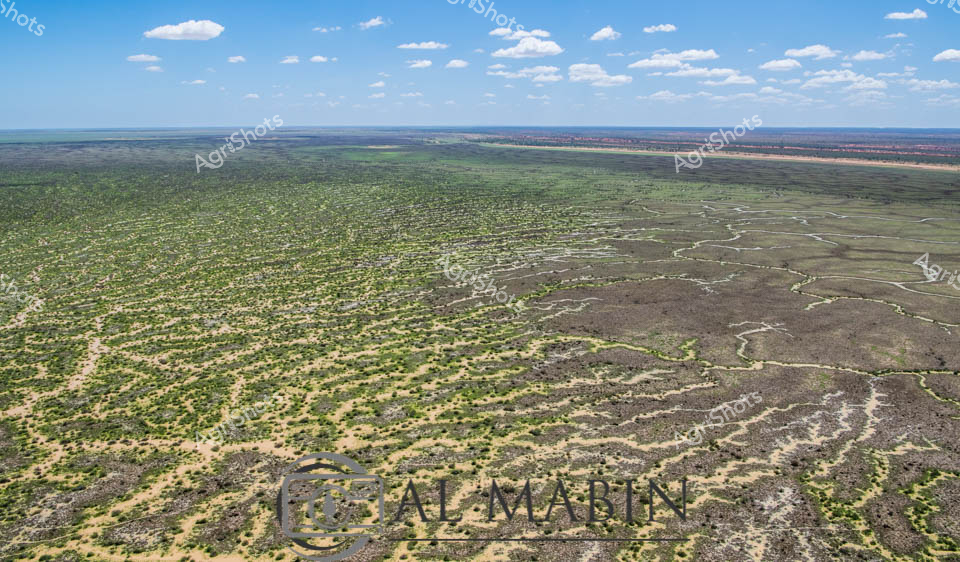
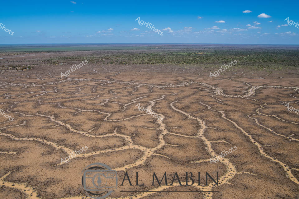
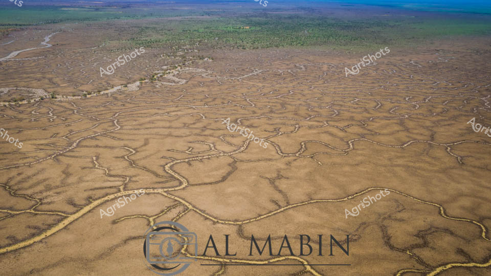
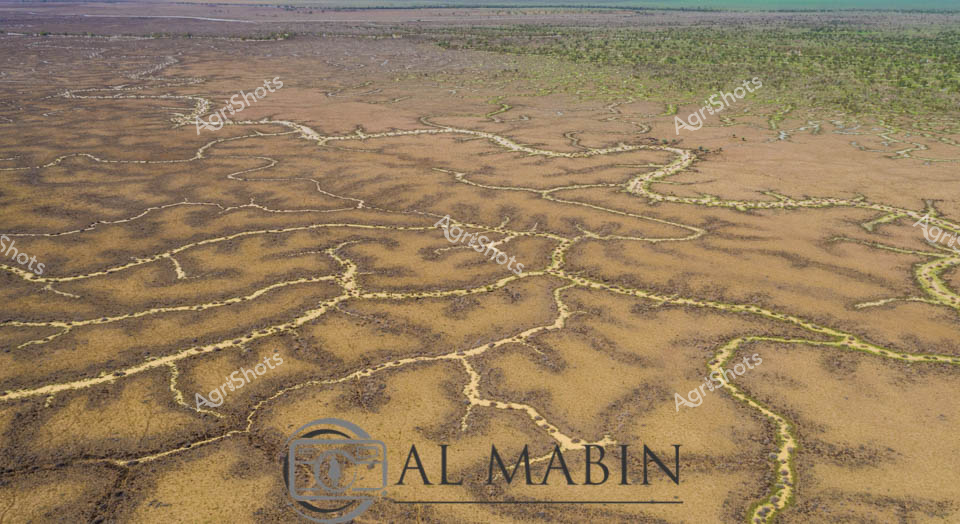
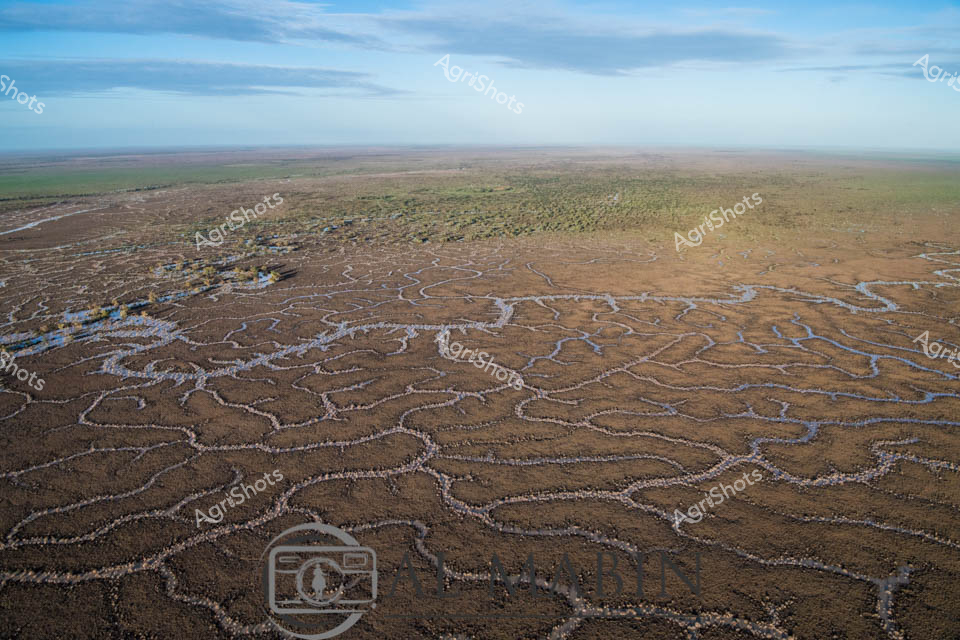
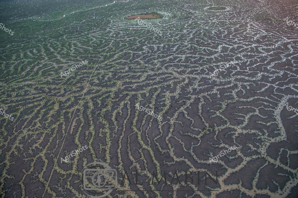
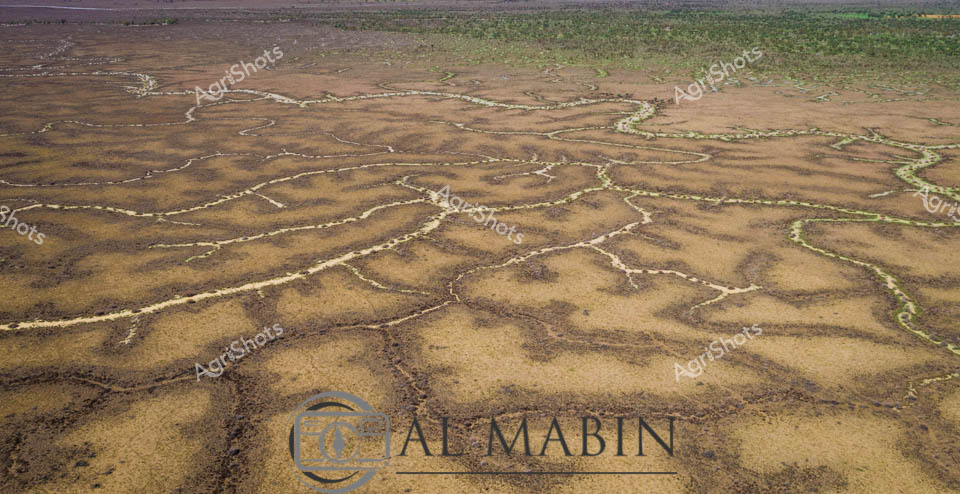
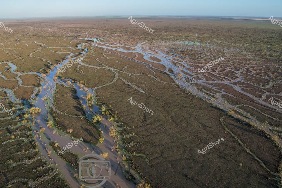
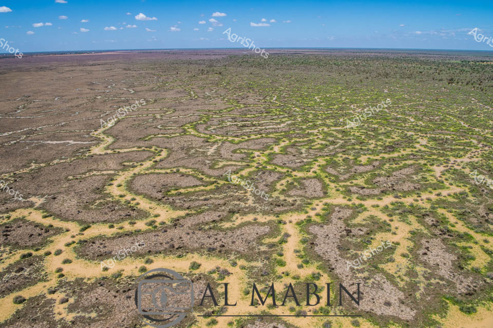
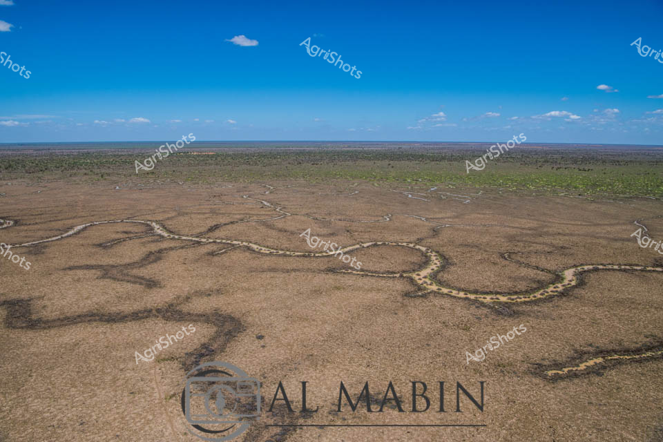
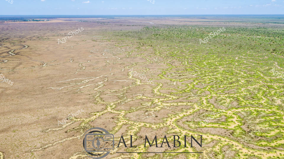
Aerial expanse of Channel Country in western Queensland reveals nature's extraordinary irrigation network. Intricate waterways trace delicate, serpentine patterns across the arid landscape, creating a complex network of seasonal creek channels that transform the dry terrain during flood events. The natural hydraulic system spreads across muted earth tones - deep charcoal greys, olive greens, and dusty yellows - demonstrating the remarkable adaptation of Australia's inland ecosystems. Sparse vegetation clusters around the water channels, highlighting the resilience of plant life in this challenging environment. Expansive blue skies with scattered white clouds provide a luminous backdrop, emphasizing the immense scale of this remote pastoral region. This landscape represents the vital water management systems that sustain livestock production in some of Australia's most demanding agricultural territories, where strategic water distribution can mean survival for cattle stations spanning thousands of hectares.