Related Images & Videos
View All Similar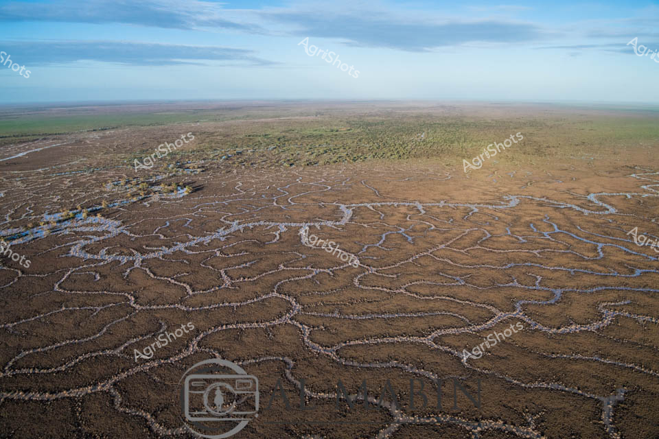


Purchase This Image
Get unlimited downloads with a subscription
View Subscription PlansAbout This Image
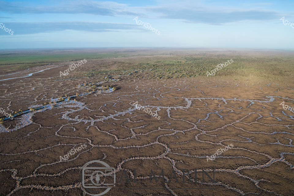
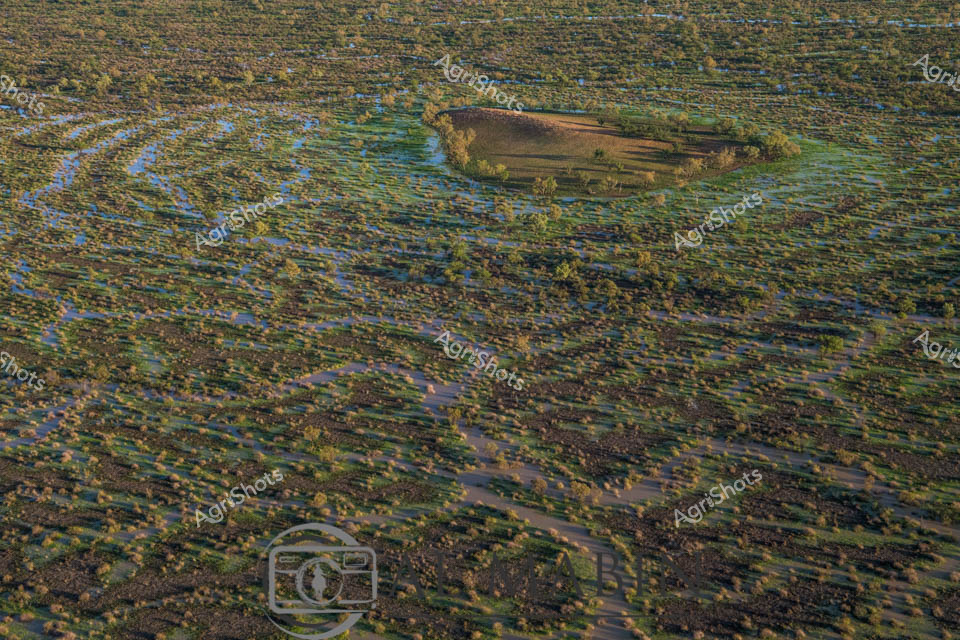
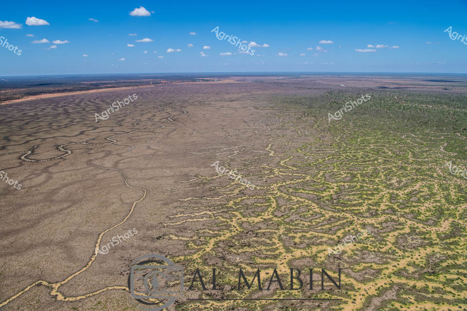
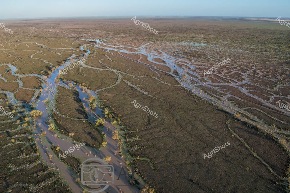
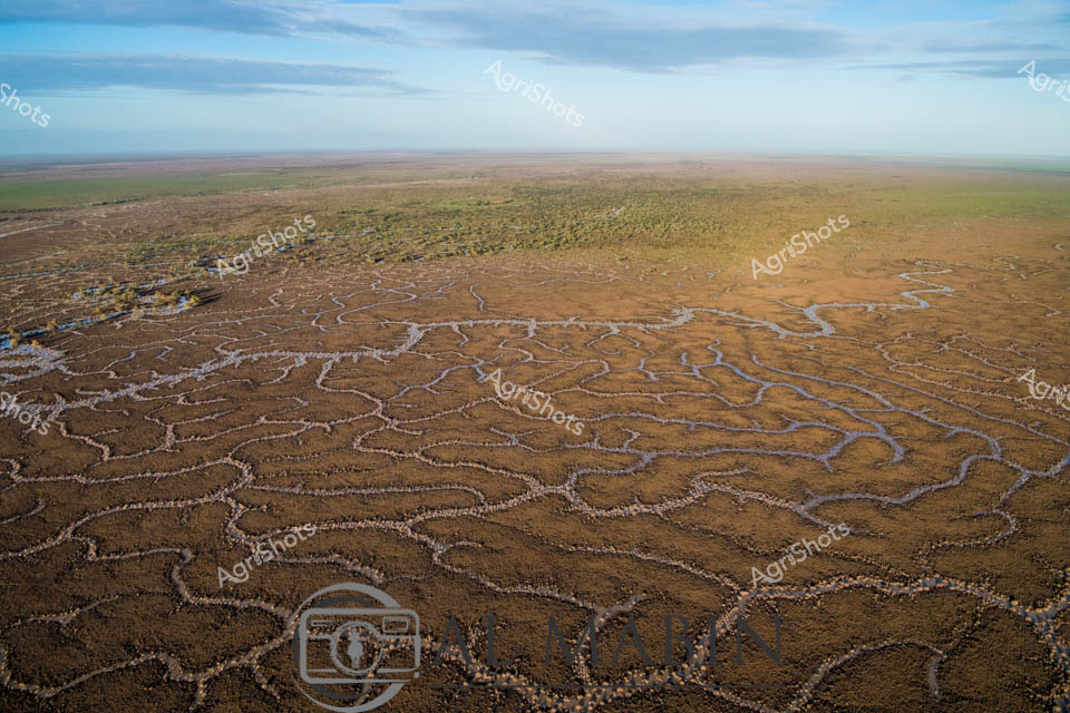
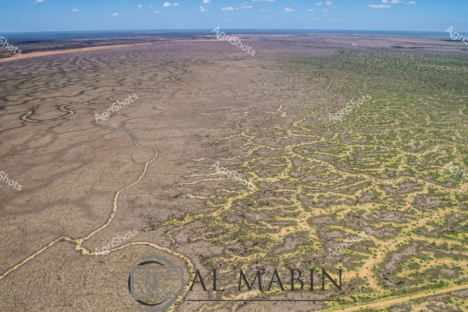
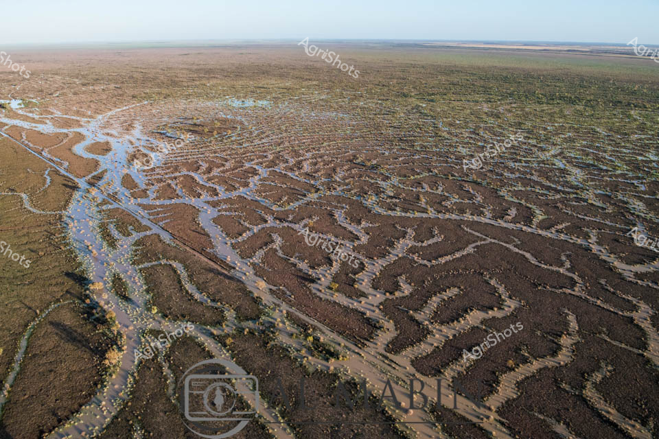
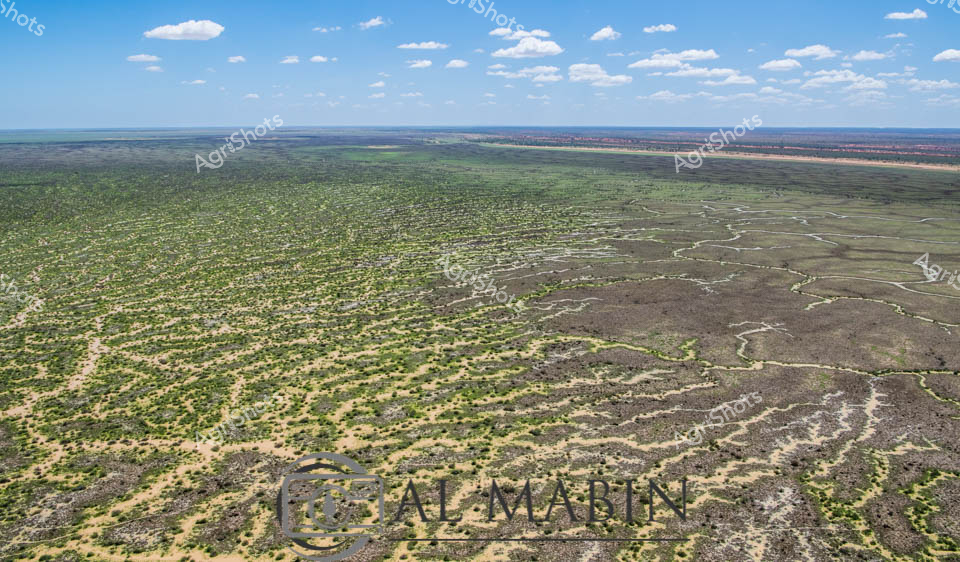
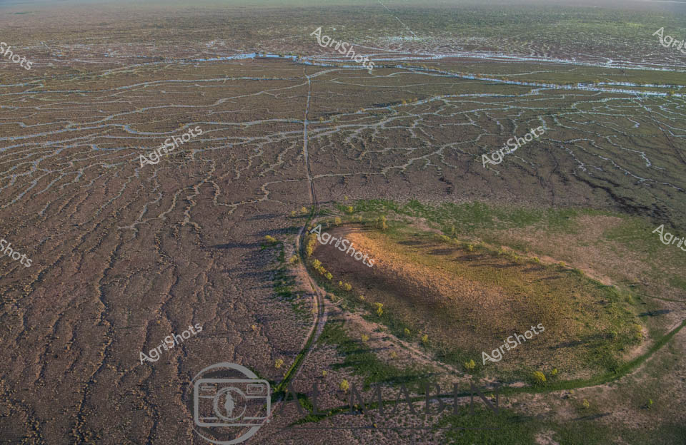
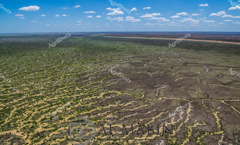
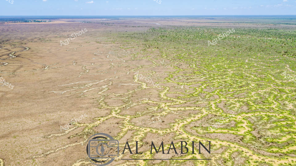
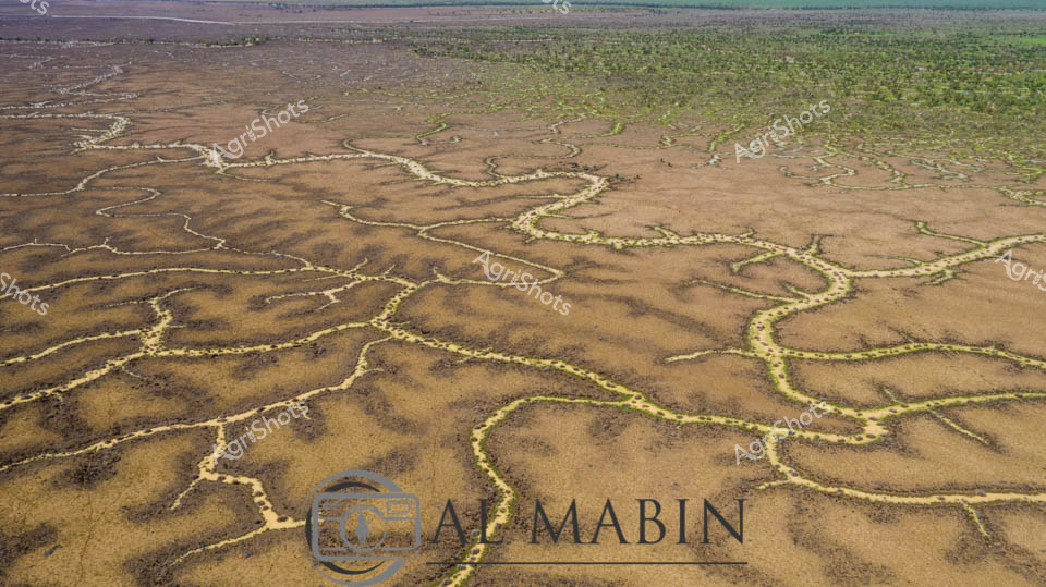
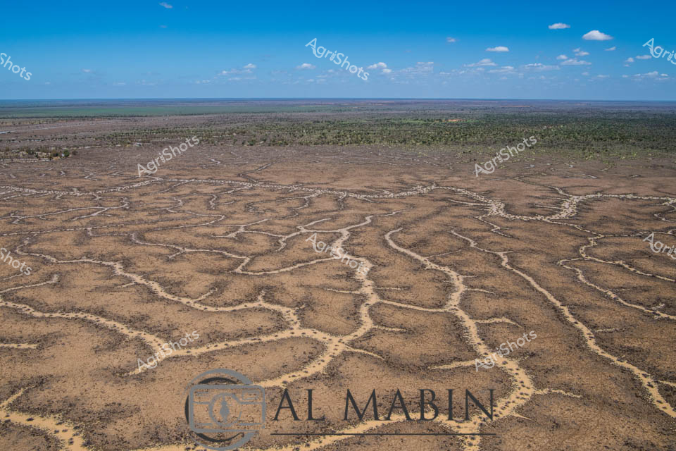
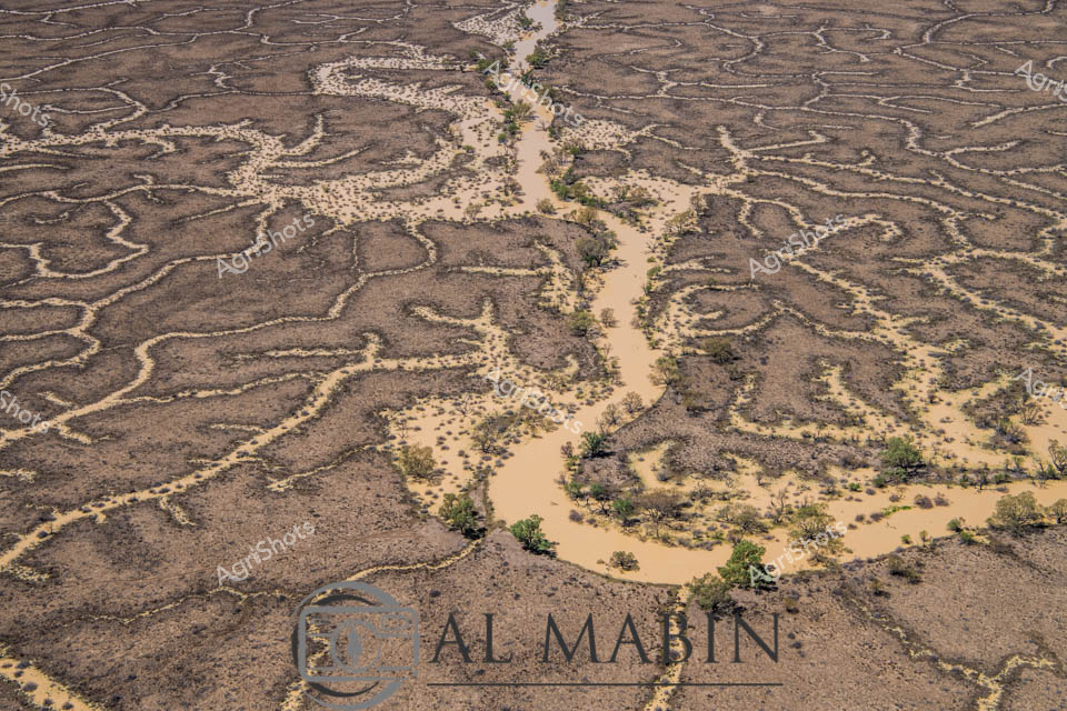
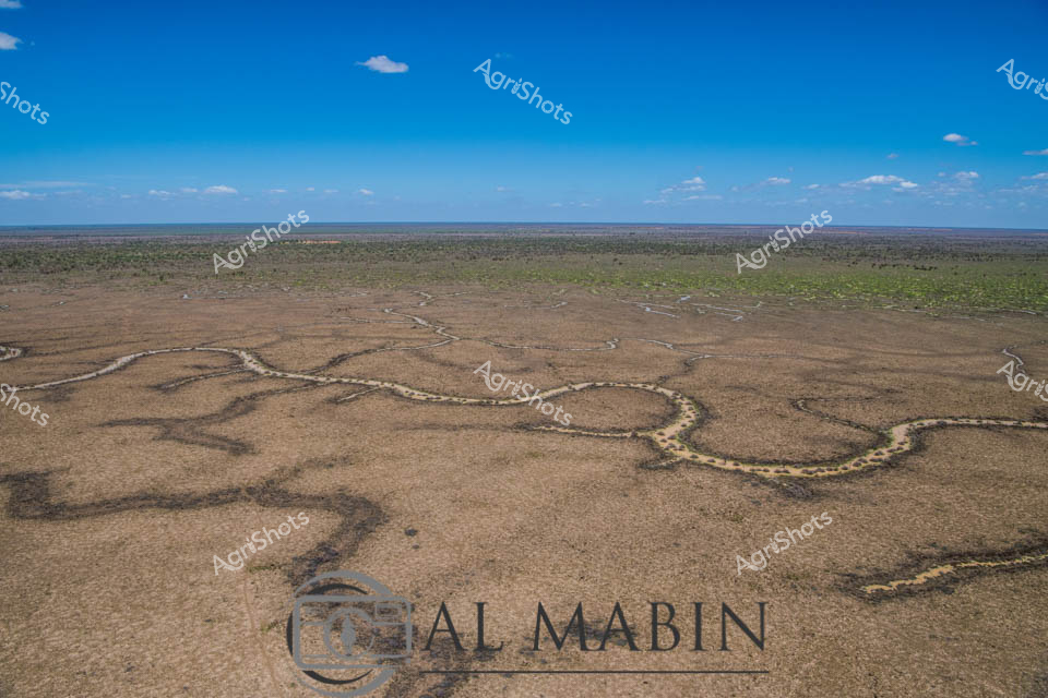
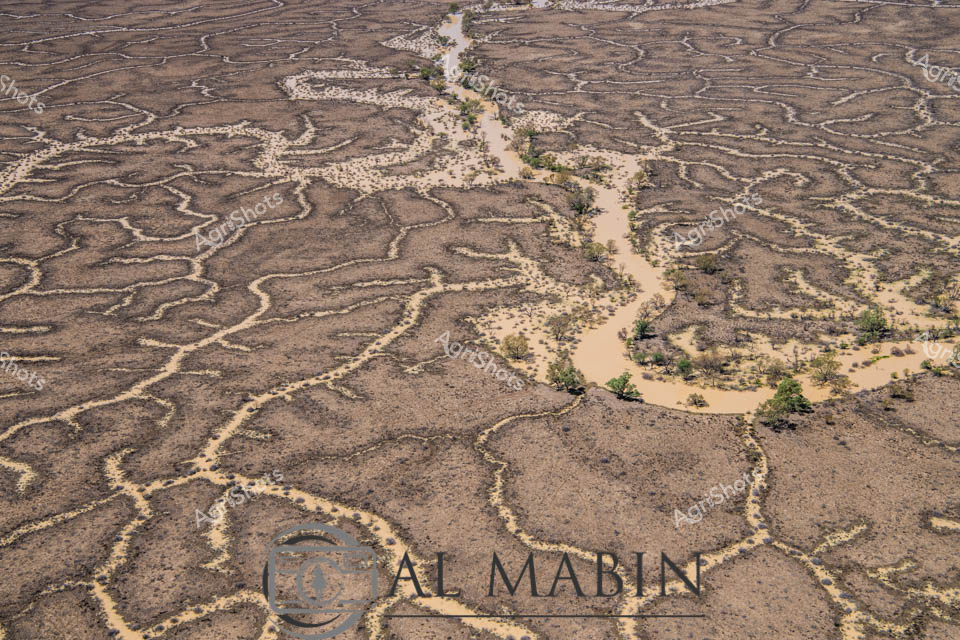
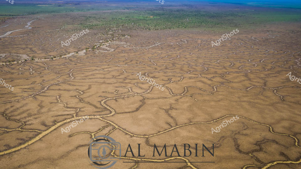
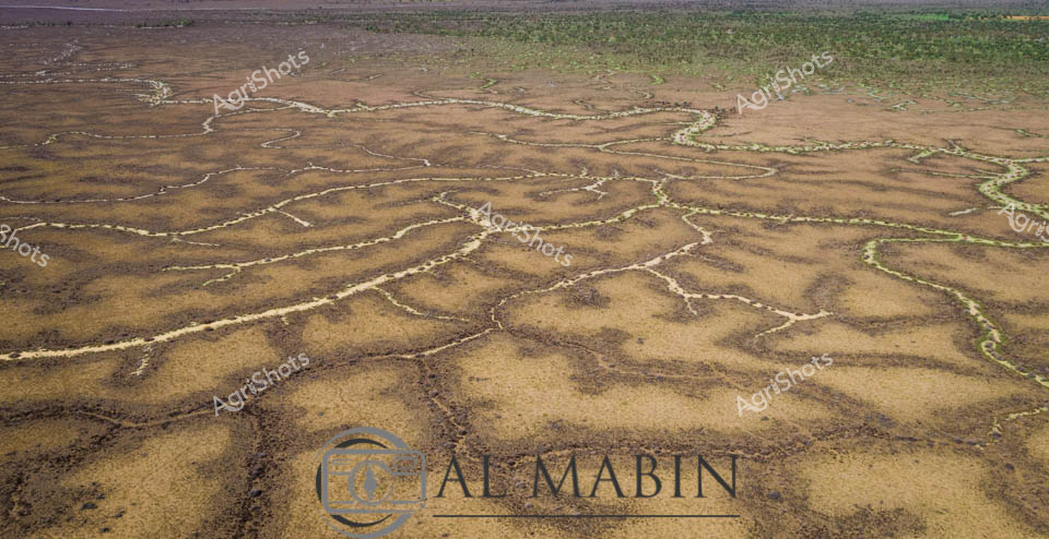
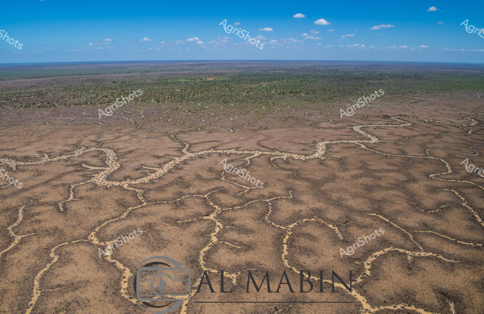
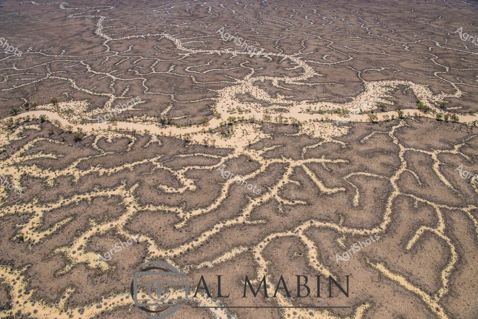
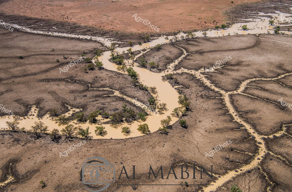
Intricate water channels weave across the arid Channel Country landscape near Windorah, Queensland, revealing the complex hydrology of this remote beef station. Seasonal flooding has transformed the parched earth into a network of silvery-blue waterways, tracing delicate, interconnected patterns across the brown and green terrain. The aerial perspective captures the extraordinary natural irrigation system, where ephemeral creeks and streams branch and meander like veins across the expansive pastoral landscape. Soft blue skies stretch to the horizon, creating a sense of infinite space and revealing the harsh yet beautiful ecosystem of inland Queensland. This image speaks to the resilience of Australian agricultural landscapes, where water is a precious and transformative resource that shapes both the geography and the livestock production of the region. The subtle color gradients from earth tones to water reflections illustrate the dynamic relationship between land and water in this remote, challenging environment.